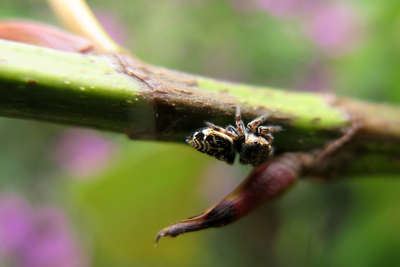
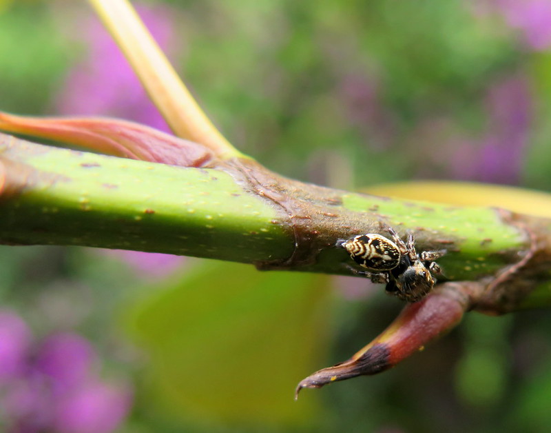
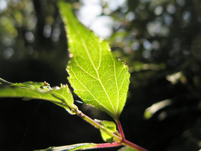
A jumping spider (perhaps of Plexippinae) crawls along a plant stem.
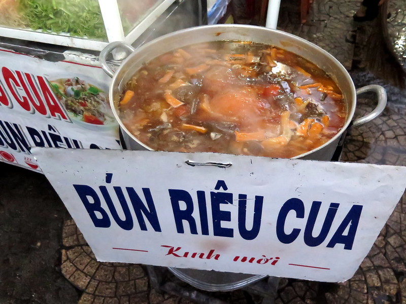
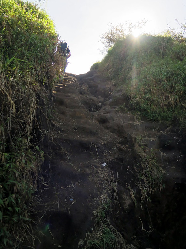
I’ve got more bugs for you! These ones come from all over Da Lat, whose temperate climate is surprisingly kind to insect and arachnid populations. There are butterflies, mosquito hawks, and of course your favorite, jumping spiders. I’ve tried to ID them where possible:
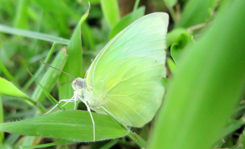
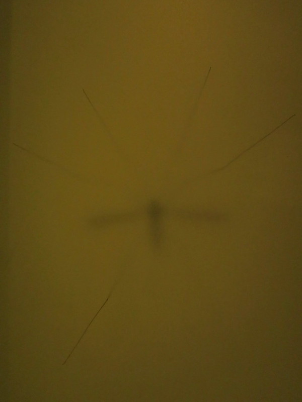
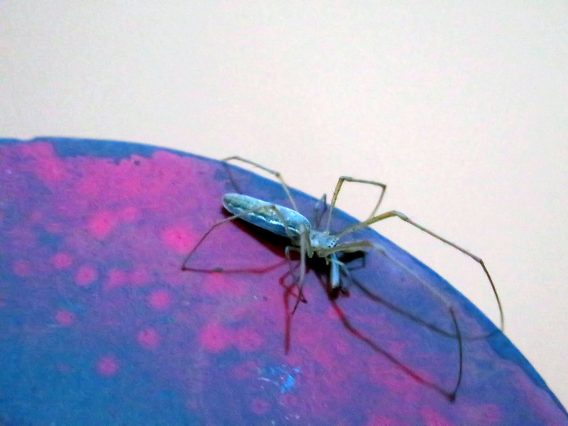
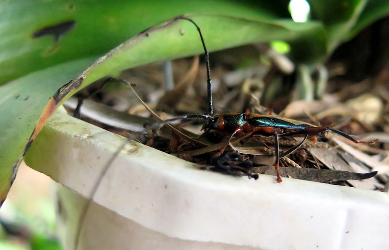
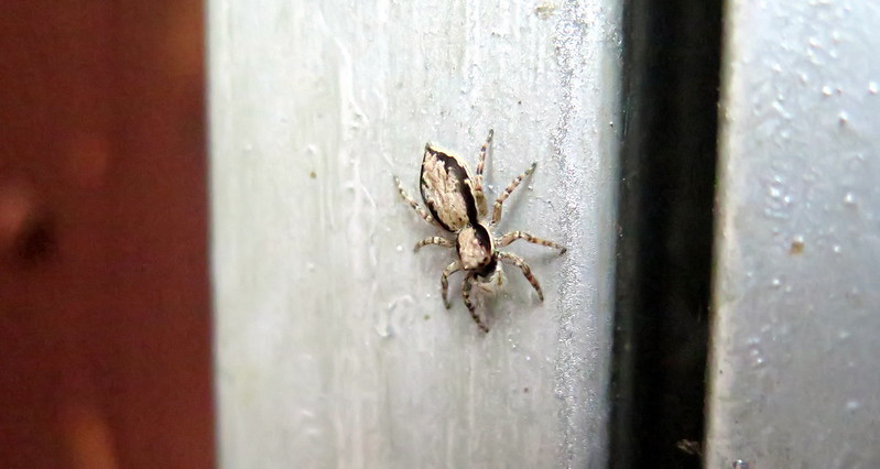
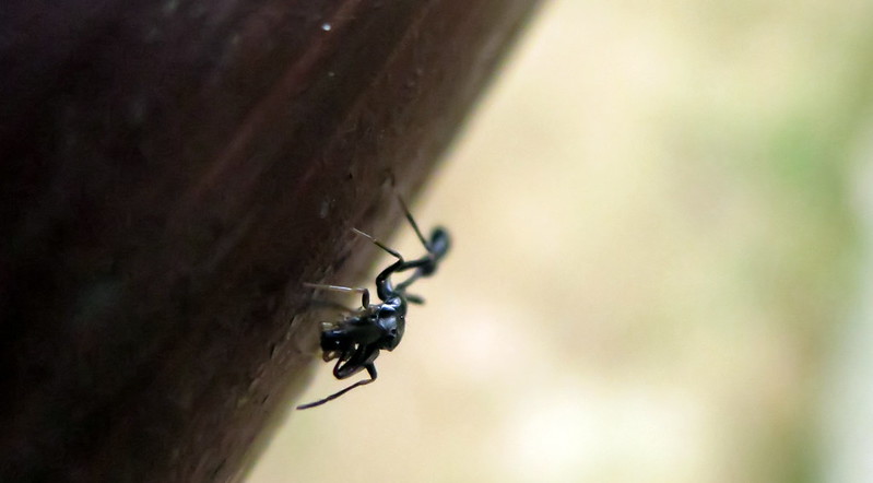
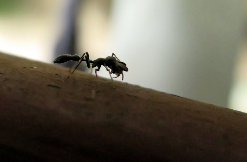
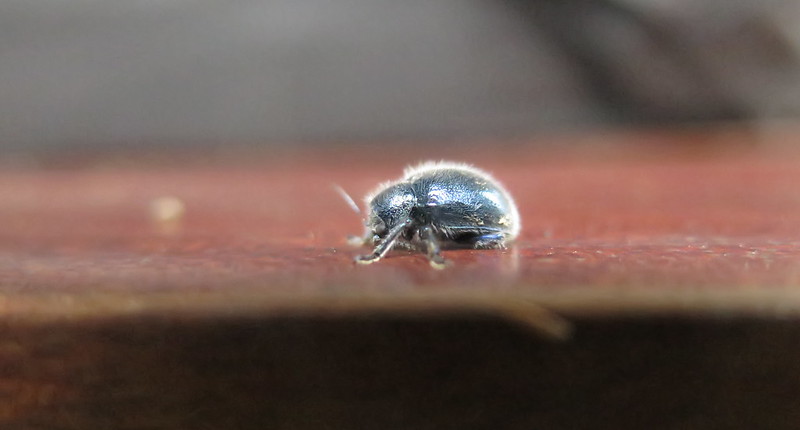
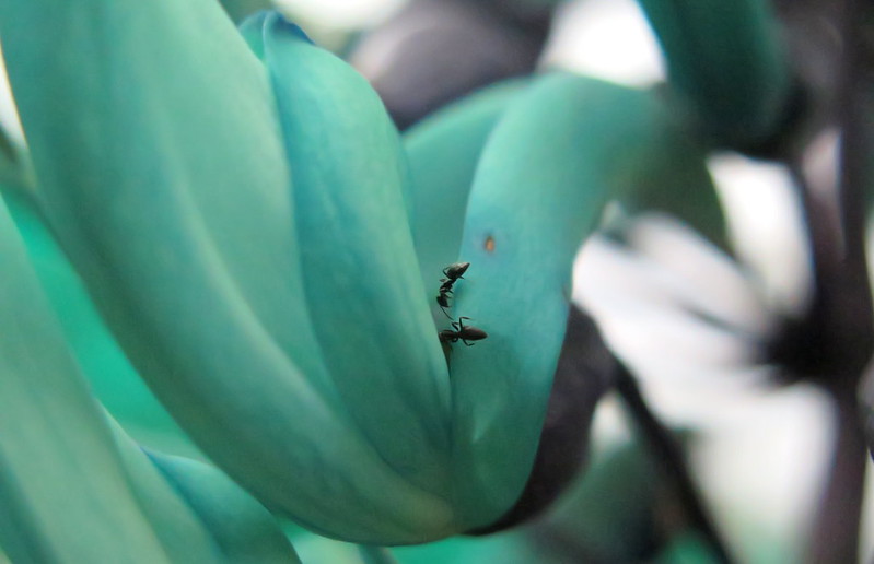
A Catopsilia pomona perhces on a blade of grass.A jumping spider, perhaps a Hyllus spp. in Plexippinae according to abdomen patterning.A jumping spider, perhaps a Hyllus spp. in Plexippinae according to abdomen patterning.A haunting shadow of a crane fly, seen through opaque glass.A spider from the daddy long legs group (Pholcidae) crawls along a post edge.An unidentified salticid takes a ride with us on our swan boat.Some kind of weevil or borer. I’m a lot less patient with IDing beetles and beetle-related insects.Another unidentified jumping spider (UJS).An amazing jumping spider of the family Myrmarachne. They have evolved to look like and mimic ants!An amazing jumping spider of the family Myrmarachne. This one has lunch in its jaws.An unidentified inchworm.An unidentified fuzzy beetle.Two ants explore a nectar for flower.
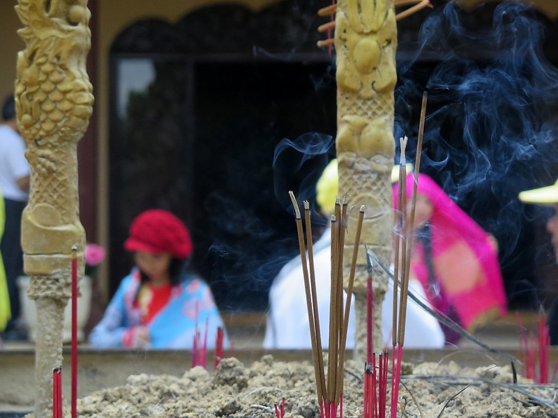
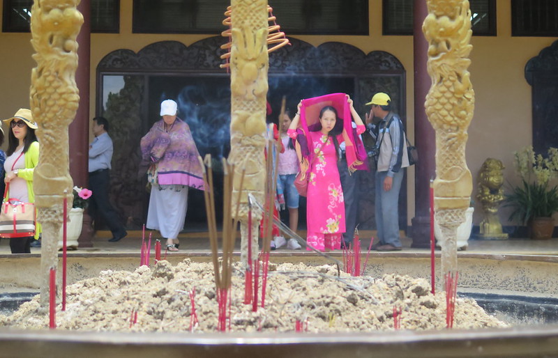
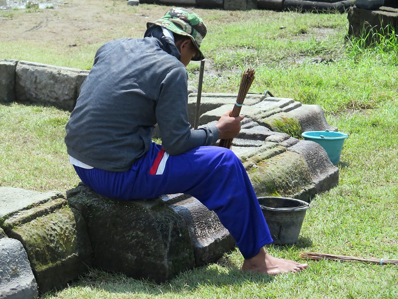
Incense sticks burn at Thien Vien Truc Lam Temple.
We’ve been longing to get out to nearby Tuyen Lam Lake to see some nature, but Stoytcho has staunchly vetoed the idea of renting a motorbike. “What, come on!” I say, “It’ll be fine.” But Vietnam does have some absurdly high motor vehicle death rates, so I’m not terribly convincing. We also promised our travel nurse we wouldn’t do this. As we were getting shots for yellow fever and Japanese Encephalitis and goodness-knows-what-else, we told her about our travel plans in Southeast Asia. “Just promise me you won’t rent a motorbike there. That is more likely to kill you than any of these diseases combined.”
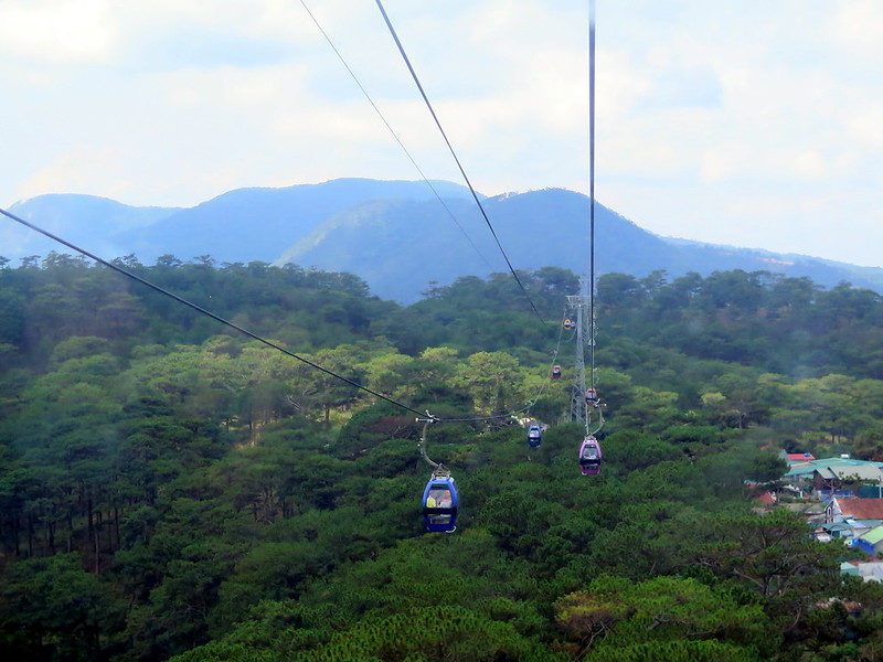
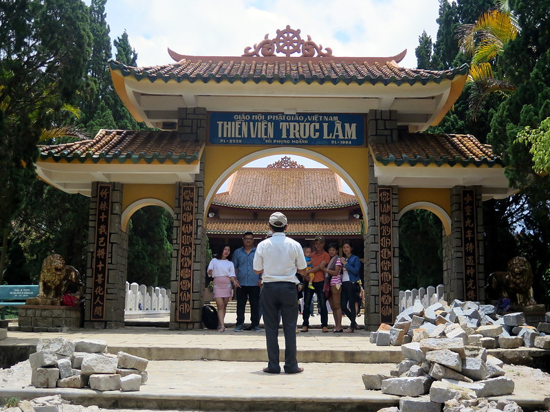
But thanks to a cable car, there is one bit of Tuyen Lam Lake we can reach without a vehicle. So on our last day in Da Lat, we caught a cab up to the cable car entrance, bought tickets, and soared over pine tree forests and farms for fifteen minutes. We arrived at Thien Vien Truc Lam Temple, walked through its grounds, and had a lovely stroll by the lake. In one cluster of buildings by the shore, we found a restaurant and had lunch and I survived a near-concussive experience as a lumber beam perched over their bathroom door came crashing down an inch from me. The cook’s wife came running in horror, assuming she’d killed a foreigner, but I managed to communicate that I was ok. And to celebreate the near brush with death (even in absence of renting a motorbike), we took a swan boat out onto the lake. That’s as good a celebration of life as any, right?
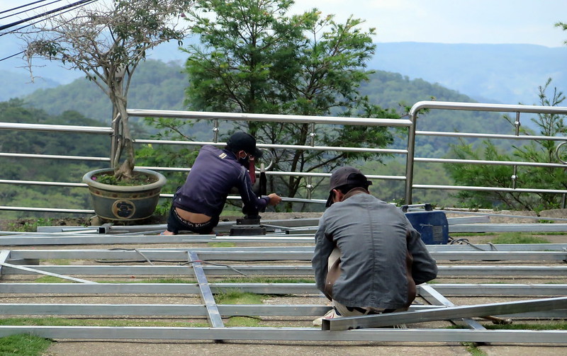
Men weld steel outside the cable care ticket office–probably not for the cable car.
Riding the cable car.
A man photographs his family at Thien Vient Truc Lam Temple.
People enter and exit the prayer space in the temple.
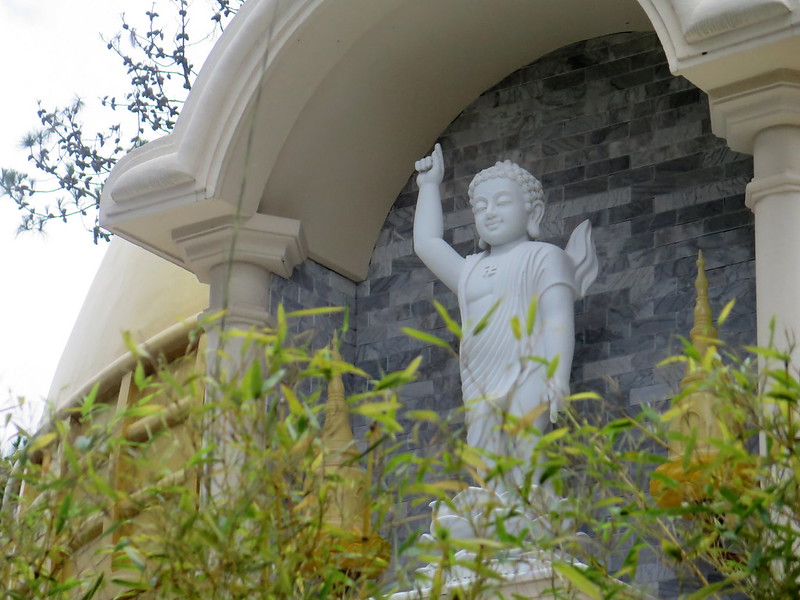
A Buddha statue gestures toward the sky.
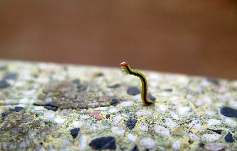
An inchworm raises up to find branch to crawl on.
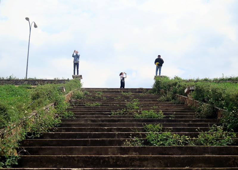
Visitors take photographs around Tuyen Lam Lake.
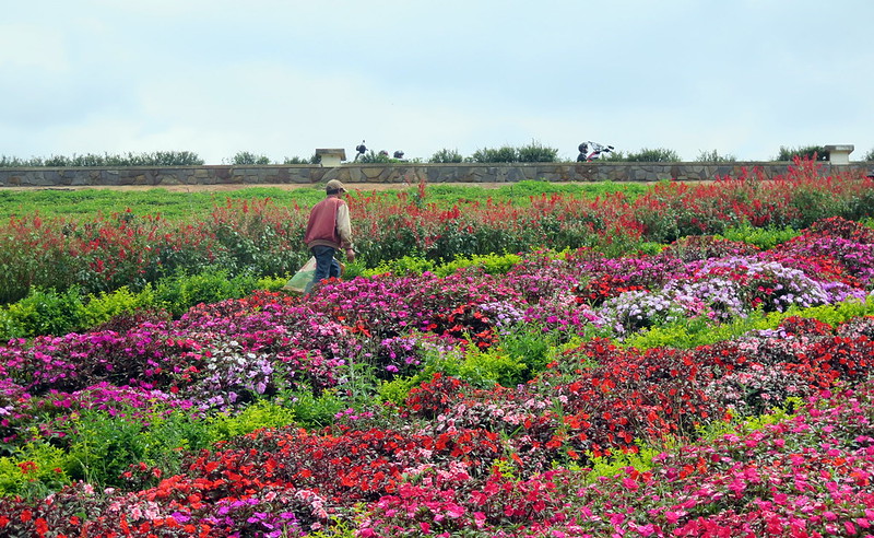
A man walks through flowers planted in the arc of a rainbow.
Tourist boats line lake shore, Vietnam flags waving proudly.
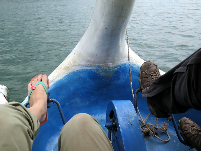
We paddle our swan boat out onto the lake.
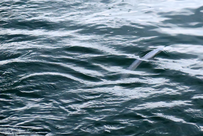
A lamprey surfaces in our boat wake. I could see the ring of its jawless mouth.
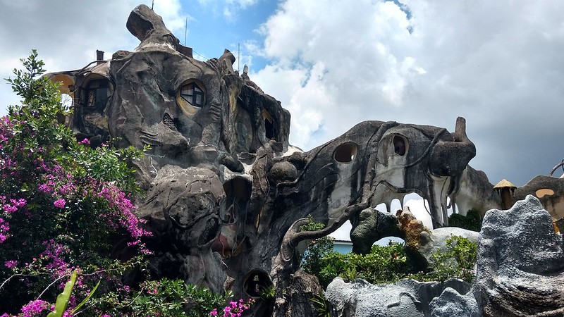
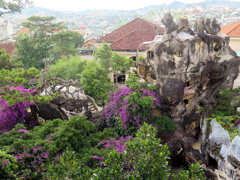
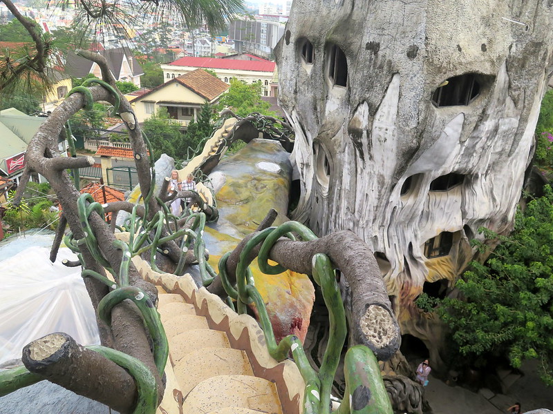
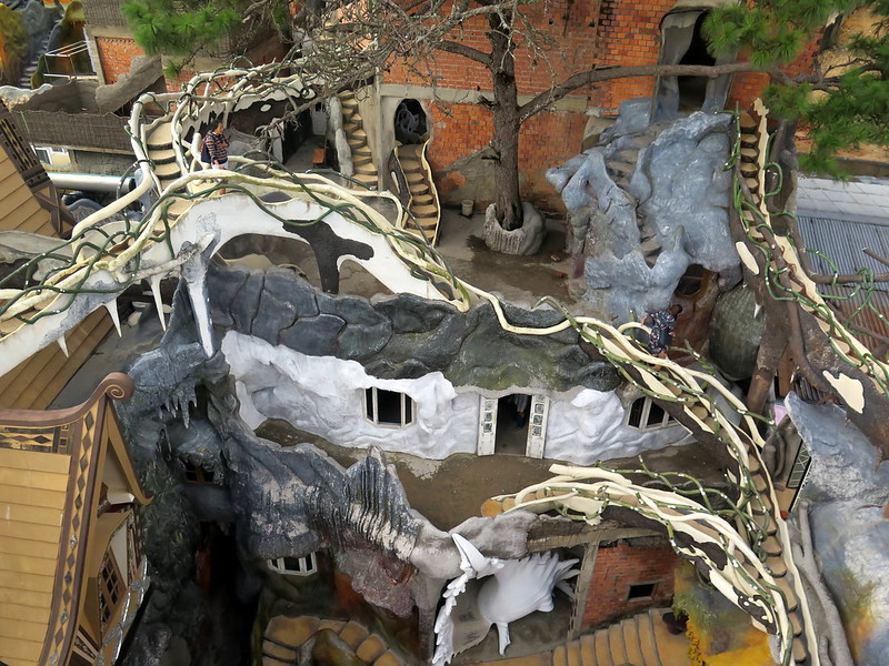
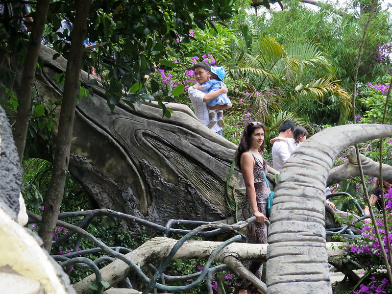
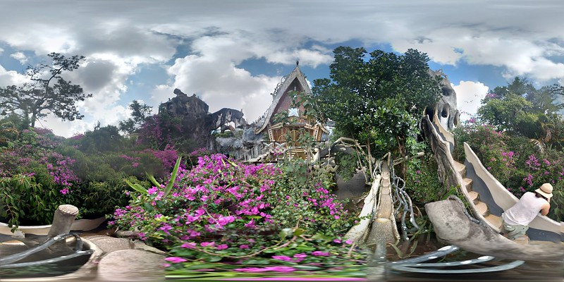
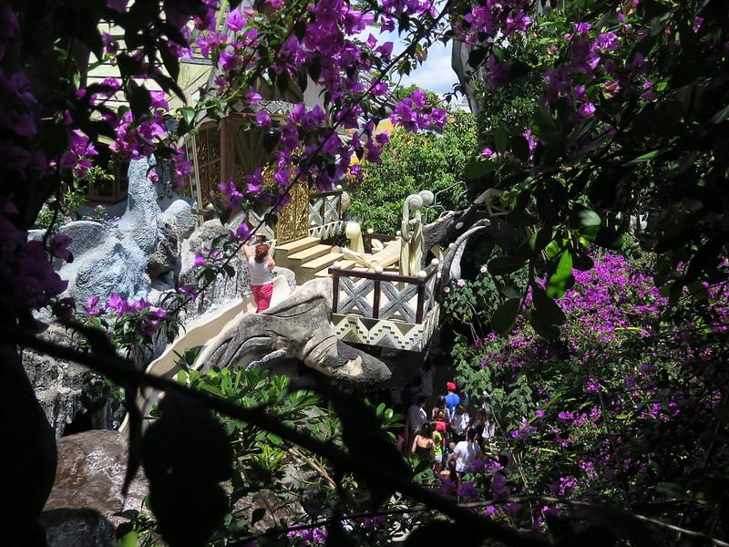
A view of the guesthouse portion of the Hang Nga Crazy House. Yes, you can stay there, although it’s not the cheapest accommodation in Da Lat.
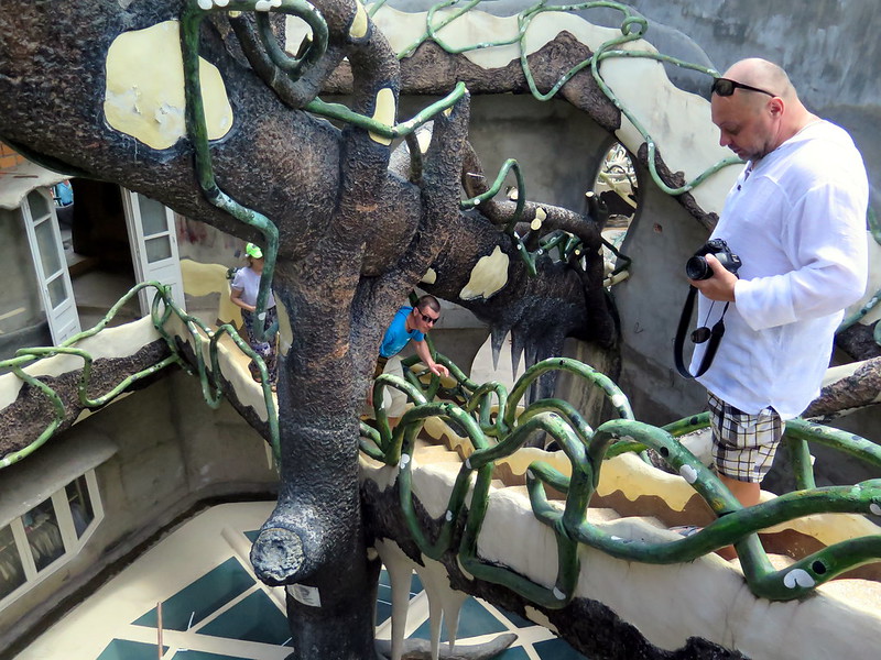
You know how some cities have an iconic ‘thing’, the likes of which you can’t find anywhere else? Something like the Hollywood Sign of Los Angeles, the Sagrada Familia of Barcelona, or the Opera House in Sydney. That’s what Hang Nga Crazy House is to Da Lat. An ever-growing, organic architectural feat, the twenty-seven year old structure is the child of Dang Viet Nga, an architect who found inspiration in the natural beauty surrounding the city. It opens its doors on weekdays, allowing visitors to explore the structure’s winding paths, snaking staircases, and baffling rooms. And it’s a one-of-a-kind place, in part because almost anywhere else in the world it would have accrued hundreds of building code violations. Watch your head while you take in the magic.
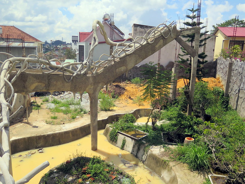
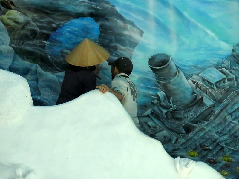
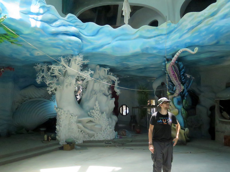
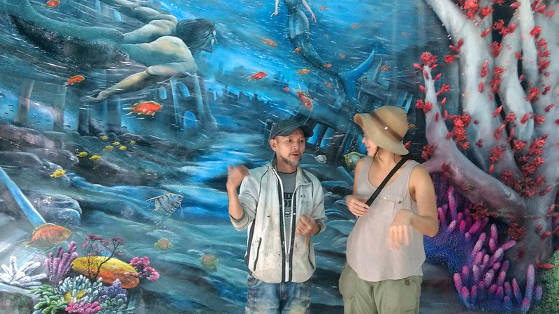
This was my favorite place in Vietnam because of its architectural whimsy, but also because it’s still under construction. Hang Nga Crazy House has already swallowed up two nearby lots that went on sale, and Dang Viet Nga shows no signs of stopping. As we wandered through the labyrinth of passages, we stumbled into sites under construction and some laying fallow, waiting for the artist’s hand. Several artists work on the house at any given time, and they’re excited to show you their art.
Below are our most amazing pictures of Hang Nga Crazy House. It stole my heart with its unapologetic quirkiness and unwavering commitment to the organic form. I’ll have to go back one day to get it. ❤
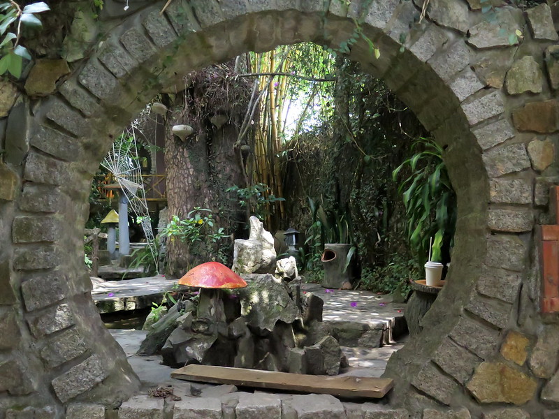
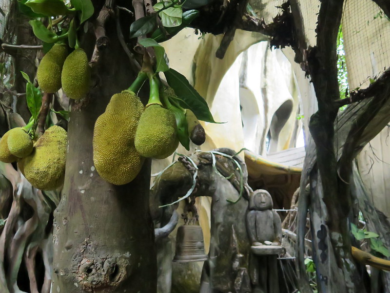
The guesthouse, hidden amongst trees and bougainvillea.Narrow stairs with low railings snake around the structure like vines, leading you between different buildings.Two women pose for a selfie atop a stairwell.A maze of stairs leading between the different levels.Touirsts duck under another stairwell while climbing, as another tourist eyes the short railing warily. This place is definitely not childproofed or adultproofed.People wander the labyrinthe paths, which wind through gardens and over buildlings.The front garden, complete with concrete mushrooms and a koi pond.A live soursop tree grows among the buildings. The entire Hang Nga Crazy House is a mix of living plants and concrete structures shaped like living plants.A tourist finds his way into the under-construction region; you can see the normal apartments across the street in the background.The back portion of the Hang Nga Crazy House lies fallow, waiting for artists to continue work on its extension. The project has grown from its original size, and looks poised to grow more.Artists discuss a mural in an under-construction part of the house. I have a sneaking suspicion that the woman in the hat is Dang Viet Nga (the project mastermind), but chickened out out on asking her.Stoytcho stands in an under-construction ocean-themed part of the house, where coral and anemonae await paint in the background.I talk with artist Hoàng Đức Thành about his work on the house. They’ve been working for months on this part, using reference material to create undersea-inspired sculptures from concrete and plaster and painting murals on the room’s walls.Hoàng Đức Thành’s workspace and reference material.A Google Photosphere produced from one of the balconies, making the house no more or less strange than it already is.
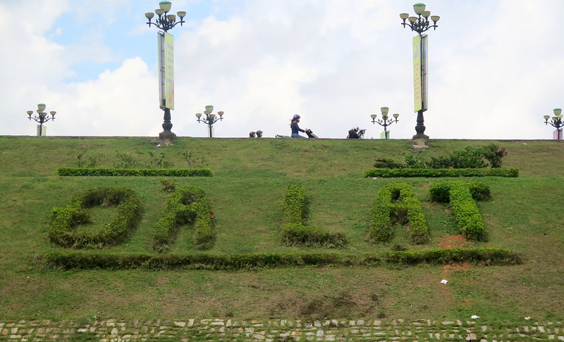
If you want to visit Vietnam without the rote tourism, overcrowded cities, and tropical humidity, Da Lat is your city. Situated in the 1,500 m above sea level on the Langbian Plateau, Da Lat (or Dalat) is a year-round temperate getaway for people looking to relax, take in the mountain air, and drink coffee. The primary tourism market here is domestic and the foreign tourists that do make it here are primarily Russian, so don’t expect many English speakers. But several places offer English menus, and paper, a pen, and a smile are all you need to barter in the city’s markets. So pull up a chair and order a coffee, visit the city’s flower garden, or explore Da Lat’s bizarre architectural wonderland.
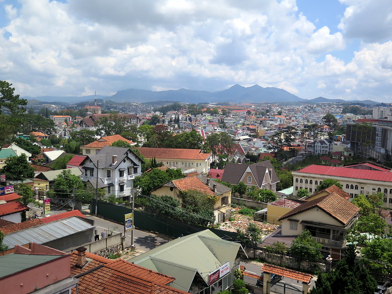
A view of the city; red-roofed French villas from the colonial era sprawl across the countryside, a reminder that this was once a getaway for the French-colonial elite.
A rain-kissed flower grows in a planter in Da Lat. The city is also known as “the city of a thousand flowers” and its temperate climate produces flowers for export.
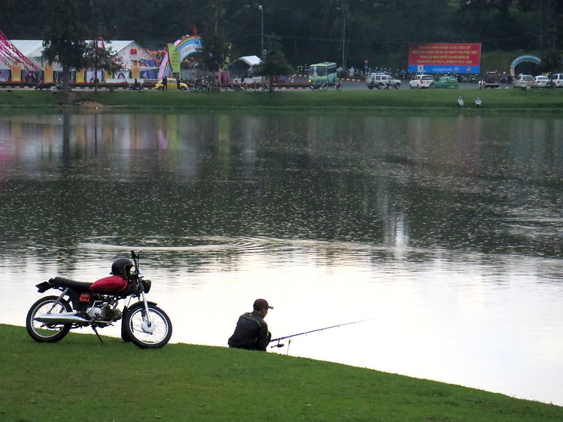
A man fishes in Xuan Huong Lake. I personally would not eat anything from this lake (see below).
A woman uses a net and pole to fish waste out of Xuan Huong Lake after a storm. Heavy rainfall washes everything from plant debris to plastic bottles to dead fish down into the lake, so people like the above keep Da Lat beautiful.
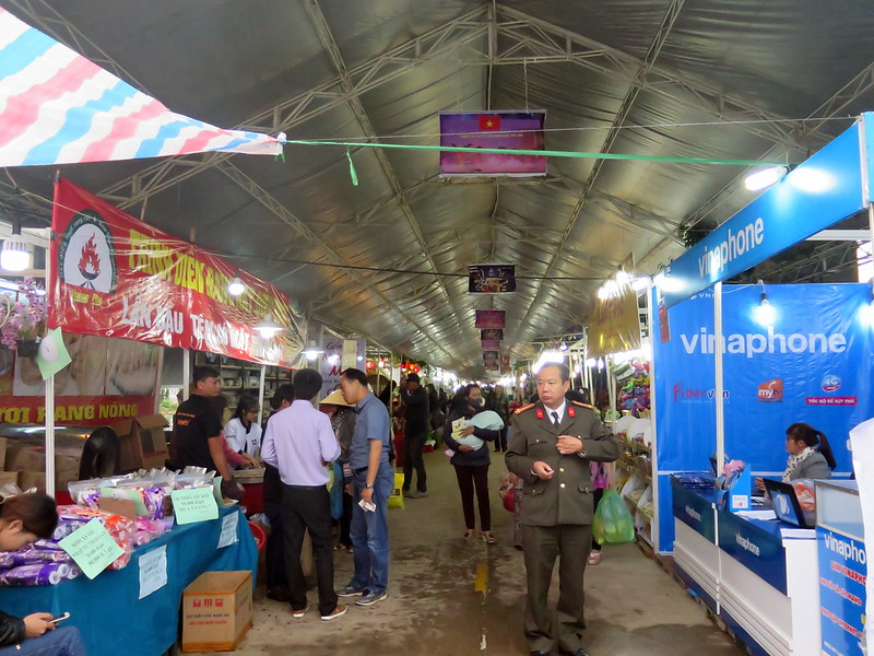
A military officer looks around at stalls in an indoor market.
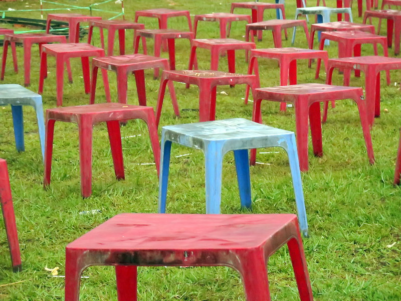
Plastic tables double as chairs, set out in preparation for an evening concert.
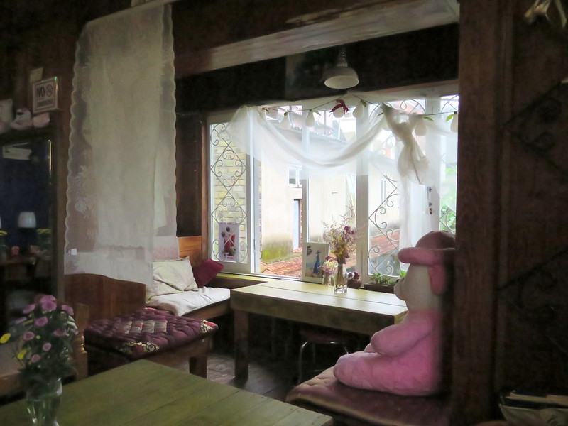
Not someone’s home, but the interior of a local coffee shop. The city is filled with dozens of cozy cafes like this one.
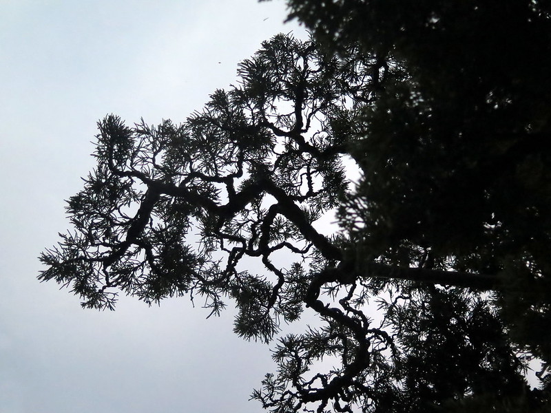
The branch of a bonsai tree on the shore of Xuan Huong Lake.
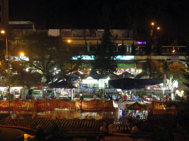
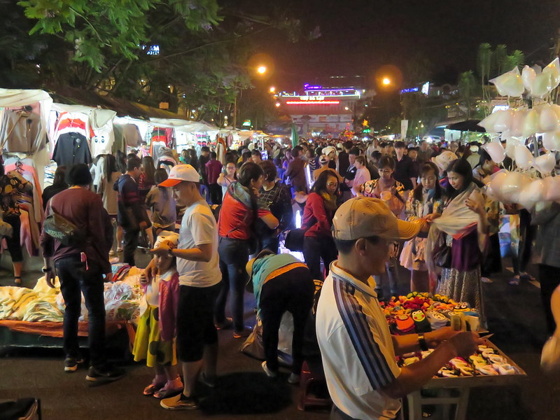
A view over the night market in the city center.
Vendors display wares to potential customers in the night market.
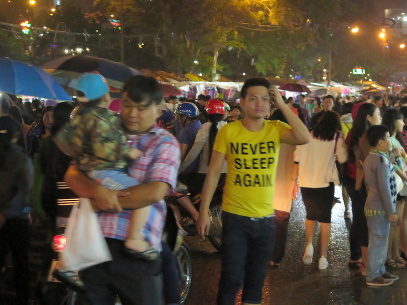
Looking lost in the night market.
Toys posed (by someone else) in a mall in Da Lat.
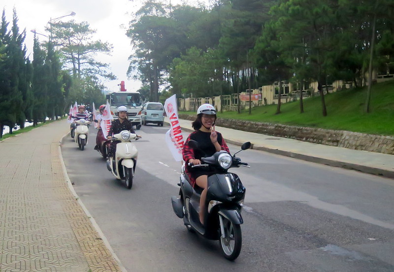
A woman poses for a photo while riding as an advertisement for Yamaha motorbikes.
A woman takes a selfie (left) while tourists wander by below (lower center) in the confusing architecture of the Hang Nga Crazy House.
A bubbling cauldron of stew in the local market. IT WAS DELICIOUS.
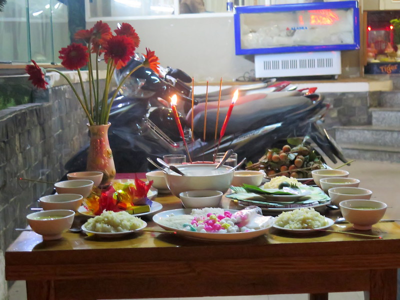
An offerings table for deceased ancestors in front of a local business.
A truck-sized lotus lantern awaits deployment onto Xuan Huong Lake, part of a celebration of Buddha’s birthday.
The night skyline of Da Lat, reflected into the lake.
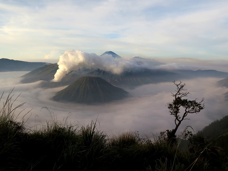
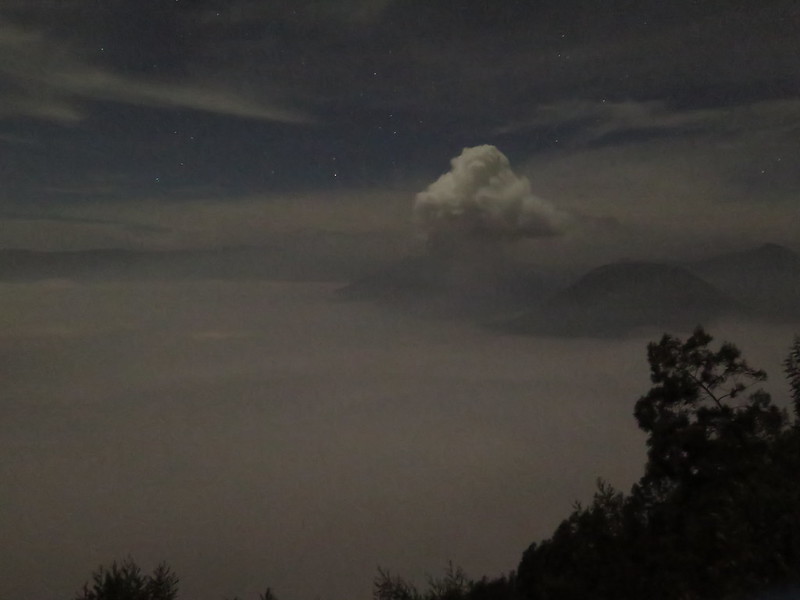
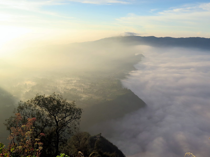
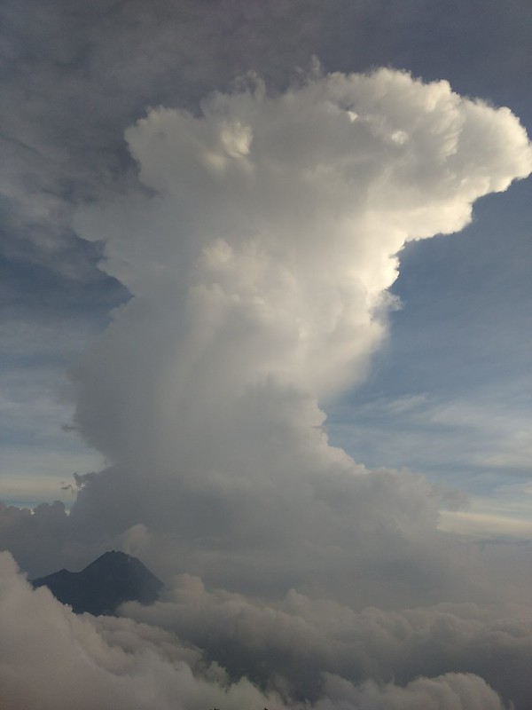
A view of volcanic peaks rising above the mist-filled Tengger Caldera.
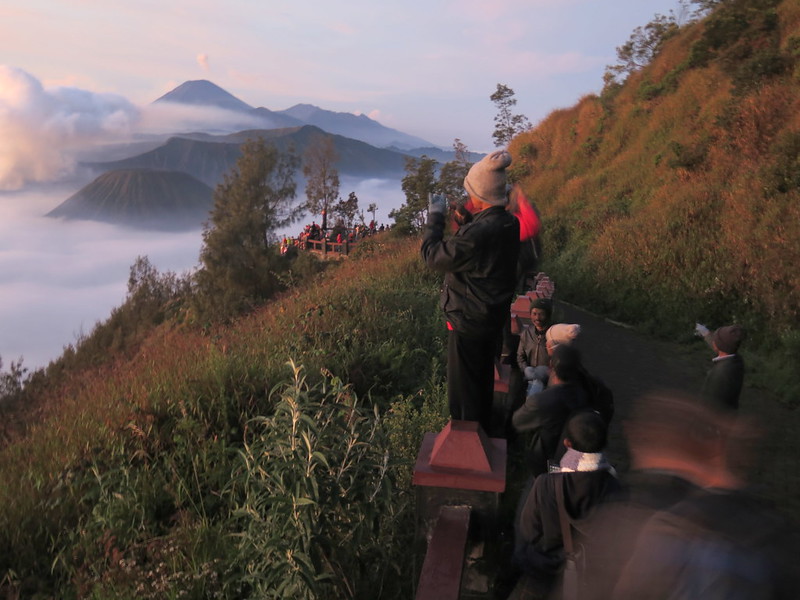
The Bromo sunrise hike is part of a regular tour circuit and as such we’re not super enthusiastic to do it. But others have effused to us about Bromo’s beauty at sunrise, so on our last morning we wake at 3:00 am to start the hike.
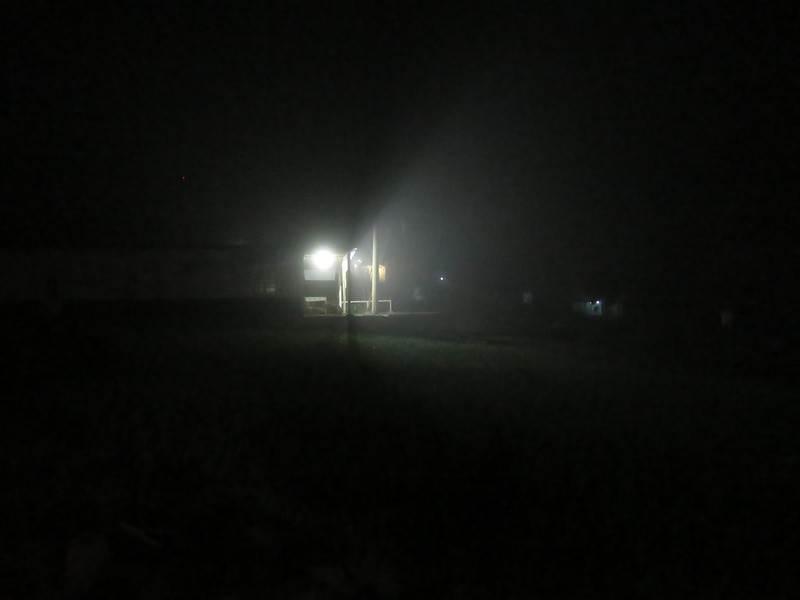
A light in the dark on our road to King Kong Hill.
With the exception of a few other tourists heading toward the King Kong Hill lookout point, we are entirely alone on Cemoro Lawang’ s roads. After half an hour, we begin ascending via switchbacks up the hill. There are more people here, tourists sporting headlamps hiking up, being driven on ojeks, or riding horses. A few locals wait along the road, asking if we want a ride. Others have set up stalls selling alluring hot tea and instant noodles. With temperatures at around 40 F, it’s hard to resist these.
A long-exposure predawn shot of Cemoro Lawang.A long-exposure, predawn shot of the smoke rising from Bromo.
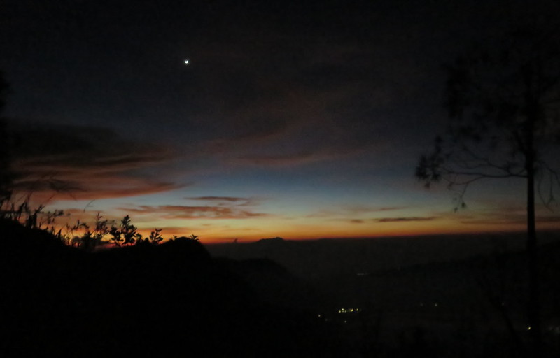
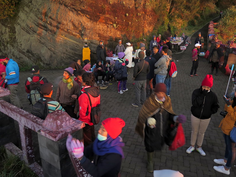
The pitch black veil of the sky begins to thin at 4:30 am, before we reach the lookout point, and for a moment we’re afraid we won’t make it in time for sunrise. We stop for a few minutes to snap some photos, then scramble up the muddy, rocky path as quickly as our cold, aching legs will take us. We can hear the noise of people just above, and we find ourselves in a rest area surrounded by a low concrete railing. People chatter excitedly and gaze through camera lenses at the tangerine sky, while locals sell keychains and postcards at a table nearby.
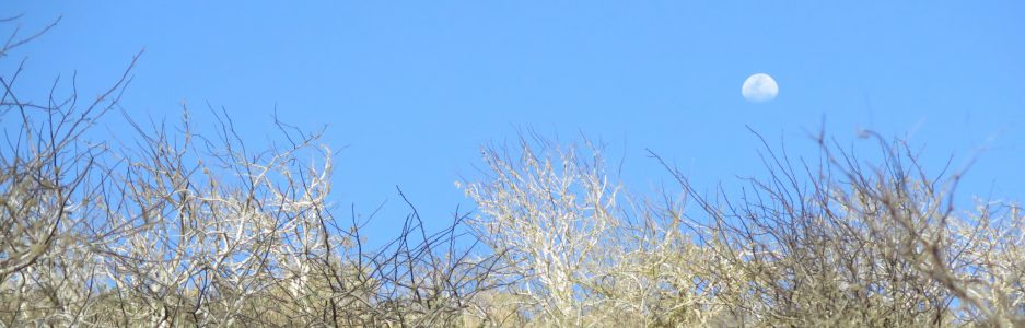
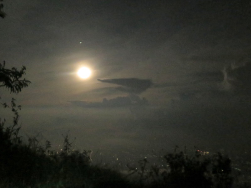
The first streaks of dawn in the sky, with the moon still hanging above in the darkness.
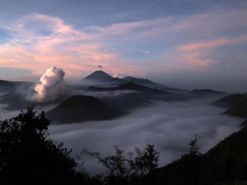
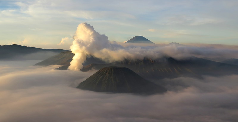
The rote tourism is entirely overshadowed by the beauty of the valley below. King Kong Hill affords a sweeping view of the Tengger Caldera and Mount Semeru (Java’s highest peak and also an active volcano). Bromo exhales a continuous plume of smoke into the air, while Semeru behind releases small puffs from its own crater. The scene is cast in soft lilacs, dusky pinks, and creamy oranges as the sun approaches the horizon. Then the sun takes her first peek over the edge, spilling her warm yellow rays onto the world.
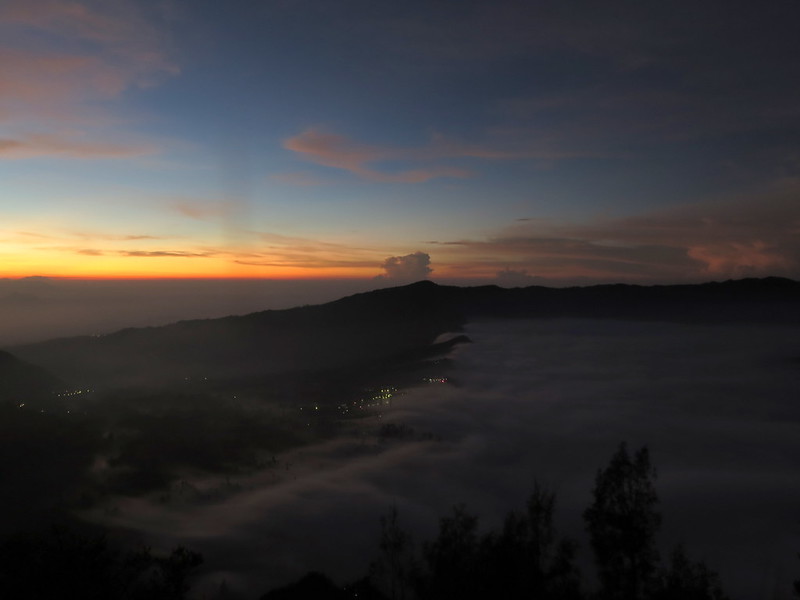
A view south-west into the Tengger Caldera. Bromo smokes on the left, while Semeru emits a single puff of smoke in the background.Clouds rise from the Tengger Caldera and slowly fan over Cemoro Lawang (lights in center).
We watch the sunrise with a dozen strangers. When the first scene of beauty is over, they stir and stretch their cold limbs, and begin to file out, down the mountain. We look around and notice an empty path further up the mountain. Ten minutes climb later, we emerge onto a broad, paved viewpoint with dozens of giggling, chatting tourists. This is the tour group viewpoint, accessible from the road on the other side of King Kong Hill by a few minutes hike, with no journey to Cemoro Lawang necessary.
Visitors take photos of Bromo at sunrise.Tourists capture photographs of Bromo as clouds spill over the Tengger Caldera and engulf Cemoro Lawang.The view of Batok (lower right), Bromo (left), and Semeru (upper right) as seen from King Kong Hill’s viewpoint.
We mingle with the tourists for a bit, enjoying their excitement and watching them take selfies. Then they, too, begin to disperse back to their tour vans and jeeps just over the ridge. We follow them up, curious what this side of the mountain looks like. It’s a cacophony of noise and trapped vehicles, piles of jeeps that have parked each other in on the narrow mountain road now trying to get out with their tourists. I’m incredibly grateful we don’t have to join them.
A tourists stands on the railing with his camera in the new sun.Tourists mill around as locals sell knitted hats, scarves, keychains, and postcards.
As we walk back down, I notice a dirt path leading into the brush. It first seems to lead only to a rubbish pile, but then it continues up the hill. Stoytcho and I follow it as it crests the hill above the rest area to offer yet another view of Bromo in the rising sunlight. The path then descends and rises narrowly and near-vertical up the next hill. I leave Stoytcho behind to navigate this path alone, higher still, emerging on a ridge about a hundred feet above the rest area. It’s empty, save for one man with a giant camera and his local guide. This is the hidden vista, the one known mostly to the locals and rarely visited.
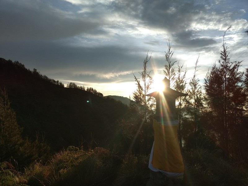
The sun rises behind a shrine above the King Kong Hill lookout.The volcanoes as seen from the highest viewpoint, above King Kong Hill.The clouds rushing over Cemoro Lawang dissipate in the warming sunlight.A view westward, along the Tengger Caldera’s edge.
It’s past 6:00 when we start our descent from the mountain, an hour after the tourist hordes have disappeared. The going is faster downhill and the warming air is a comfort after the morning chill. Going is mostly easy. About halfway down the mountain I pause at a faint chittering noise. Glancing up, we see a troupe of monkeys gliding through the trees above us, leaping on bending branches and scrambling along the slender tree trunks. In seconds they are there and gone, off to their daily business now that this mountain home is theirs again.
Locals pack up their wares after everyone has left King Kong Hill.Offerings of flowers and tea left by locals for the mountain gods.
UPDATE: Here’s a map of our hike from Cemoro Lawang up to King Kong Hill lookout point.
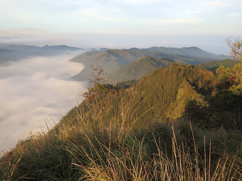
The southern valley of the Tengger Massif, with volcanic cones rising on the left. The massif is the remnant of an ancient volcanic caldera more than three miles across.
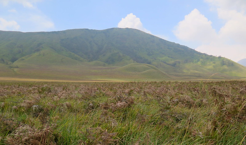
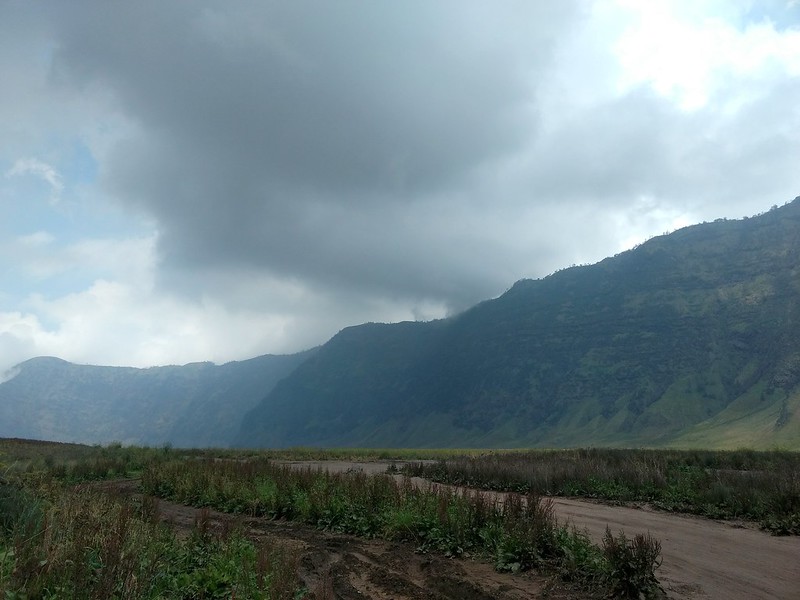
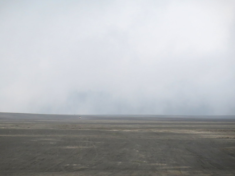
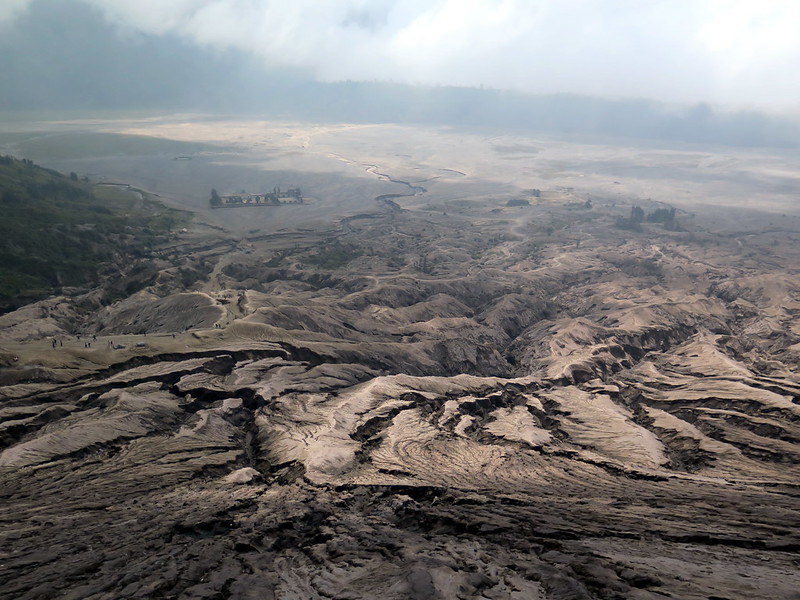
The Tengger Massif is endlessly photographable, one of those surreal experiences that you’d more ascribe to a high-budget movie or video game than a real place. It’s a massive crater more than three miles across, the remnants of a volcanic explosion millions of years ago. The west side of the crater is a vast, living prairie: grasses ripple in the gentle wind under drifting sea of clouds. To the north lies the volcano Bromo, carrying the torch of Tengger’s volcanic legacy with a low, continuous roar as it sends thick billows of noxious gas skyward. And to the east lies the sandsea, a desert devoid of life except for a few patches of grass eking out an existence on a barren landscape of sand and dust.
Prairie grasses sway in the wind on the caldera floor, while new volcanic cones rise behind.
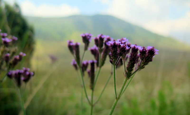
Wildflowers bloom in the prairie of the caldera floor.
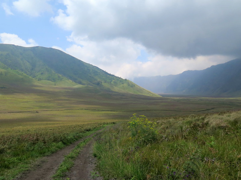
A foot and vehicle track winding along the caldera floor, between newer volcanic cones (right) and the steep caldera wall (left)
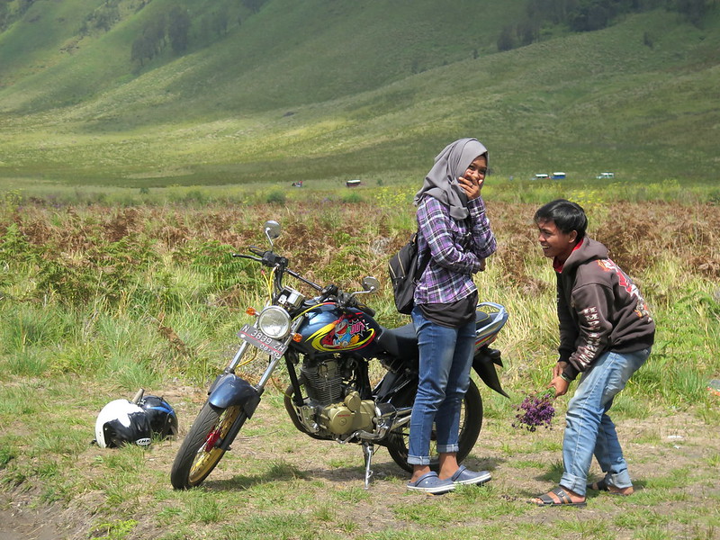
Young lovers.
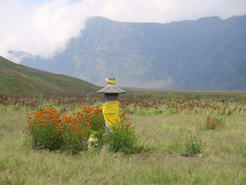
A shrine to the volcano gods on the caldera floor.
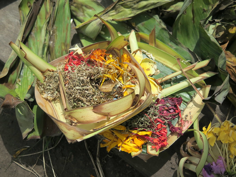
Offerings of food and flowers on a shrine to the volcano gods.
The near-vertical wall of the caldera crater.
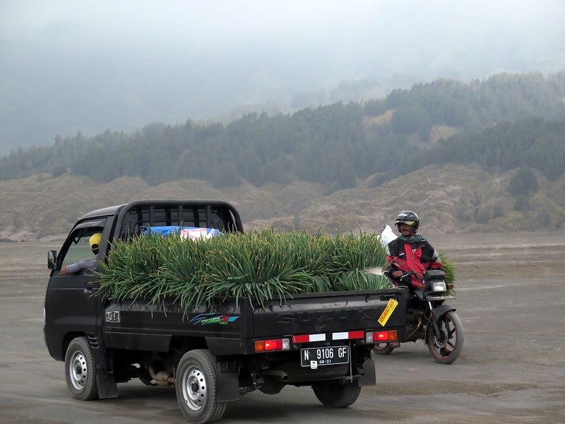
A woman harvests grasses along the road, near the edge of the sandsea.
This shrine marks the end of the prairie and the beginning of the Bromo sandsea.
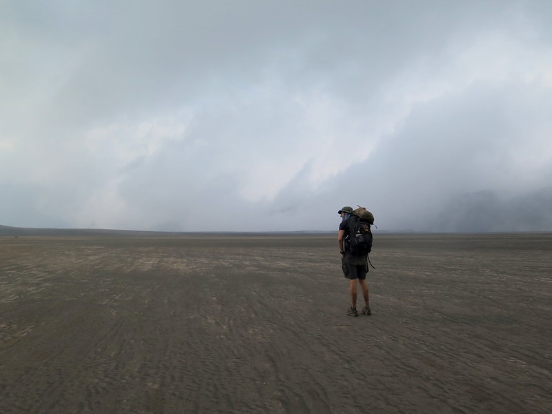
Stoytcho stands in the Bromo sandsea. Mist and fog often limit visibility in this part of the caldera.
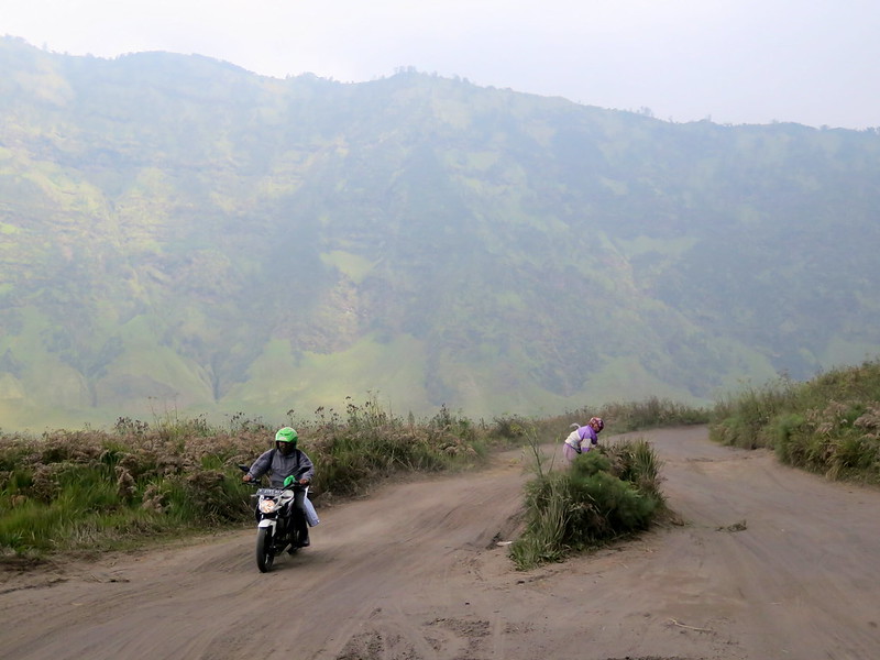
An ojek (motorbike) approaches us in the distance.
Locals passing in opposite directions stop for a chat.
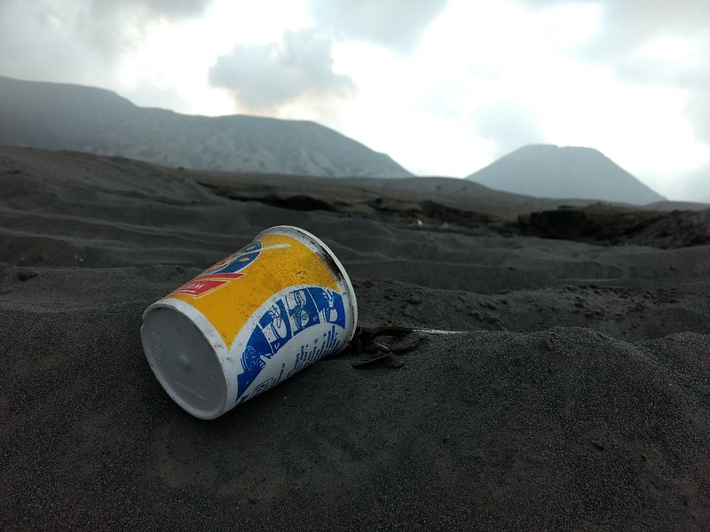
An instant noodles cup abandoned in the sandsea, with volcanoes Bromo and Batok in the background.
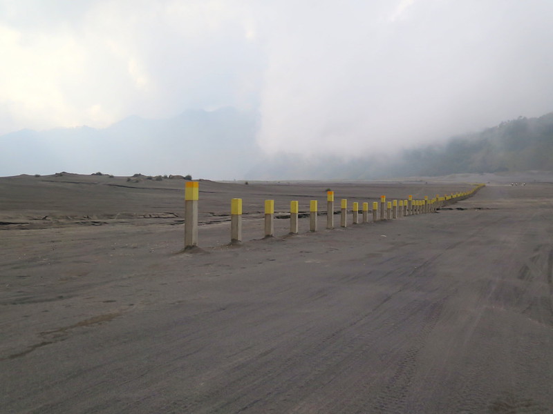
The guideposts to Cemoro Lawang, at the eastern edge of the Bromo sandsea.
Mount Bromo (left) pictured beside Mount Batok (right). Mount Batok is the only volcano in the park that is not currently active, and greenery has taken root on its sides.
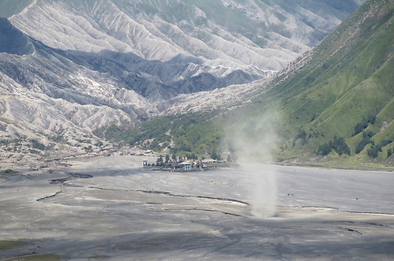
A dust devil forms on the Bromo sandsea between Bromo and Batok, in front of the Pura Luhur Poten Temple.
A view of the sandsea and Pura Luhur Poten Temple as seen from Bromo.
A sign for the village of Cemoro Lawang in the sandsea, with volcano Bromo in the background.
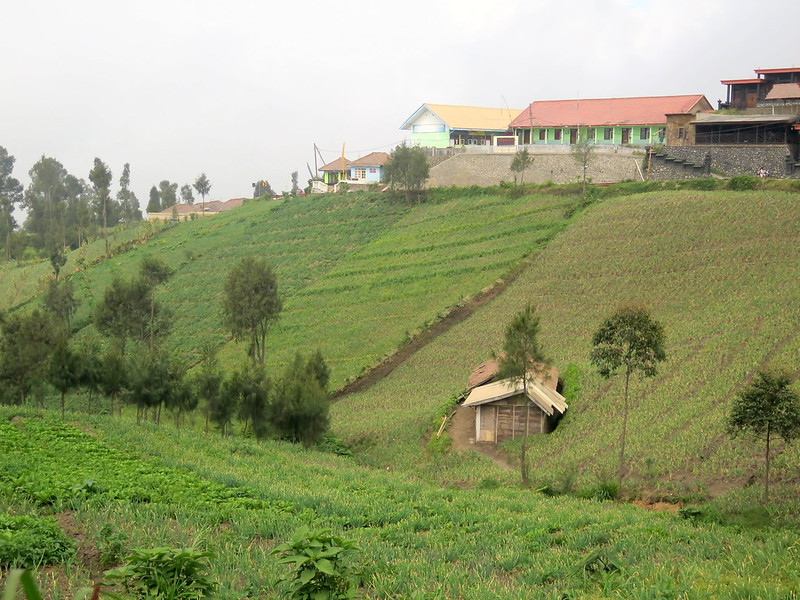
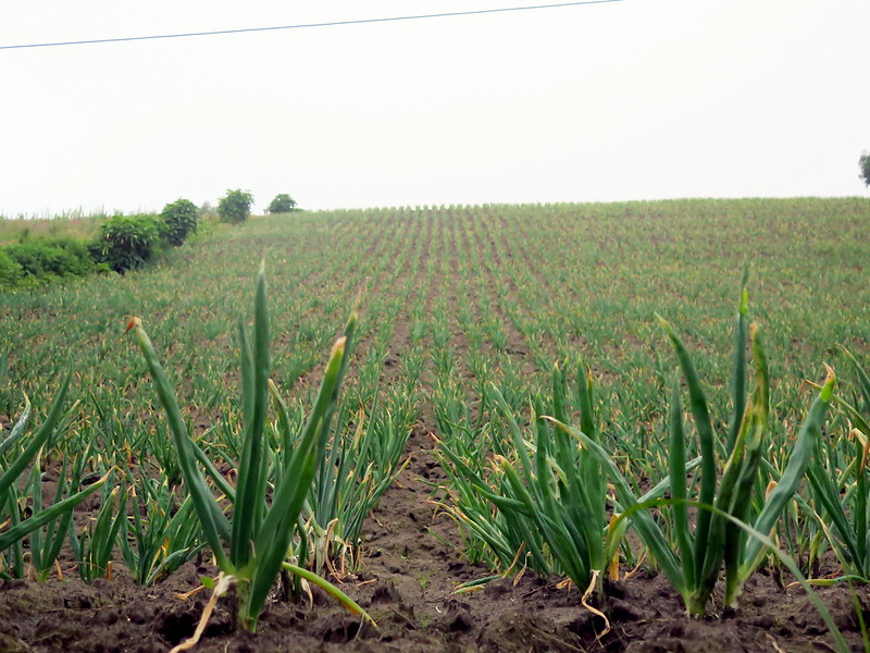
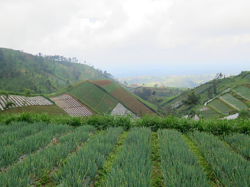
Cemoro Lawang is a tiny village at the edge of the Tengger caldera and were it not for Bromo’s close proximity, it would likely have never seen tourists. Most residents here are farmers, though some are now part of a growing tourism industry that serves tourists to Bromo as hotel staff, restauranteurs, and tour guides. The wealth disparity between the visitors like us and the residents here generates a feeling of desperation, where streetside vendors sell Bromo souvenirs half on pity. Part of the reason is that we’re (once again) in a tourist town during the off-season, when times are hardest. But part of it reflects an economic shift wherein people realize that tourism-related jobs, even one that requires standing out on the cold street selling Bromo kitch, will make far more than any farming work. We might visit Cemoro Lawang one day to find the fields replaced by artisans’ shops and tour agencies in their place. But for now, the dominant feature of village’s landscape remains rows of neatly-planted spring onions, nourished in the volcanic soil.
Farms cover the hills in Cemoro Lawang.
A field of spring onions stretches off into the horizon.
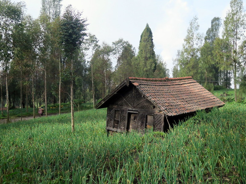
A farmhouse surrounded by fields of spring onions.
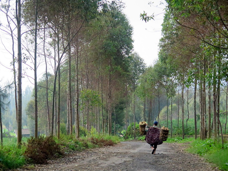
A man carries his farm produce into town.
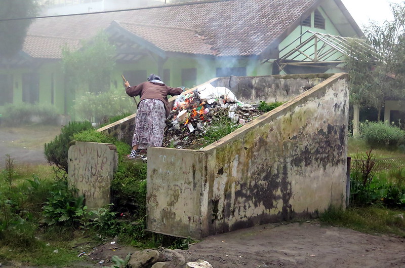
A woman burns garbage at the edge of town.
Our hotel in town, the Cemarah Indah.
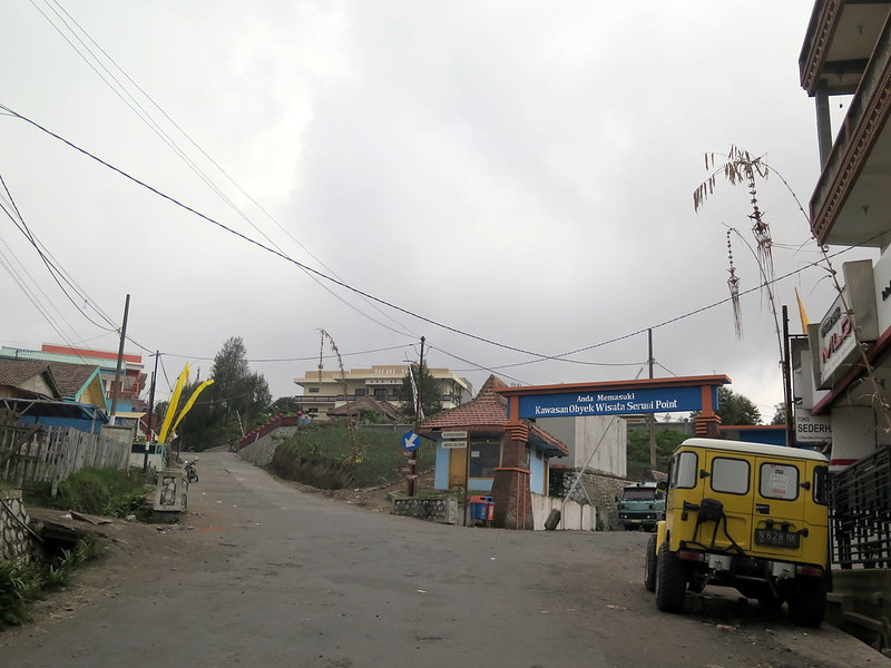
The entrance to Bromo Tengger Semeru National Park, with a tour jeep parked in front. The poles hanging over the streets are charms, important to the Tengger people who inhabit this and nearby villages.
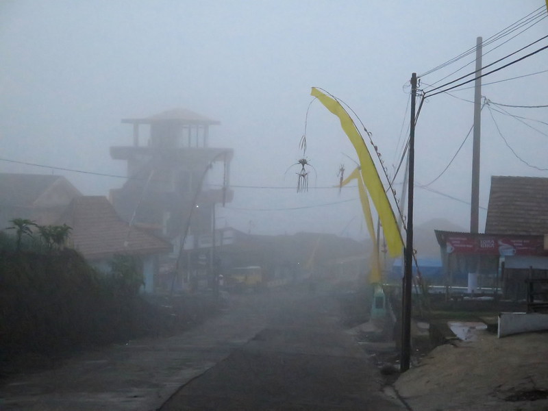
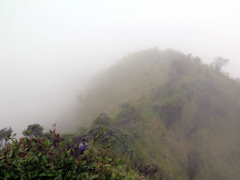
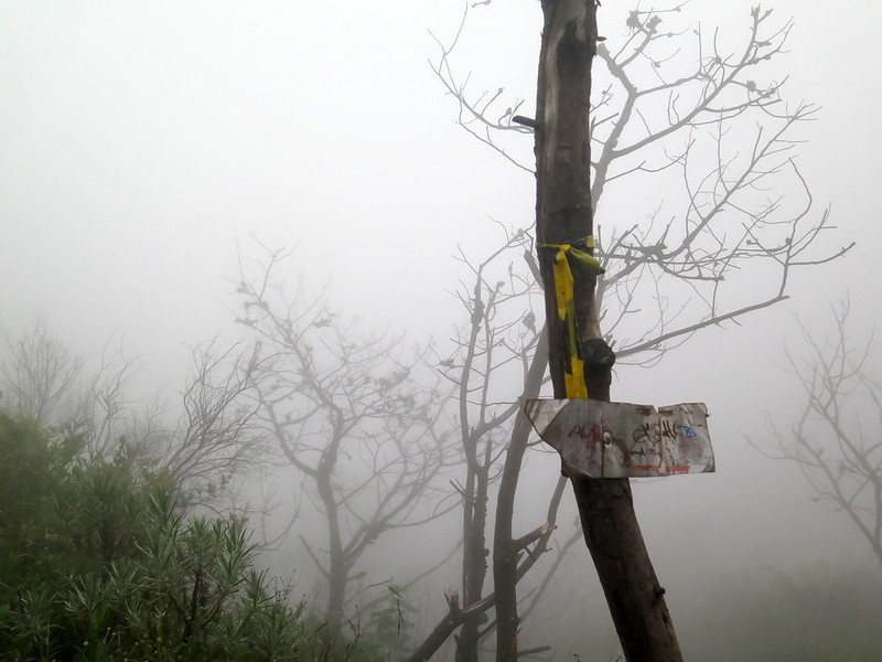
A view down the hill into town on a foggy day. The proximity to the Tengger Caldera means that most days start or end with fog.
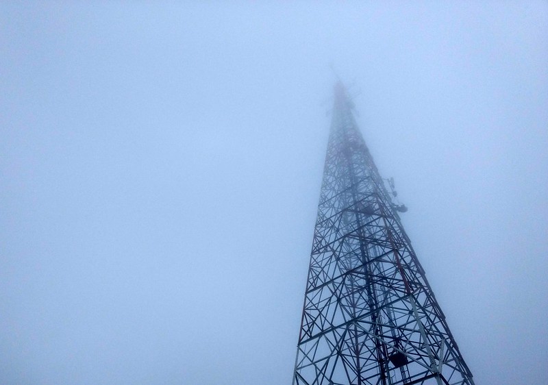
A communications tower in Cemoro Lawang disappears into the fog above.
The view of Mt. Merapi behind one of Mt. Merbabu’s lower “peaks”.
The Hike Summary:
This is a challenging two-day hike with some flexibility in where you camp and what route you take up/down. If you want to hike Selo (southside) to Kenalan (northside) be warned that the trail to/from Kenalan is steep (see below for our experience)—aim for Kopeng instead for a gentler descent. This hike is best done in good weather so you can enjoy the views, with a downloaded IndonesianEnglish dictionary if you don’t speak the language, and with expectation you’ll be paying around $20 USD in entrance fees for the hike.
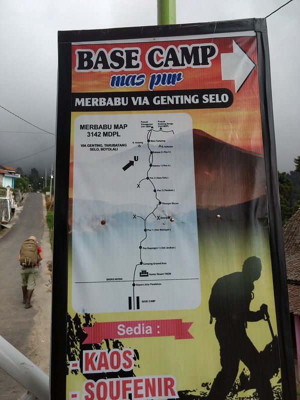
A map of the hike from Selo, in case anyone finds it handy.
The Story:
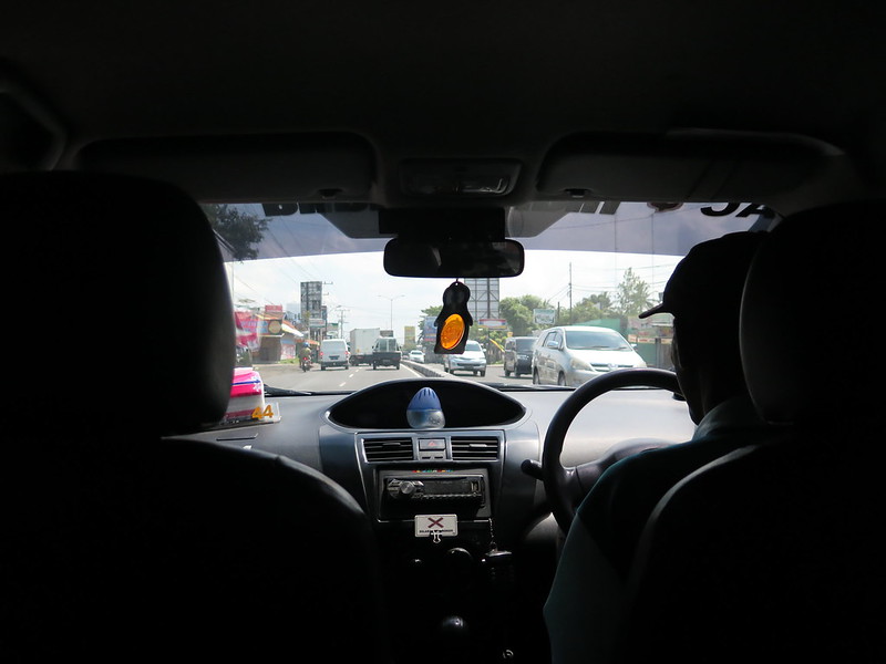
It’s back to the hike circuit! We haven’t had a serious, multi-day trek since the Salkantay, we’re going to start off easy and do a two-day trek up and down the dormant volcanic cone Mt. Merbabu. While most tourists hike neighboring Mt. Merapi, they do it with a tour guide and the Merapi summit is currently closed due to recent volcanic activity. In contrast, there are no English-language tours of Merbabu and it’s basically a DIY hike with a well-marked trail. It takes us a couple of hours to even find a taxi willing to drive us there, and I even managed to negotiate a 25% discount off the standard 400,000 rupiah fare.
Riding in the taxi.
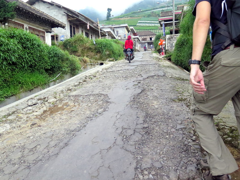
The road out to the village Selo, which sits in between Merbabu and Merapi, is pretty rough. We meet up with our cab driver at 9 am and in less than an hour we’re at the base of Merapi. From there, we turn down the winding road between Merapi and Merbabu. It seems fine at first, but the road rapidly gives way to potholed concrete and we’re stuck going only a few miles an hour over them. Kids from the local villages stand beside the road and help cars navigate the holes for a few rupiah. We spend two hours on this road, slowed by the potholes and then stopped because of construction. Our taxi driver has to ask for directions several times, but he’s a good sport about it. In the end, we arrive at Selo around noon, far later than we expected. I pay our driver the full price for all the trouble.
The town of Selo, with Mt. Merapi in the background.Walking up the steep, terribly paved roads to the Merbabu trailhead.
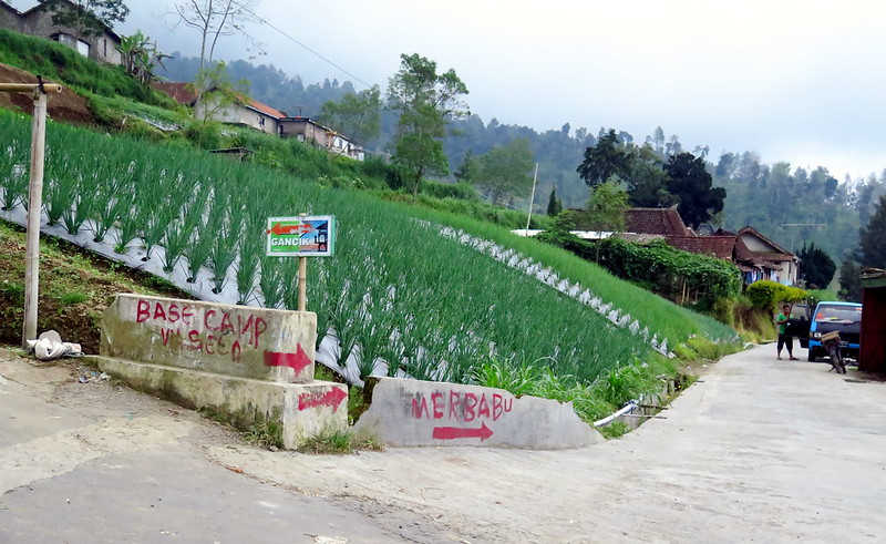
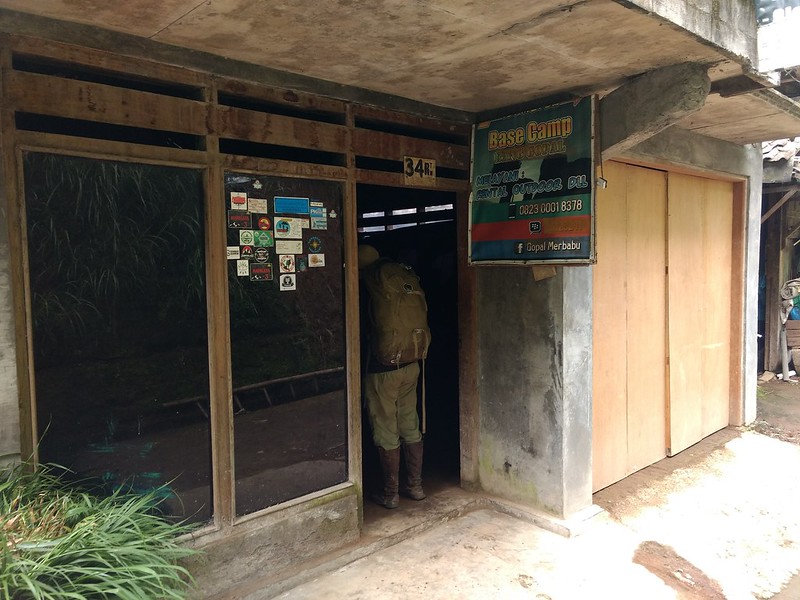
We know the hike starts somewhere around here, but directions online were vague so we ask farmers and passing villagers for “Merbabu” and they point us in the right direction. We’re also helped by spray-painted signs on walls along the way. It’s another hour of climbing concrete roads before we reach the park entrance, a tiny village with a few hostels (all named some variant of “base camp”).
Spray-painted signs appear on the road, guiding us toward Merbabu.Ridiculously steep fields cover the landscape leading up to Merbabu.
The park entrance is at the top of the village, a cluster of official looking buildings where we write our names and pay a lot of money to do the hike: it’s 300,000 IDR (~$20 USD) for us foreigners, and it’s more than a little bitter to watch a group of guys pass through right after us and pay only 15,000 IDR (~$1 USD) for the hike. It’s true that we have way more money, but after spending $40 a day living in Yogyakarta, the park entrance fee is a sticker shock. There are some guides online for how to avoid paying, but I don’t know how to feel about that either. The money made here (hypothetically) goes back into maintaining the park.
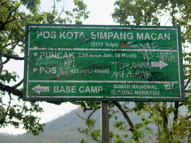
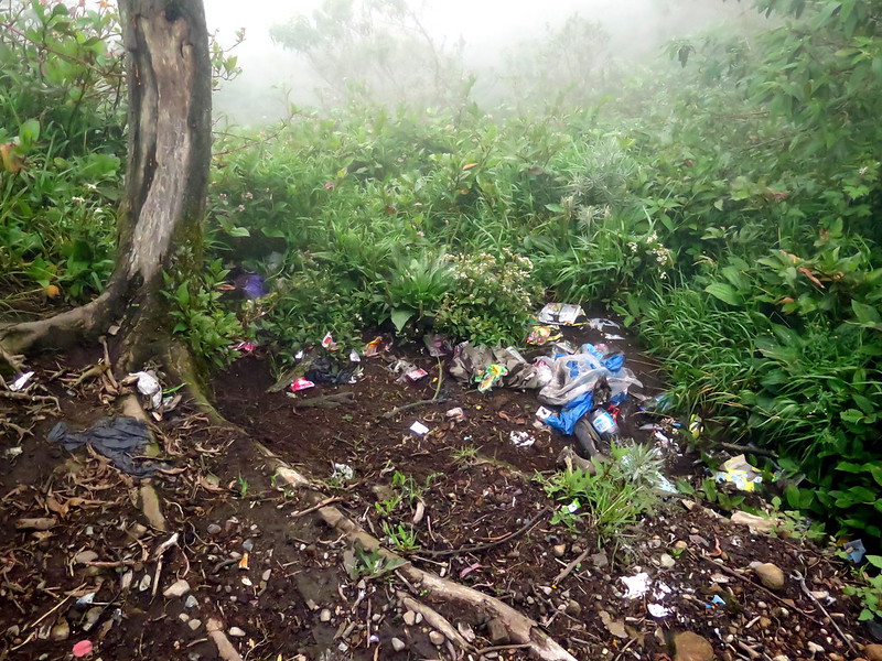
The climb up the mountain continues, but we’re now on a dirt path that alternates between a gentle slope and steep inclines as it weaves through the forest at the mountain’s base. Every hour or two we find a sign denoting a campsite (Pos 1, 2…) that points us to the peak, scribbled over with layers of graffiti until they’re hardly legible. There’s a pile of trash at every campsite, and litter is scattered along the trail. It’s apparently hard to convince the hikers here to “pack it in, pack it out.”
Dense forest alongside the trail.The barely-legible sign for Pos Kota, pointing the way to the peak (‘puncak’ in Bahasa).Trash at one of the campsites. You guuuuys….
As we continue upward, the jungle over lower Merbabu gives way to steep, grassy slopes and muddy trails that we half hike, half climb. At around 16:30 we reach what we would guess is Pos 3, a broad patch of level ground above the cloudline. We’re exhausted, but after some rest continue upward. There’s not much sun left and it’s getting colder, but the number of people setting up camp around here means there will probably be noise late into the night.
Stoytcho hikes up a near-vertical part of the trail.A view from the grassy slope of Merbabu.Pos 3 (or 4?) is on the lower left, a flat dirt patch where a lot of people stop to rest and camp.
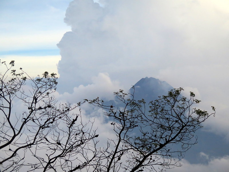
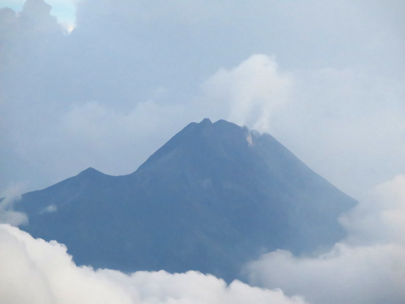
A kilometer on, we our first view of neighboring Merapi through a break in the clouds. The sun is behind Merbabu now and the wind is chilling to the point of unbearable in our sweaty clothes, but the island of Merapi’s peak suspended in the sea of clouds is too beautiful not to stop and admire. We make it up the next hill, pass through another small huddle of tents, and halfway up the next hill find a small, mostly level area behind a tree. It’s not far from the trail but it’s secluded, and that’s good enough for us.
The first view of Merapi, Merbabu’s more volcanically active cousin.Gases rise from the central vent of Merapi in this close-up shot.A full view of the dusk clouds enveloping Merapi.
To say we slept well would be an outright lie. First it was the cold, and when we finally shivered ourselves warm it was the continuous flow of hikers near our tent that kept us up. People walked by talking, laughing, singing as they continued toward the peak in the frigid temperatures. If you’re doing this hike and plan to overnight, bring earplugs.
The moon was also super bright, which was fun at first but then made it hard to sleep.
We decided we weren’t getting any more sleep around 4:00 and broke camp to continue the hike. By the light of headlamps and an abundance of caution, we followed the maze of trails upward. The peak of Merbabu is not fed by a single trail, but a vast network of zig-zagged trails cut by people and erosion over time. Some are easier than others. Some take you closer to the cliff edge than others. All of them are steep and could lead to a fatal fall. All will be a huge pain to climb down later. We choose carefully.
A sign for the peak that we find by headlamp-light.Dawn reveals a misty morning, looking back down the trail we’ve come from.
Dawn comes gradually, revealing a foggy morning that dims the chance of any view from the peak. We continue the hike upward for another hour, and around 5:30 we find the level ground of the Merbabu’s peak, full of groups holding up school flags, club flags, and Indonesia’s flag. Despite the lack of any view (we’re all literally in a cloud), everyone is excited that they’ve made it. We try to muster the energy for excitement as well, but it’s hard when you’re cold, wet, and exhausted. Though everyone else is breaking down camp, we pull out the muddy tent and pitch it to get a couple hours of shuteye.
People camped out on the peak.
It’s around 8:30 when we wake again, and we emerge from the tent warmer and happier. There only view is still of dense fog around us, but we’re ready to tackle the hike down to the town on the other side of Merbabu, toward Kopeng. We hunt around for the trail down, speaking broken English and Indonesian with nearby groups of students. Visibility stops about 10 feet out, so it takes us twenty minutes to get the right direction. As we start our descent, a guy comes running up to us with the warning “hati-hati!” and between Google Translate and his English, we figure out he’s warning us that it’s a steep and dangerous trail. We thank him and say “we know.” But it can’t be worse than the trail up.
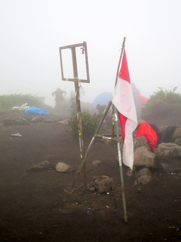
The Indonesian flag hangs next to what was formerly the sign declaring this Merbabu’s peak. The sign is now missing, and only an empty frame still stands.Late morning dew still hangs off the grass when we wake from our nap.
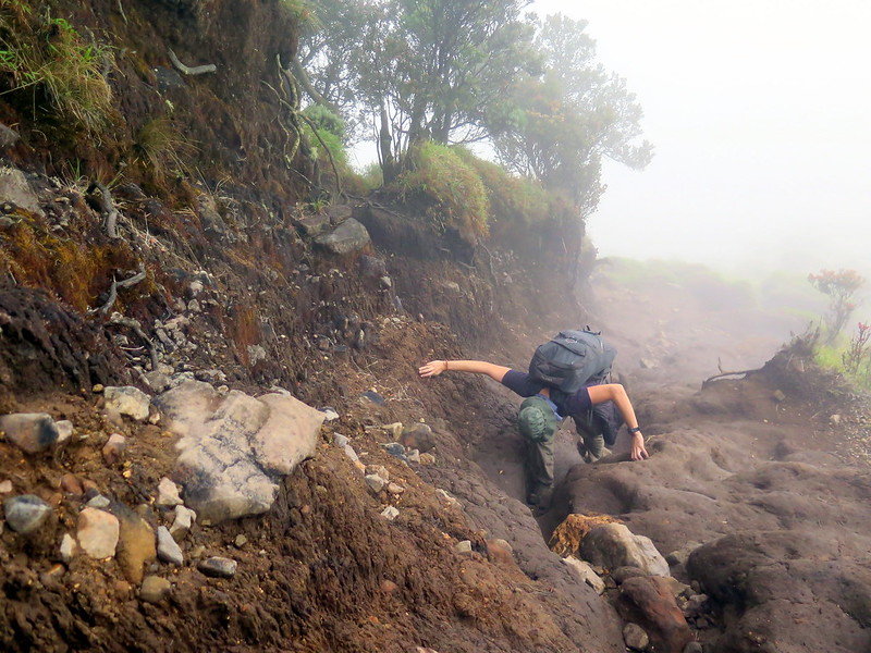
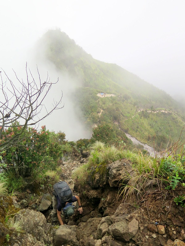
CORRECTION: it totally CAN be worse than the trail up. While the trail up was steep and muddy, it didn’t involve climbing down nigh-vertical rock and mud walls with our 55 L packs. At some points, the paths are so narrow that we use makeshift ropes to lower our bags down a cliff face first, then climb down ourselves. The going is slow, but we’re comforted by the fact that we’re losing altitude quickly. We just don’t want to lose it too quickly all at once.
How bad can this descent be, right? Definitely not worse than the ascent we just faced in the dark.Nope nope nope, it’s definitely steeper and worse. Here’s a 9 ft drop we had to navigate by sending down our packs, then climbing right along a 6-inch wide path to find a way down.Stoytcho climbs down the trail.
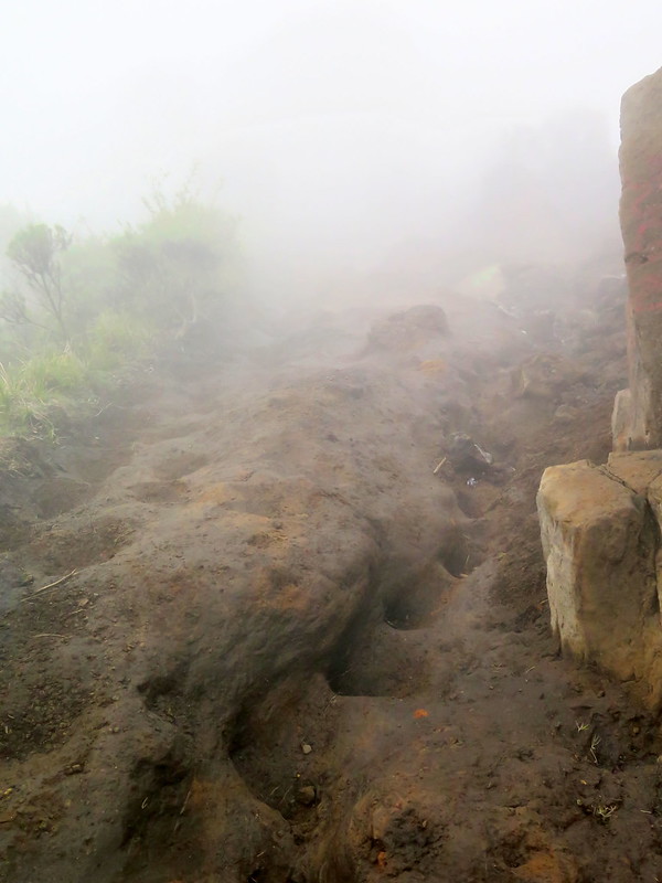
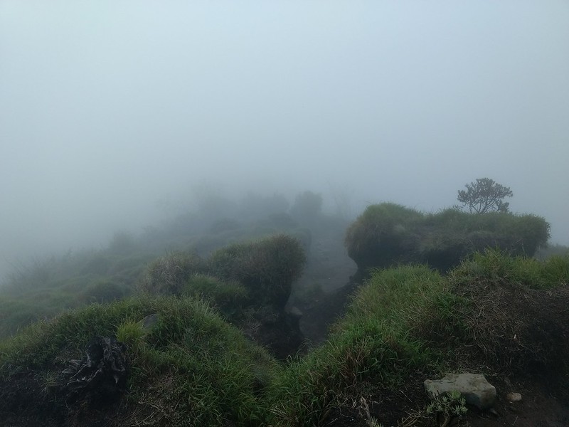
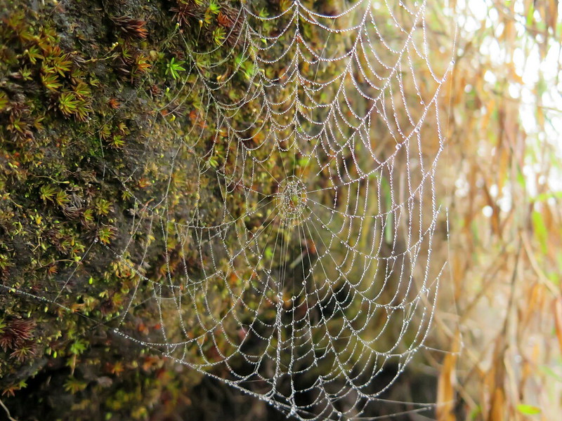
The dense cloud cover never fully lets up, but it creates a damp wonderland of life on this side of Merbabu. We take our time heading down, stopping for pictures of fungi, flowers, and dew-laced spiderwebs. We pause to admire the scenery when there’s an occasional break in the clouds. Though we can see little of the surrounding area, we often catch eggy, sulfurous whiffs in the wind—active vents offgassing. Merbabu is still a living volcano, even if it’s dormant now.
Erosion creates small islands of greenery and life in the mist.A dew-jeweled spider web.An orange fungus grows on a dead branch.A rare break in the clouds reveals a campsite at a lower peak and the valley below.
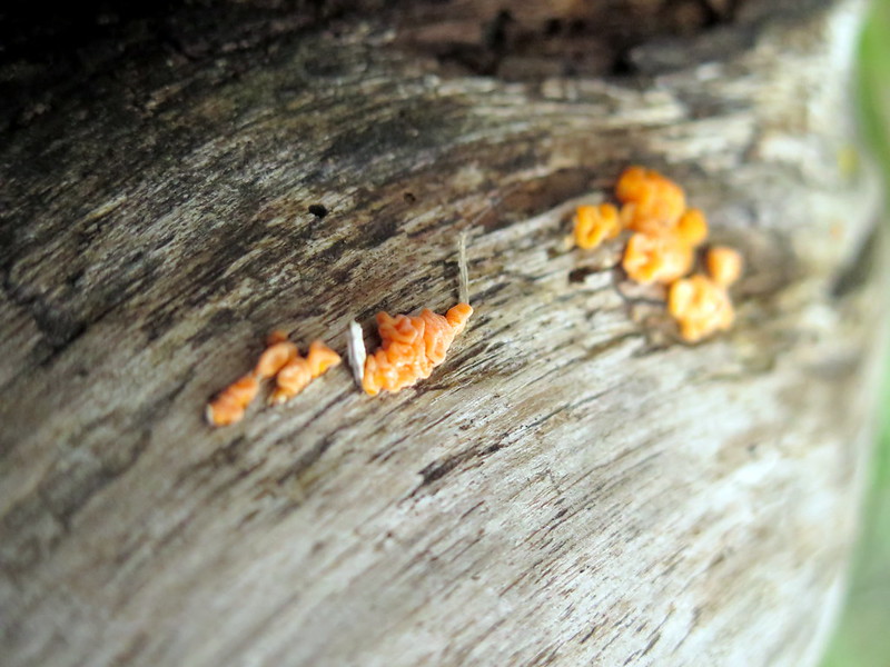
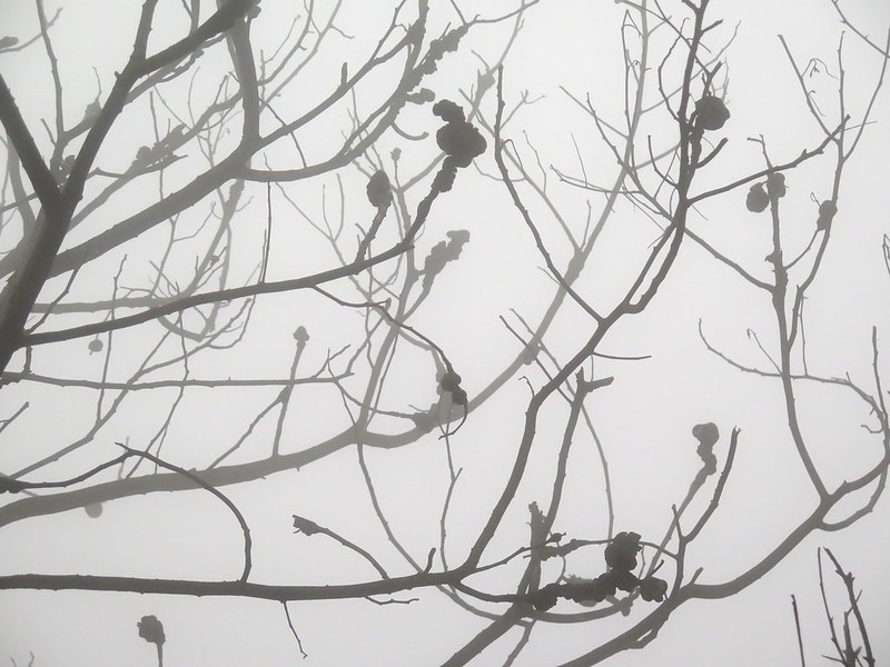
We reach the treeline and the forest re-starts, but in the thick fog it’s mostly eerie. There’s a disease afflicting the trees; they appear only as leafless skeletons standing in the mist, marked with bulbous growths that I would wager are a fungal disease. Then these trees give way to greenery, and we’re back in a live forest.
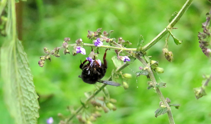
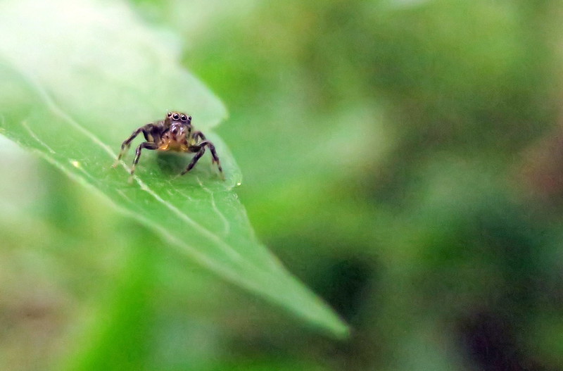
The start of the dead forest.Black, bulbous projections from the branches in the dead forest. This is likely a fungus.Back in the living forest, a bumblebee pollinates a flower.A jumping spider perches on a leaf.
Thanks to either impeccable or terrible planning (depending on who you ask), at this point we’re almost out of food and water. We ration the remaining half-bottle as we hike on. There are already signs of human life here: PVC pipes snake beside the trail and broken ones jut from the muddy trail walls, probably carrying water down to the farming village below. Then suddenly there’s a building, and a cemetery, and one of the PVC pipes empties into a trough of water. We’ve found civilization.
The cemetary at the end of the trail, one of the first signs of civilization.
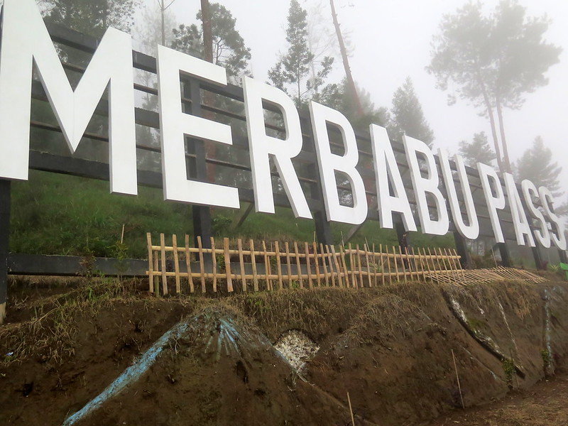
It’s another few hundred meters down to town proper, which turns out to be the town of Kenalan and not Kopeng as we’d hoped. We either took the wrong trail from the top or missed a turn on the way down, taking a totally different trail than the “gentle slope” suggested by this trail description. While this town may not be Kopeng, it does have a selfie-rific spot that the locals created to draw tourists to the town, with a huge white-letter sign that reads “MERBABU PASS” and a point where it suggests you put your camera to get a photo. There are also an odd array of sculptures and buildings, some still under construction. With the heavy mist, we’re the only people here, but it seems like a shame to not take some photos.
Kenalan’s “Merbabu Pass” sign.The lookout, where they suggest you put your camera to get both yourself and the whole “Merbabu Pass” sign into one picture. I climbed out there and verified it was stable, but would not recommend jumping up and down much.The marks of a hoe in the carved mud walls that lead down to the village.
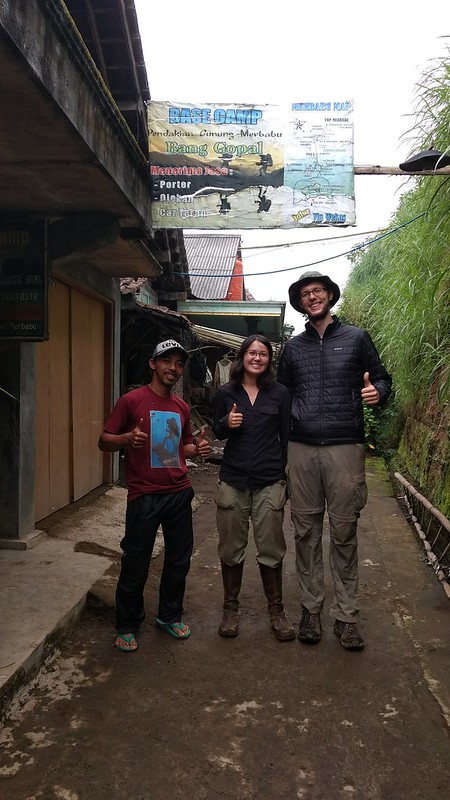
We hike the last stretch of road into town, a path more treacherous than any we faced on the mountain because of its steepness and damp moss on the stones. At the bottom, we’re greeted by a row of houses and some very curious women. We ask after a ride to Jogja and with shy smiles they bring us down the street to a tour runner, defined mostly by a banner proclaiming “Base Camp” and a woman inside selling trail food. She’s stunned to see us and invites us in, where we purchase some hot tea while she runs to get the only semi-English speaker, her husband. He’s a lively fellow, and in a few minutes we’ve negotiated passage back to Jogja for 600,000 IDR.
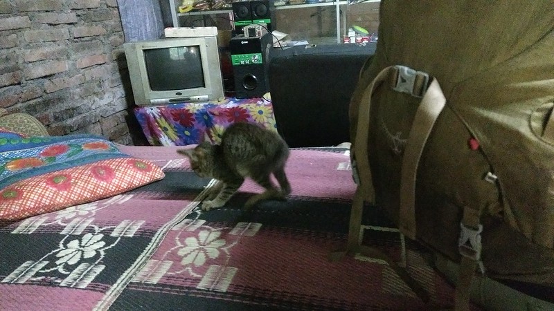
I ask for passage back to Jogja at “Base Camp”We play with the family kitten while transport is readied.
There’s some commotion as we leave, since the woman running the shop insists we take some cookies with us. We ask how much they are and she shakes her head with a smile that says, “Just take them.” We’ve paid her and the whole town of Kenalan in gossip for weeks to come, the two weird muddy, foreigners who appeared from the mists of Merbabu with some broken Indonesian, who sat in her house and played with her cat and her kid, and who then disappeared, probably never to be seen again.
We pose with the guy who drove us back to Jogja, whose wife so kindly gave us cookies.
If you want to do this whole hike, here’s a Google Maps guide of it. You can see the main northbound hike (to Kopeng) northeast of the trail we took:
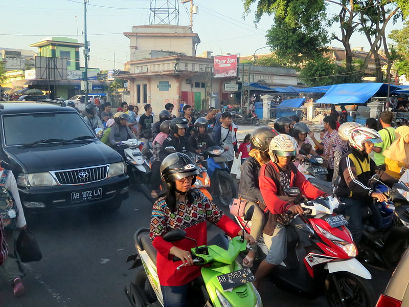
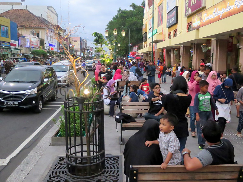
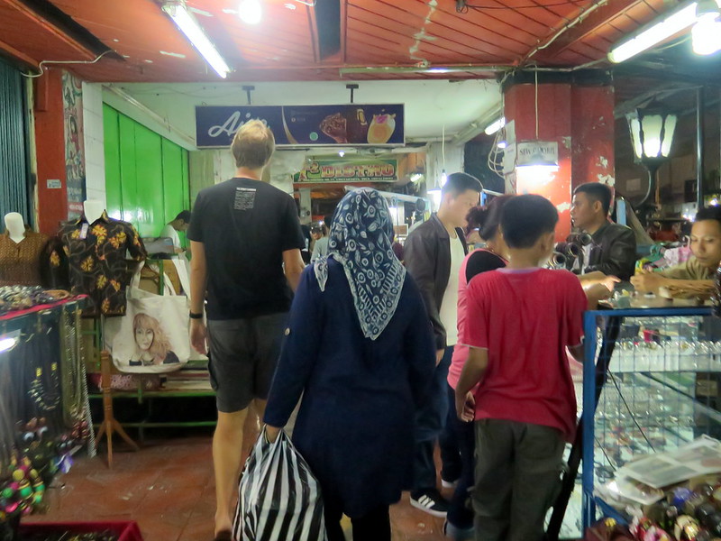
After spending a few days in Borobudur and Prambanan, we’ve moved to the Maliboro district in the heart of Yogyakarta (Jogja) proper. We’re here to eat food, rest a bit, and people watch. And on a street lined with multi-story malls housing American fast food brands, traditional batik clothing outlets, and pop-up vendors cramming the streets with cheap souvenirs and delicious food, we couldn’t ask for better. Maliboro is an artery for the city’s commuters that thickens to a crawl during rush hour. It’s also where the newly affluent middle class comes to shop, where a panoply of shopkeepers flood onto the streets to sell their wares, where everyone mixes and mingles. There’s always something to see.
Stoytcho and I roam the streets, ducking between people and capturing what we can on a camera with reflexes too slow for life here. On one occasion, I’m staring out into the flow of traffic and watch in awe as a man with a dozen sacks of rice and a crate of fruit on his scooter deftly weaves between cars. I shout to Stoytcho, “WHOA, did you see that?” “No,” Stoytcho replies, “I was distracted by a chainsmoking ten-year-old shopping for a lighter.”
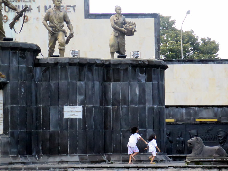
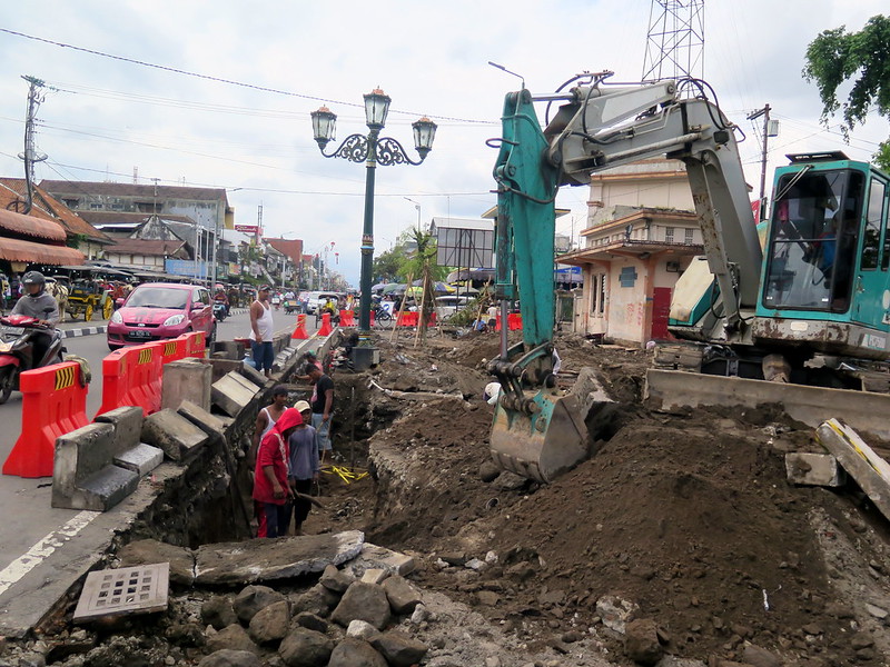
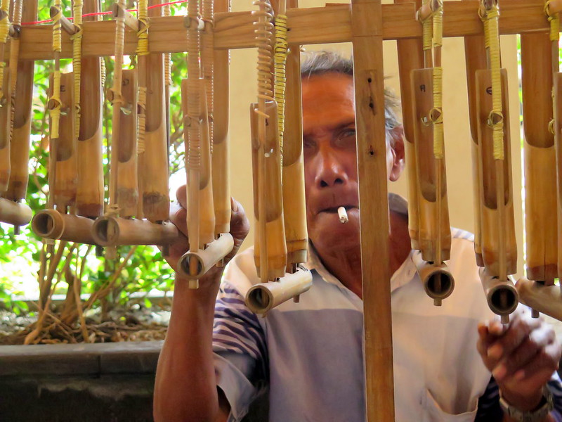
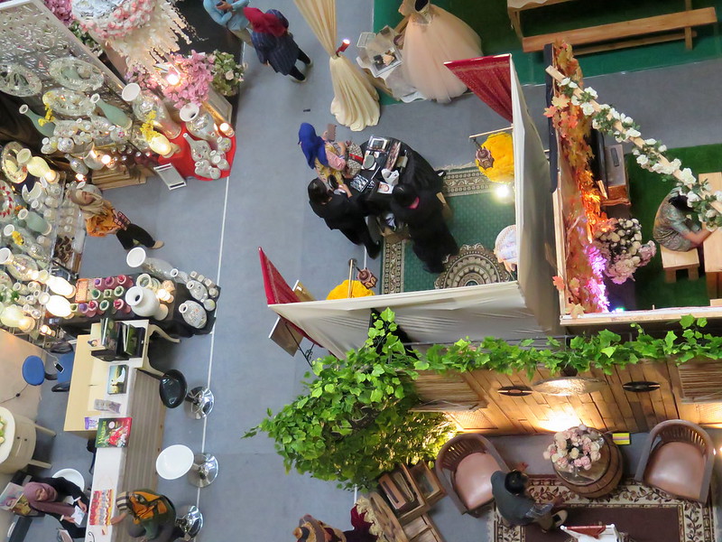
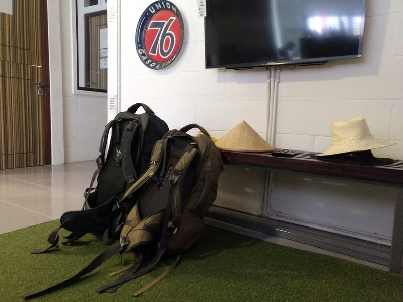
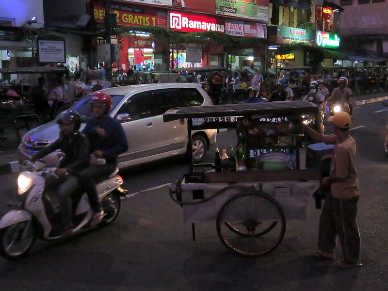
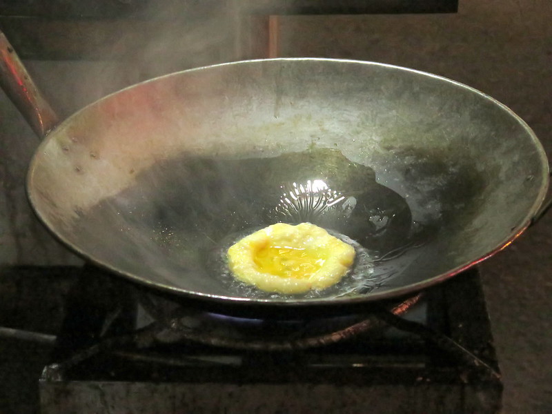
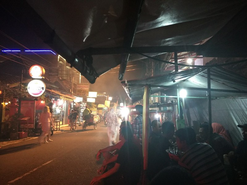
Two girls play near a monument to Indonesia’s revolutionary heroes, along Jl. Maliboro.Men work in a ditch along Maliboro, further complicating the daily rush hour.Angklung performers shut down Maliboro as they protest a ban on musical street performances. Their signs read variations of: “We are artists, not vagrants.”A performer plays the angklung on Maliboro, in defiance of the street performance ban.Women shop for bridal accesories at pop-up shops in one of Maliboro’s malls.Our backpacks rest at the Packer Lodge in Yogyakarta.Stoytcho rests in the lobby of the Packer Lodge in Yogyakarta.Ojeks and cars crawl along Jl. Maliboro in rush hour.Two women try to cross the street.People gather and walk the street in the evening at Maliboro.The late afternoon sun through a sculpture.The narrow walking corridor between shop stalls on Maliboro’s west side. Stoytcho towers over everyone here.A neon sign for a batik clothing store.A man attempts to cross the street with his food cart.A scrambled egg fries in a hot wok before rice and seasoning are added to make nasi goreng.Light and color in the night: the view from a food stall off Maliboro.
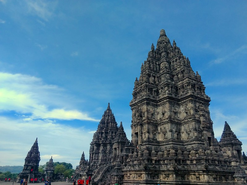
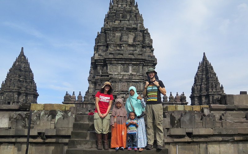
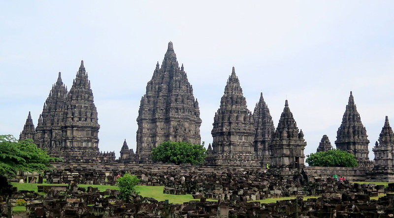
A visit to Jogjakarta is incomplete without seeing the massive temple complex that sits just on the edge of town, forty minutes or so by bus from the center. Prambanan is a towering and expansive series of Hindu temples, thought to have been erected during the 9th century when the ruling dynasty of Indonesia shifted from Buddhism to Hinduism and answered the Buddhist temple of Borobodur with Prambanan.
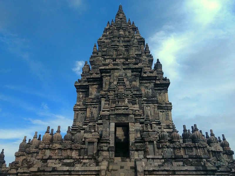
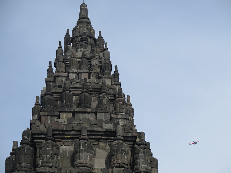
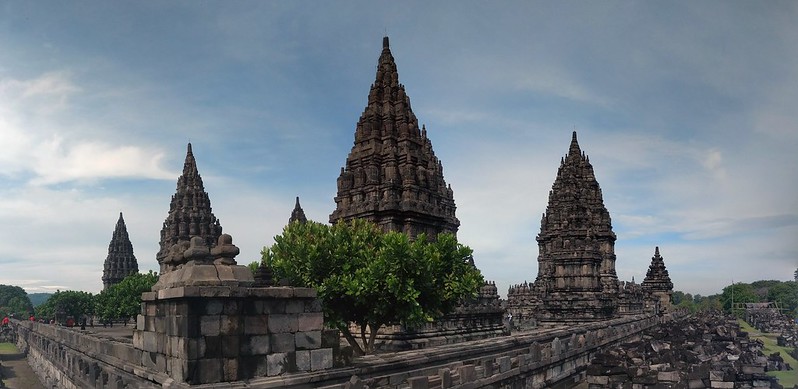
Photos do little justice to the feeling of the place. Unlike Borobodur where you can scale the temple itself so that it seems smaller the closer you get, Prambanan offers no such relief. The nine central towers do exactly that – they tower over you and climb to incredible heights. In my opinion the eye is fooled even further by the shape of the towers themselves, dwindling to needle-like peaks which seem all the further away.
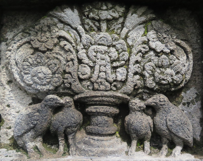
Each spire has a set of stairs leading up about halfway, leading to a path encircling the temple and a door into the tiny inner chamber. The path takes you through a relief carved religious story or legend. This is a photo of the tree of heaven, a common theme in many Indonesian works.
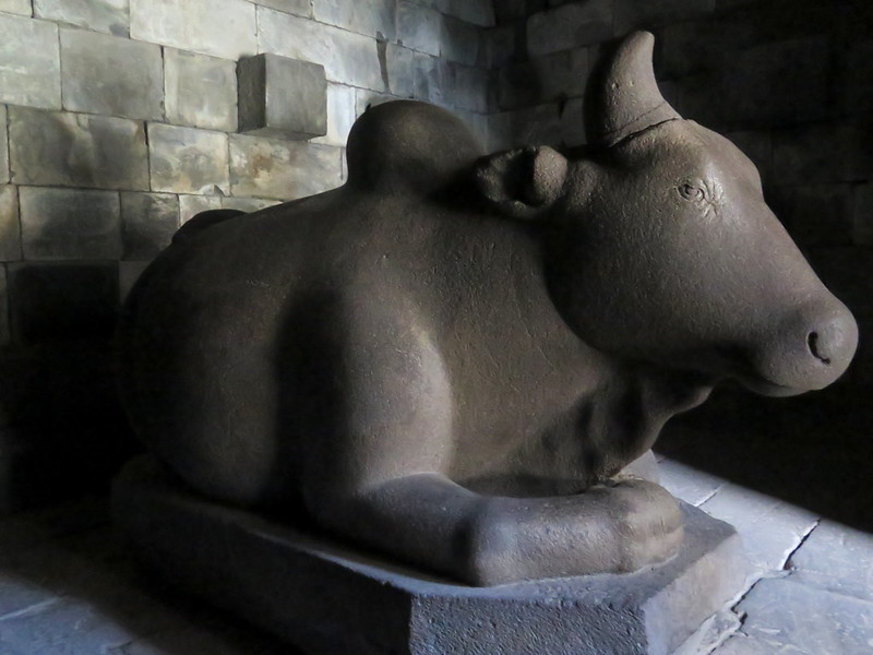
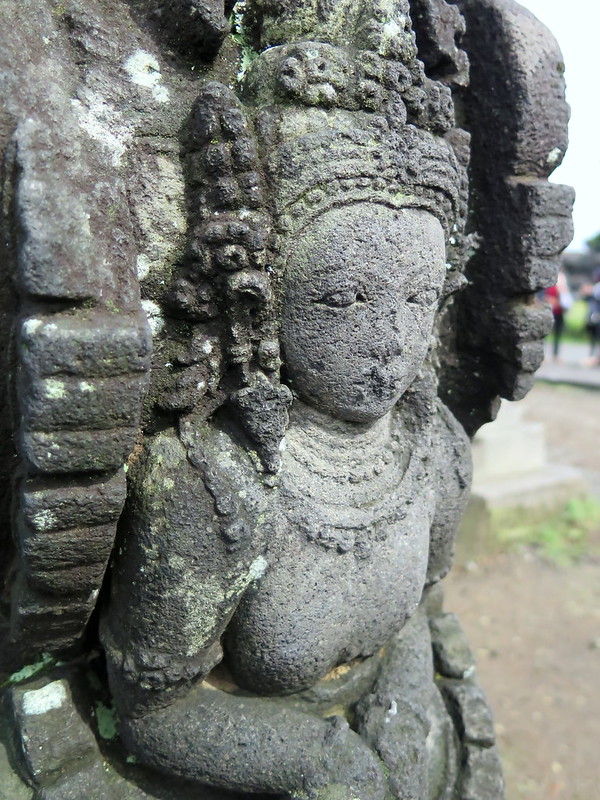
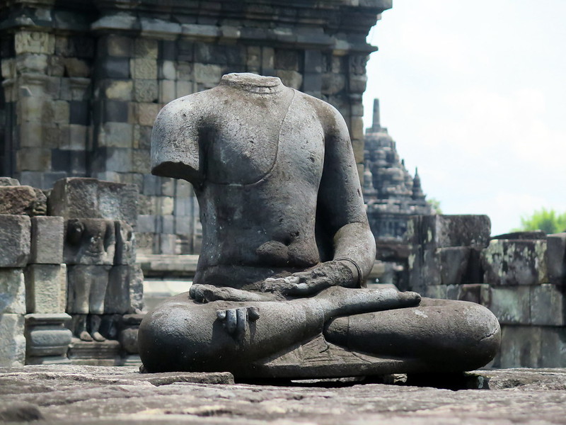
Inside each spire is supposed to be a deity or their representation though most of the statues are missing.
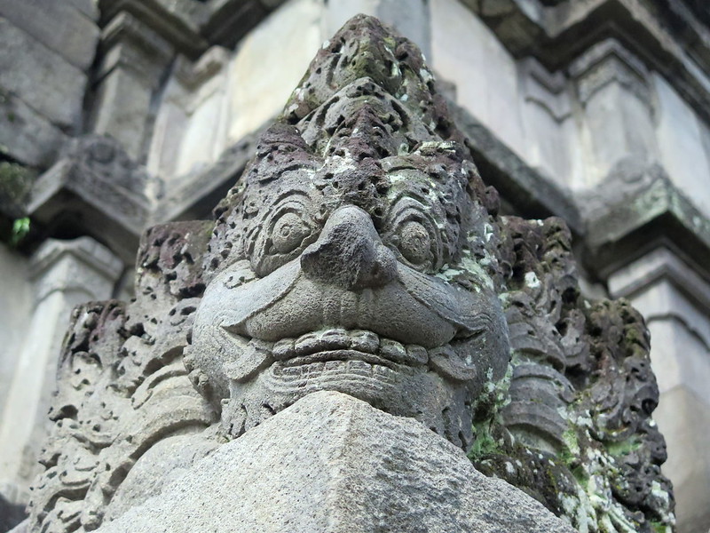
The surviving ones are treated with care, though many are replicas and the originals are housed in museums. The outsides of the temples are covered in carved statues and faces, often better preserved than the shallow reliefs inside.
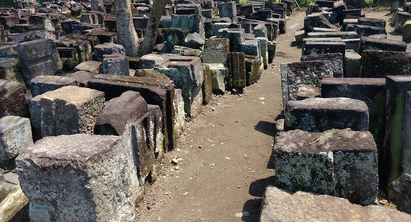
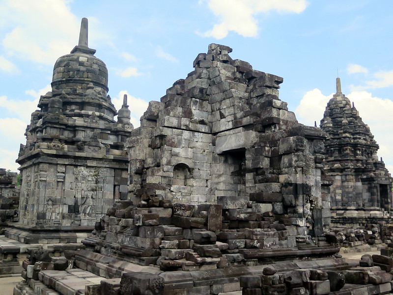
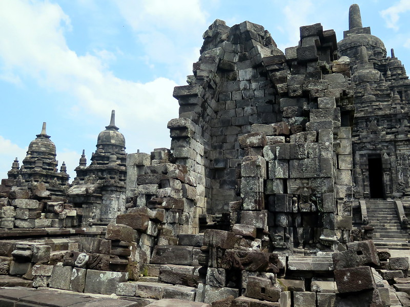
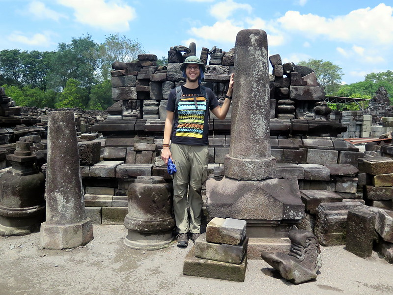
The temple area includes four separate temple complexes – Prambanan, Lumbung and Bubrah temples, and the Sewu temple. All four are in various states of repair, having been historically plundered for stones and statues and in recent times suffering damage from earthquakes. Prambanan once housed many temples of various sizes in concentric squares. Now only the central temples stand, and a few of the smaller outer temples. The rest are waiting in piles to be rebuilt.
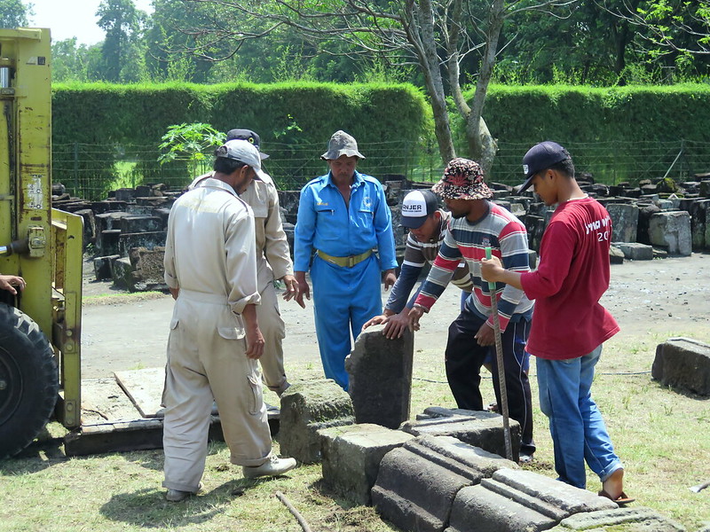
We saw reconstruction teams working on putting some of the smaller temples back together. Fitting the pieces together in the correct order and making the structure stable again is hard work. Not only is the location not marked, but each piece weighs a ton. Maybe not literally, but heavy enough that one person can’t lift it.
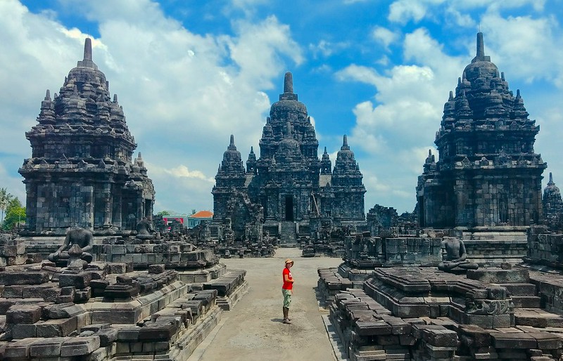
For all the wonder that is Prambanan, the other temples deserve a visit. They are smaller in both area and height, but offer more diverse temple styles, statues, and reliefs without the crowds of tourists. When we went over to Sewu temple, there was literally no one else there.
Here you can see not only more of the art and architecture, but also of the destruction wreaked on the temple site by the earthquake. These temples were once fully repaired, now awaiting time and funds.
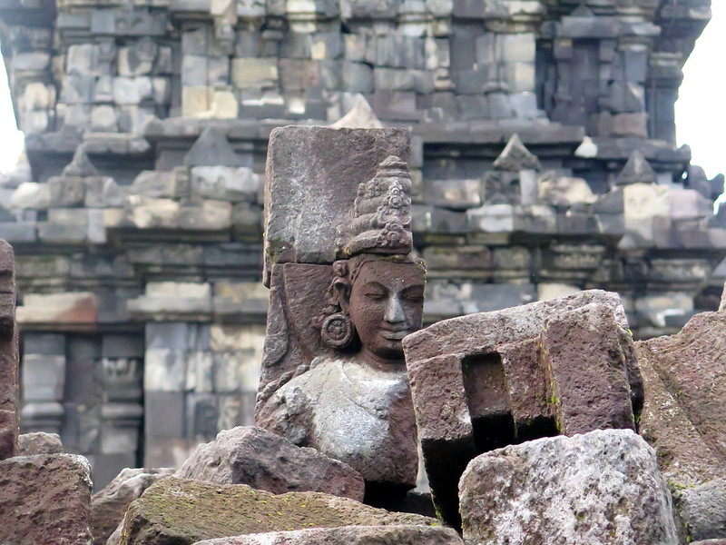
The Sewu complex is full of statues, usually damaged in various ways.
It houses reliefs waiting to be put in their proper place.
And is a storage grounds for spare spire tops and temple stones, intended either for their original location or to fill in a partially complete temple.
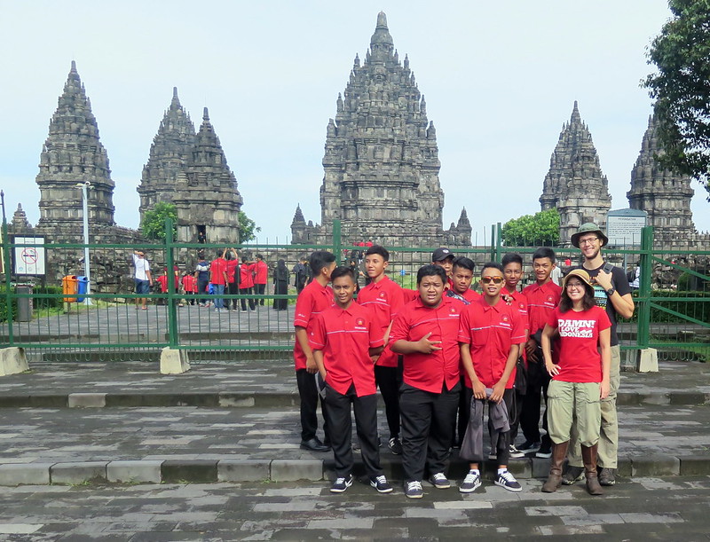
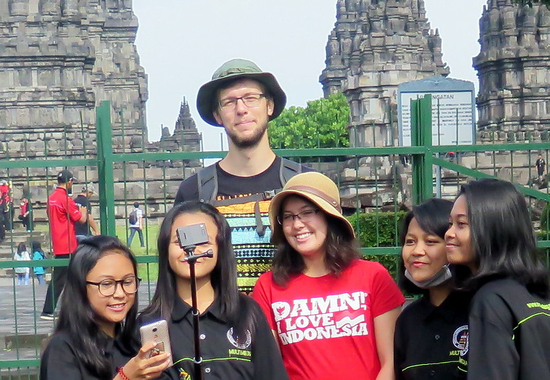
For tourists who stand out : be prepared for the local crowds. As with all other attractions we visited in Indonesia, groups and individuals stopped and asked us to take a photo with them. Sometimes this meant a selfie, other times it meant we were going to be in some classes’ travel photos. It’s exciting and fun, but eventually I get tired of it. Natalie does a bit better with photo stamina.
Finally, a few last shots of the entire complex. We found the entire day to be completely satisfying. A quick breakfast, temples and tourists, and a bit of haggling at the end. Be prepared with water and a bit of people stamina, and come as early in the day as humanly possible – the grounds get sweat-and-sunburn hot quickly, and there’s a lot of walking to be done.