I haven’t captivated/delighted/enchanted/thrilled/terrified you with jumping spider photos recently! We haven’t seen many since New Zealand, but Borobudur turned out to have several. They were going about their business, but I managed to enlist a few for photoshoots.
This little spider on one of the bas-reliefs stopped for only a moment before hopping away.
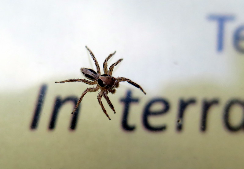
Likewise, this jumping spider on an educational sign showed little interest in me or the camera.
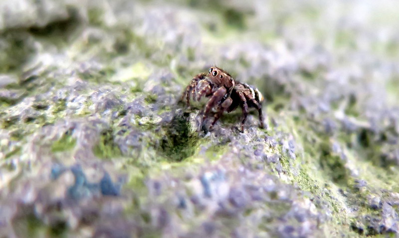
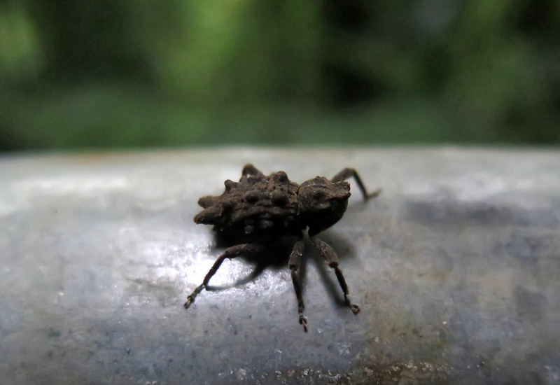
This little spider stuck around for a while and loved the camera.
Here s/he is again…
And off, saying goodbye. Judging from the abdomen shape, I’d guess this was a female.
Again, I got little interest here. “Scram! I’m eating lunch.” I managed to get only one good shot before s/he backed away into a corner.
And remember, spiders are friends, not foot-stomping material. They’ll thank you by eating all of those flies and mosquitos that *bug* you so much. (HAHAHA…I regret nothing.)
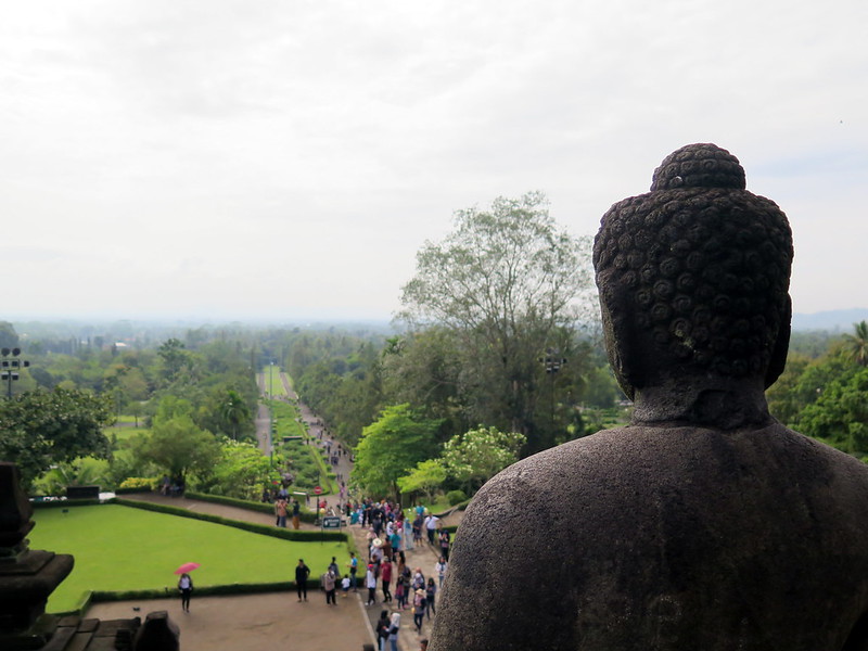
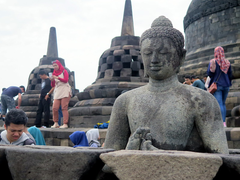
A Buddha statue overlooks crowds of visitors to Borobudur, the world’s largest Buddhist temple.
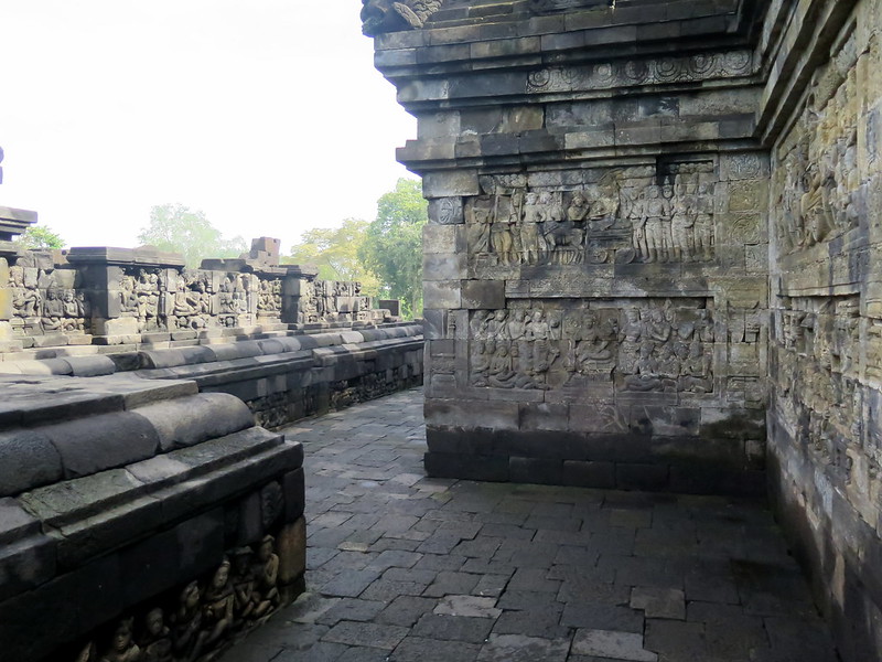
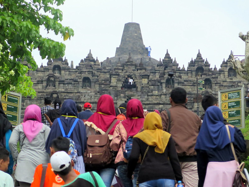
There’s not much I can say about Borobudur that hasn’t already been said or written, so I’ll keep it short: Borobudur is the largest Buddhist temple in the world. Constructed in the 9th century, the temple’s nine stories represent the three realms of Buddhist cosmology (world of desires, world of forms, and formless world) and tell the tales off Buddhism through more than a thousand reliefs carved into its stones. In walking its corridors, the temple becomes storyteller to all pilgrims and visitors, narrating the teachings of Buddha and his enlightenment.
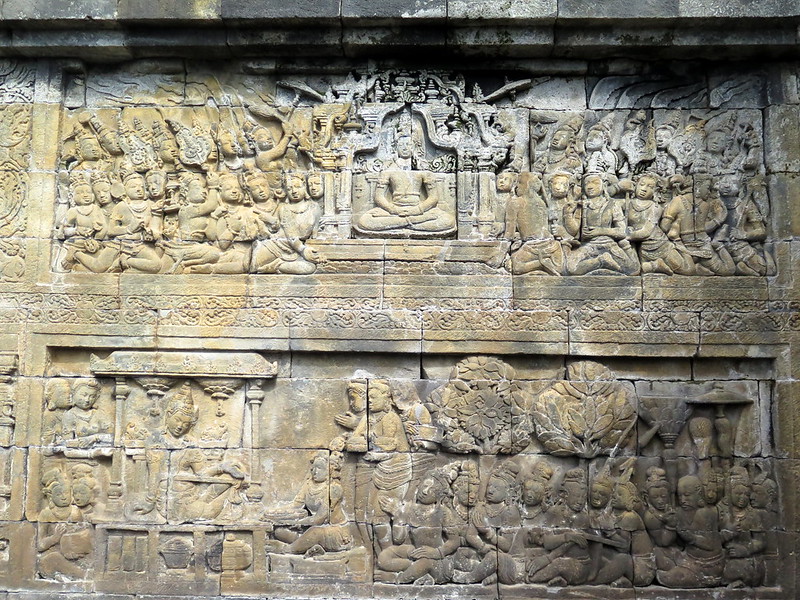
The carved bas-reliefs in Borobudur’s corridors illustrate Buddhist stories and principles. A walk through all of the reliefs is a formidable 3 km (1.86 mi).
One of the thousand bas-reliefs on Borobudur’s walls.
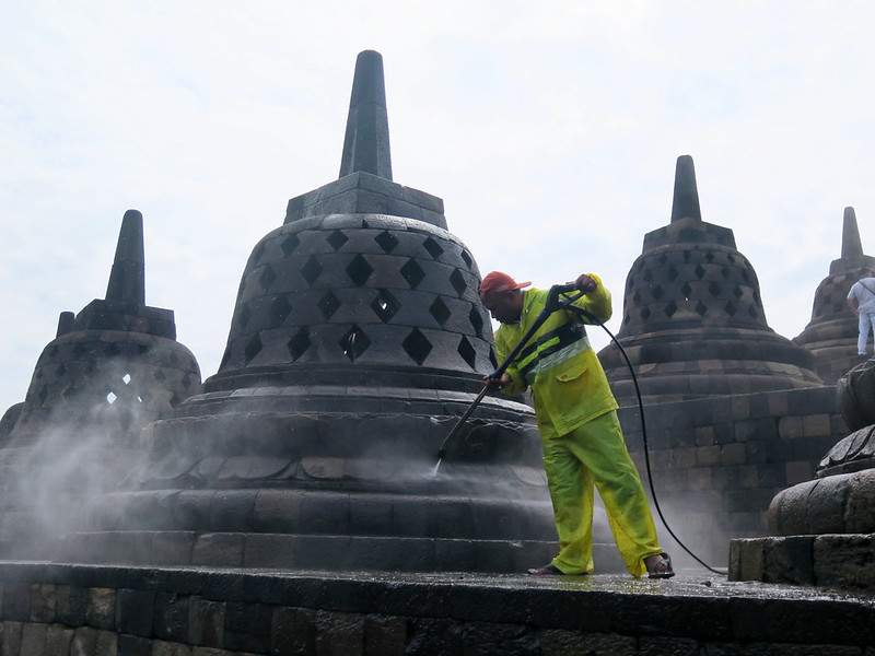
There’s not much I can show you through our photographs that hasn’t already been seen. Borobudur is one of those picture-perfect places, with each snapshot of the place becoming art in itself and tons of visitors have that awe-inspiring, Instagram-exploding photos of Borobudur at sunrise. We don’t have sunrise photos. But how about this: ever seen an ancient Buddha get a bath?
P.S.: If you visit, here’s a money-saving tip! You can buy a ticket for both Borobudur and Prambanan at the ticketing office that saves you several dollars. The only catch is you’ll have to visit Prambanan the next day, but it’s only a taxi/bus ride away.
Groups of schoolchildren climb to Borobudur Temple in the morning, as a man walks around on the dome of its main stupa.
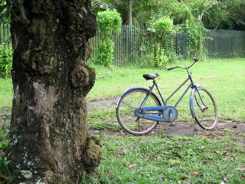
A rented bike left by a tree. People sometimes rent bikes in Borobudur to get around the compound.
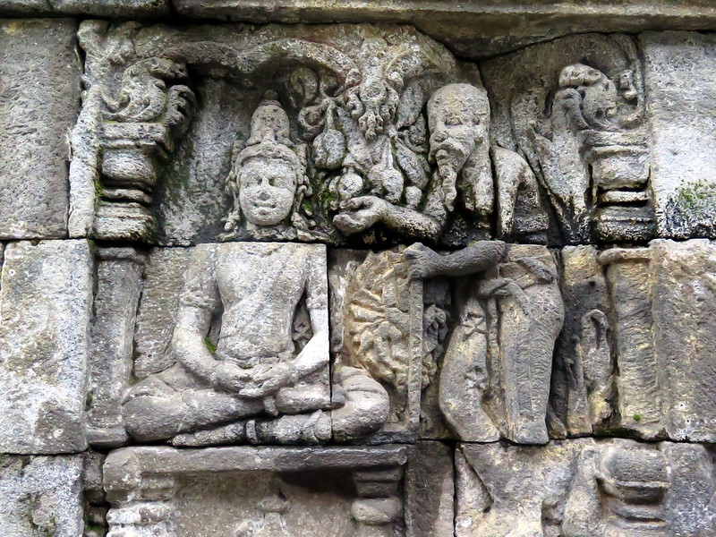
A bas-relief, depicting a man seeking wisdom (possibly from Buddha).
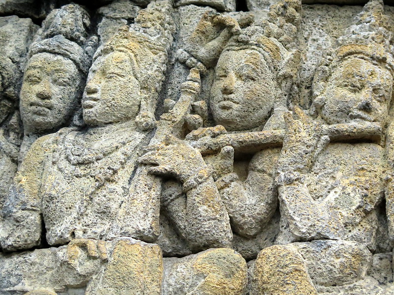
A troupe of four musicians in a bas-relief.
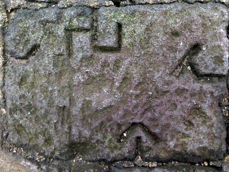
Fitting it together: markings in the stones likely helped builders figure out how to put them together. I don’t know whether these markings came from the initial construction or the reconstruction when the temple was rediscovered.
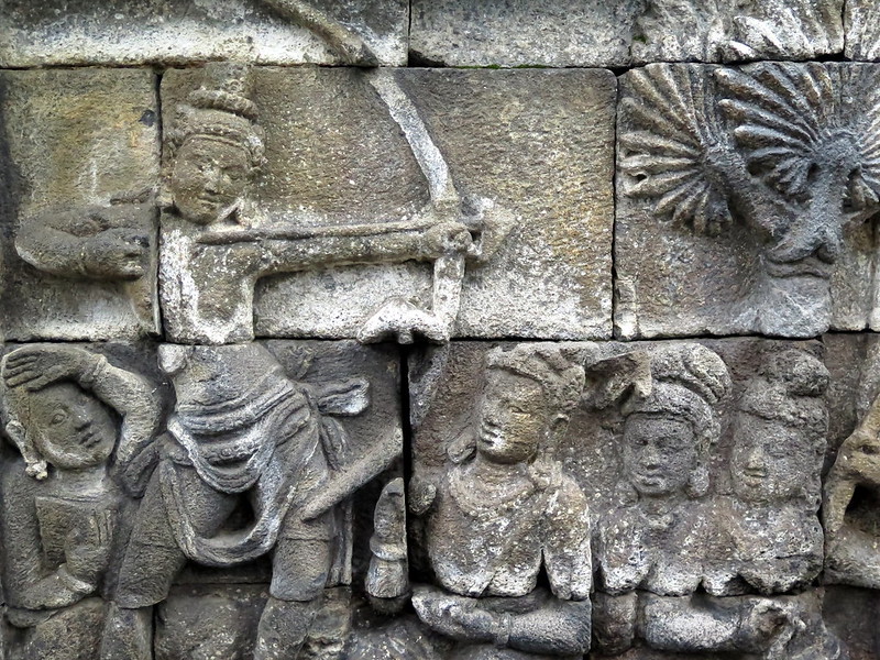
An archer in the bas-reliefs takes aim as onlookers watch in curiosity and fear.
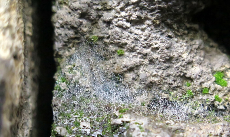
Dew-spun spider webs on the stones at Borobudur.
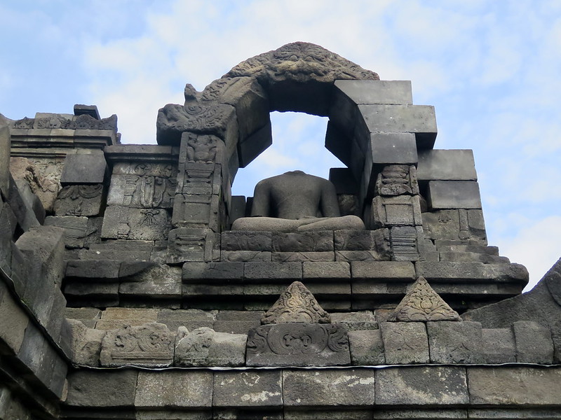
A headless Buddha statue sits in its foyer. Several buddha statues are missing heads and limbs because of both legal and illegal looting of the temple prior to restoration. Buddha heads in museums around the world originally came from Borobudur.
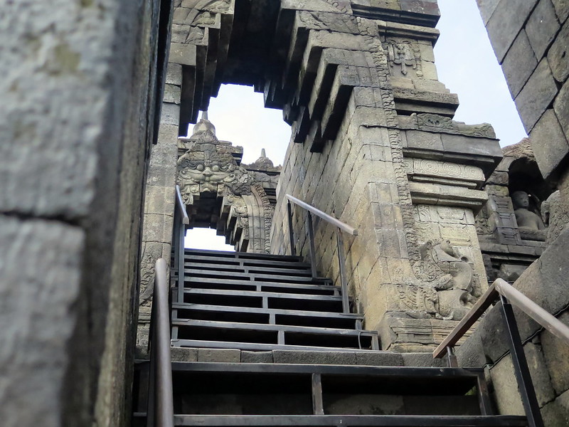
The steep ascent up to the highest level of Borobudur.
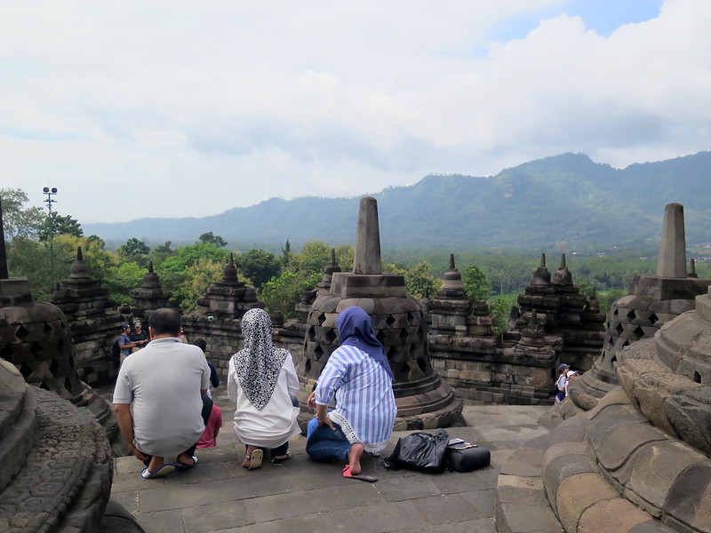
Three visitors rest and admire the scenery on the highest, stupa-studded level of Borobudur.
A partially-disassembled stupa reveals the Buddha statue within, posing his hands to represent ‘dharmachakra’ (spinning the wheel of dharma or karmic law).
A buddha stupa gets a bath with a pressure washer as part of temple maintenance.
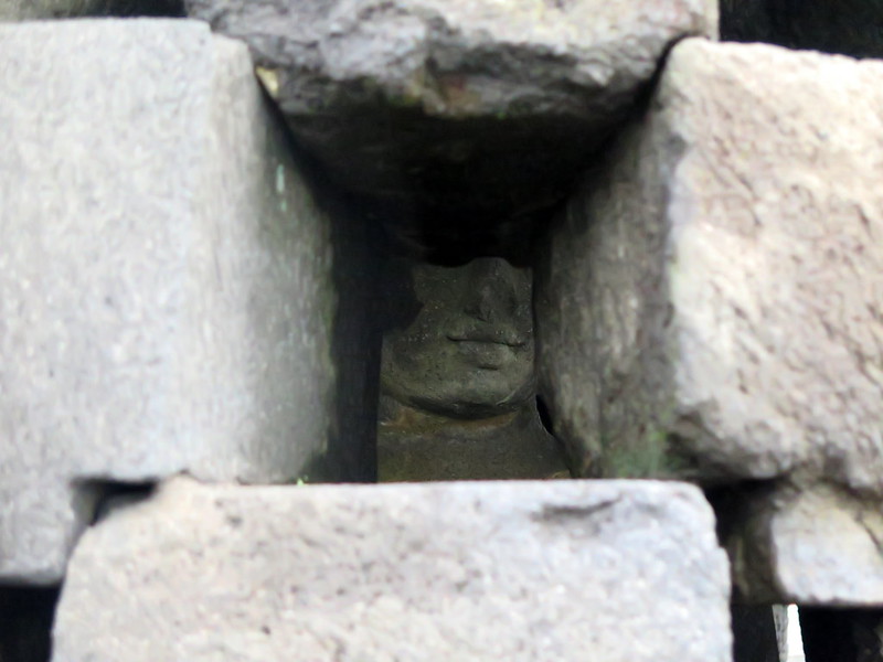
The enigmatic smile of a hidden Buddha statue.
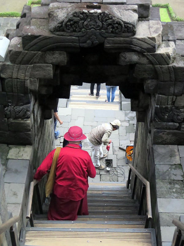
A Buddhist monk descends the steep stairs to the lower levels, where workers are assessing the stability of Borobudur’s foundation.
After visiting the temple, Stoytcho and I climb to the top of the hill in the temple grounds to get a better view.
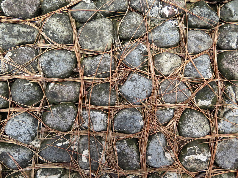
Perfect arrangement: the needles of a pine tree assorted into crevices between the cobblestones.
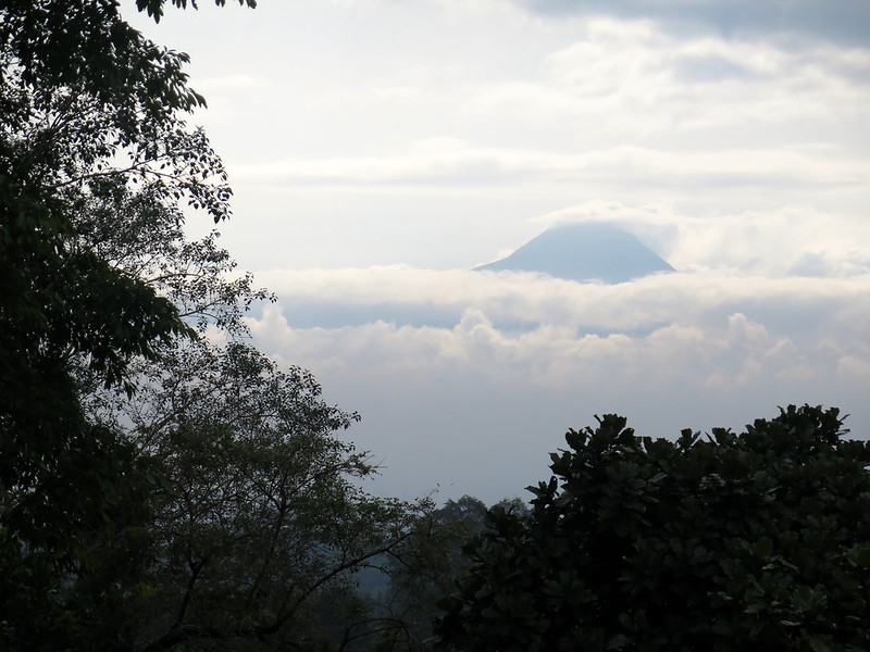
A view of one of Java’s volcanic cones from Borobudur, possibly Mt. Merapi.
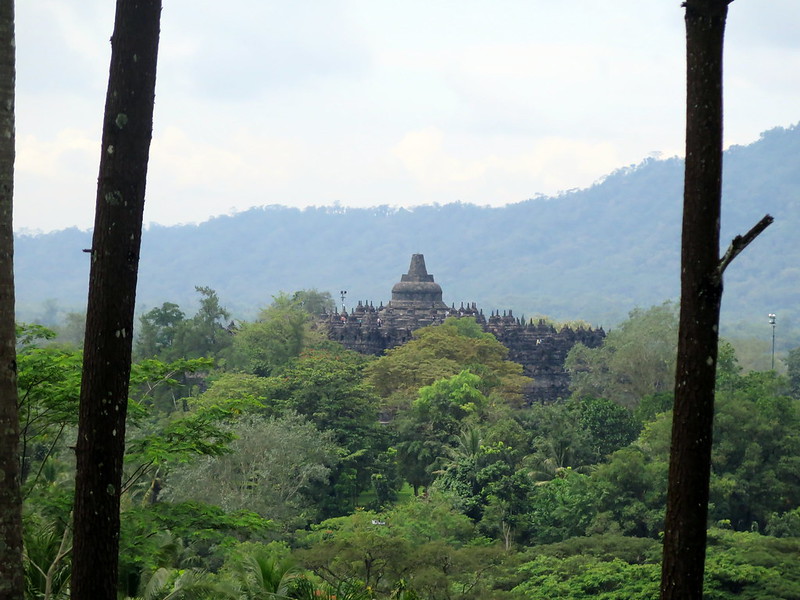
A view of Borobudur Temple from afar, rising from the jungle.
Passing the edge of a city by train, Jakarta->Yogyakarta.
We’re bound by train to Yogyakarta, the “cultural capital” in southern Java that’s affectionately referred to as “Jogja”. Though a flight is only an hour compared to the train’s nine-hour trip, it’s nine hours well-spent admiring Java’s scenery.
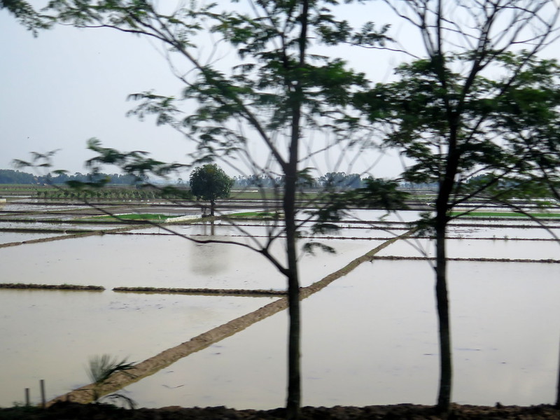
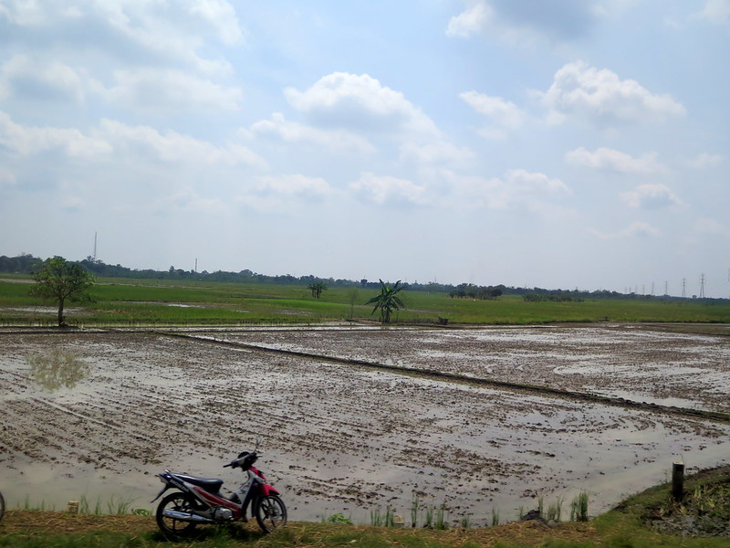
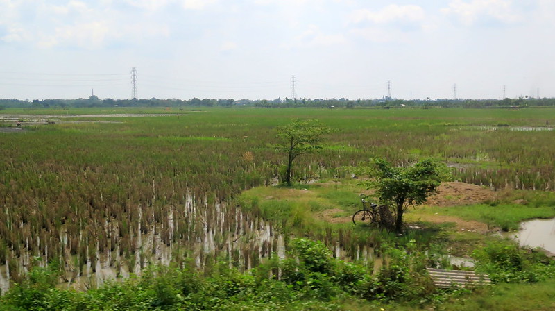
Trees silhouetted against empty rice paddies.
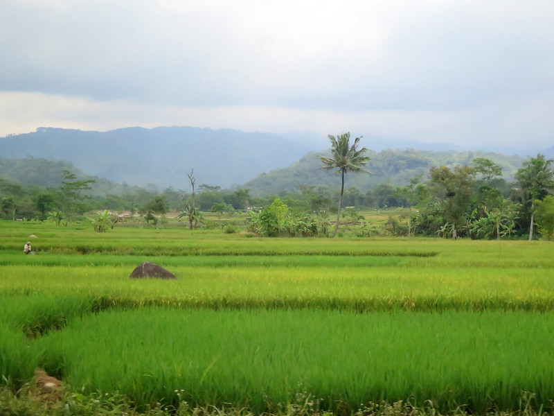
Rice paddies thick with the greenery of rice plants in Southern Java.Javanese dwellings on stilts.
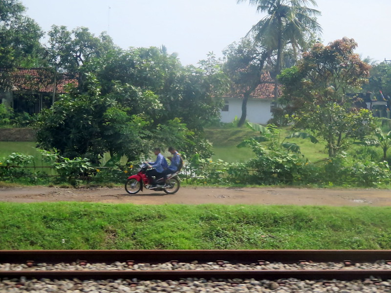
A passenger texts while catching a ride on an ojek.An unfocused photo of construction work on a river (likely for a bridge).
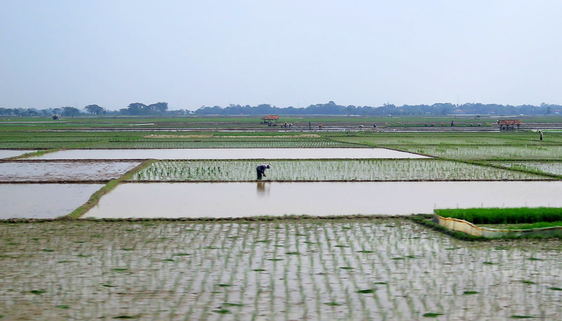
This is the most densely-populated island in Indonesia, and villages, fields, and rice paddies speed by every second. Each moment is a snapshot of Java beyond the cities, where most people farm and know no other way of life. As we speed by, I imagine all of the knowledge they must have about farming and the seasons of Java—how to start rice shoots growing, when to plant them in the flooded paddies, when to harvest the rice plants, when to let a paddy lie fallow. I try to imagine what it must be like to push the rice seedling into the muddy water, feet sunk into the same mud that will nourish this rice plant as the sun beats down on my back. It’s hard work and I’m lucky I don’t have to do it, but I want to know how it feels.
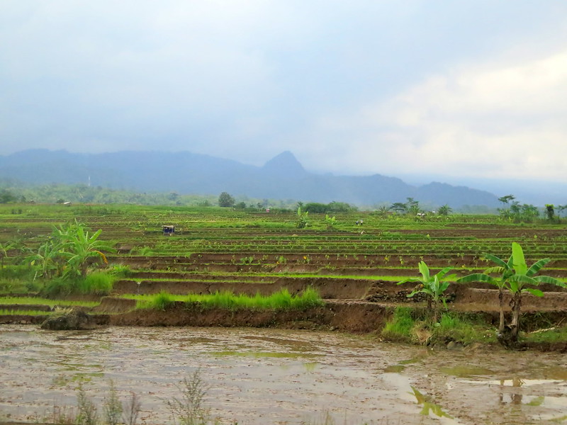
Terraced fields near one of Java’s many volcanic cones.
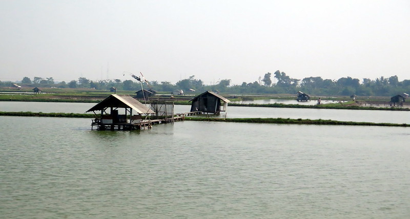
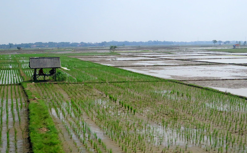
A man plants young rice seedlings in a flooded paddy.Farmers escape the heat of the day in a dwelling on the rice paddies. Most fields and paddies we passed had a shelter to hide from the sweltering tropical sun.
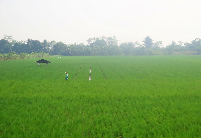
A farmer walks through lush, peridot-green rice paddies.Farmers dump harvested rice from sacks for husking.An ojek stands before a harvested rice paddy.
As people increasingly flock to Indonesia’s cities (a worldwide trend), the passage of this agricultural knowledge halts. Maybe one day it will disappear entirely, forgotten or as good as forgotten, left only in written texts. But hopefully someone here will see value in this knowledge and keep it alive.
An island in a sea of rice paddies. The erratic growth of the rice here might be from grains lost from the last harvest in a field now fallow.
Jakarta is a sprawling megacity, with 10 million people crammed into an area smaller than New York City. The people here come from a kaleidoscope of cultures and faiths; dozens of Indonesian ethnic groups rub elbows and the majority Muslim community lives alongside communities of Buddhists, Christians, Catholics, and Hindus. It’s business as usual for the thousand year-old seaport, which has seen waves of nearly all the world’s religions (Hinduism, Buddhism, Confucianism, Islam, and Christianity) carried on the tides of trade routes.
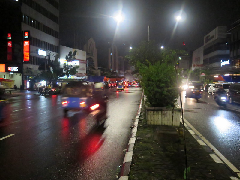
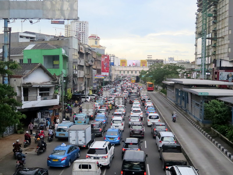
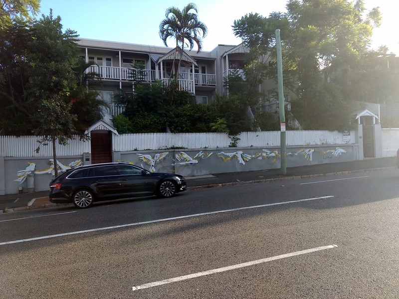
Indonesia’s wealth has increased in the past decade, but with it has come rising income inequality that is etched into Jakarta’s cityscape. We’re staying in Glodok, an industrial area near the seaport characterized by corrugated aluminum roofing, wooden market stalls, and open sewers in the streets. But take a bus thirty minutes south and you’ll find yourself in Central Jakarta neighborhoods like Menteng, surrounded by walled mansions and multi-story malls with marble floors pushing the latest luxury brands, where doors are opened for you by bellhops who speak perfectly unaccented English. The economic disparity in the city is jarring—residents of Glodok and Menteng may share a city, but they live in different worlds.
In spite of the wealth gap, nearly everyone we meet in Jakarta is happy to see us. Any smile from us is immediately returned by a passing person. On the bus and around town, people who speak English ask us about our travels and translate our responses for excited relatives. Gaggles of schoolchildren approach you at tourist attractions, tasked by their teachers to interview tourists as English homework, and in nervous giggles ask about your favorite Indonesian food. I’ve never felt more welcome in a country where I don’t speak the language. It’s as if the entire country is excitedly curious about you, reaching out to embrace you in every act.
Jakarta rush hour seen from Glodok, where five rows of cars fit into four lanes and sometimes the motorbikes skip traffic via the bus lane (right).
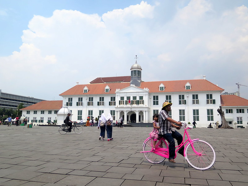
The square in front of the Jakarta History Museum in Kota Tua.
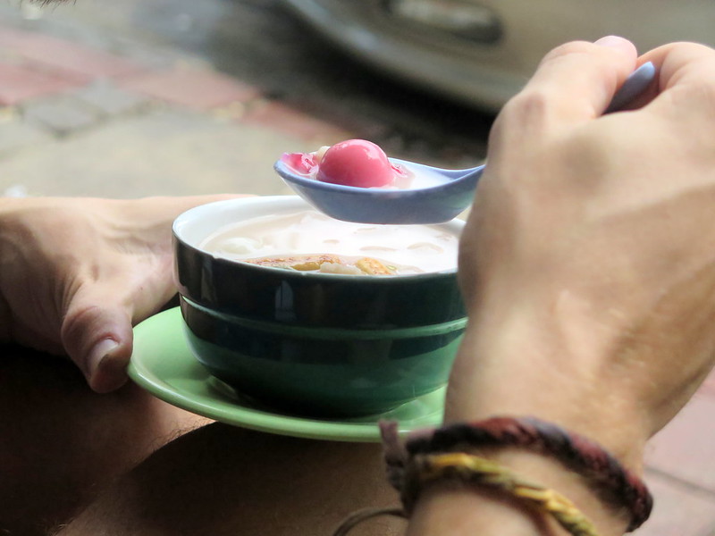
Stoytcho tries a hot bowl of wedang ronde, a local sweet snack.
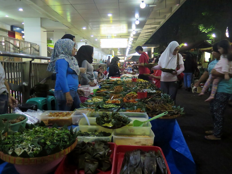
A variety of dishes offered at a padang stall in the Blok M food market.
People watch rainy-day traffic in front of the Istiqlal Mosque, the largest mosque in Southeast Asia. Across the street is the Jakarta Cathedral; both houses of worship have coexisted on this street for decades.
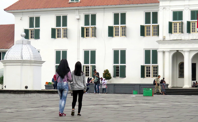
Two girls, one with a headscarf, walk together in front of the Jakarta History Museum in Kota Tua.
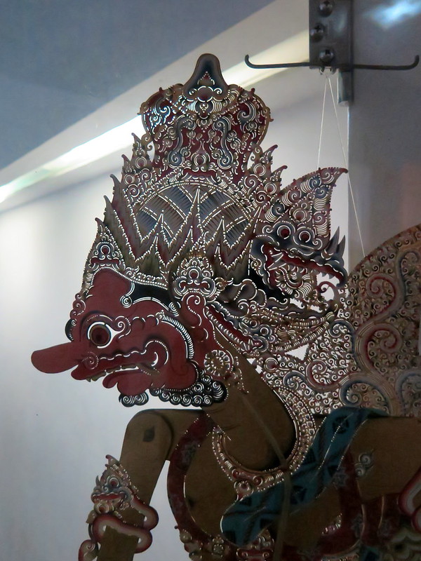
A puppet made for Wayang, the traditional Indonesian shadow puppet theater.
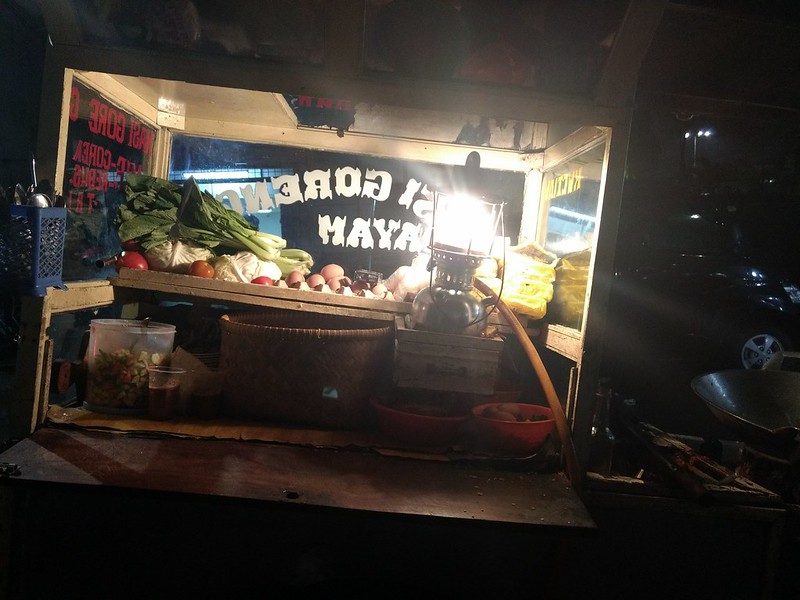
A nasi goreng (fried rice) stall on the street.
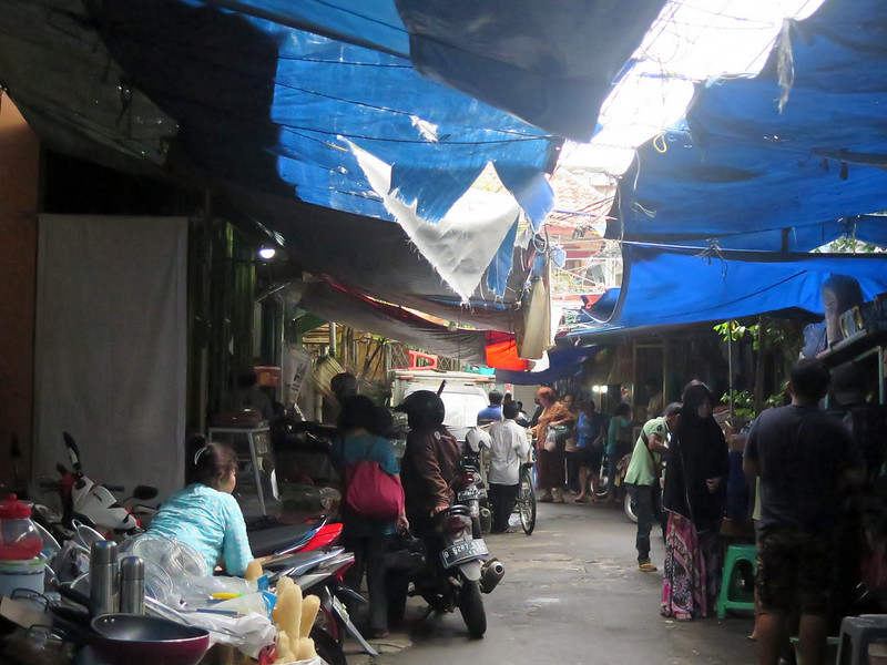
The narrow, makeshift market-crammed streets of Chinatown, near Glodok.
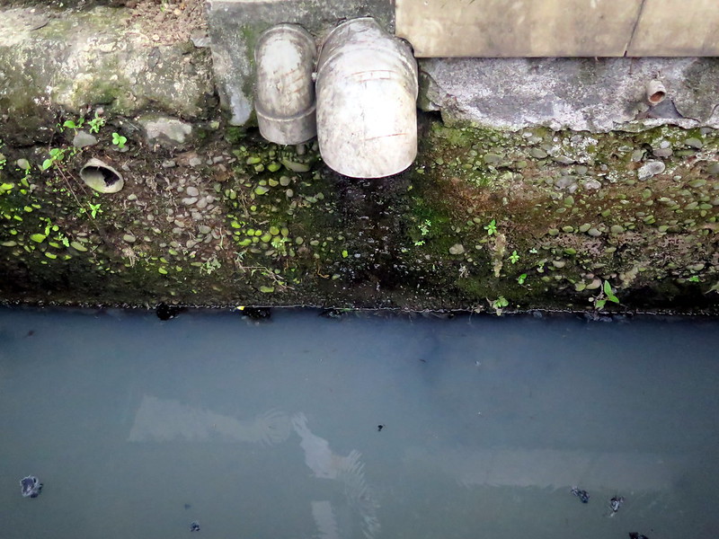
Pipes empty into a streetside open sewer in Glodok.
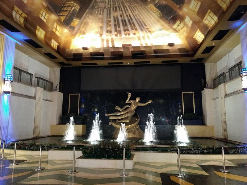
A fountain in the Grand Indonesia Mall.
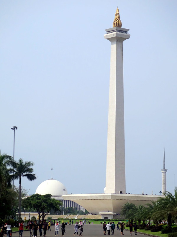
The National Monument (Monas), commemorating the country’s fight for independence.
A woman and her child in an ojek (motorbike) parking lot.
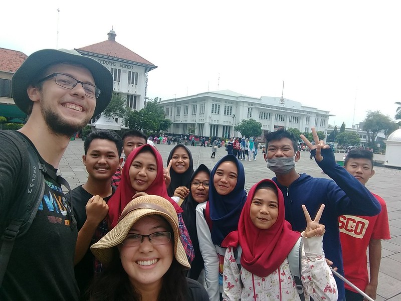
We take a selfie with Indonesian students that interviewed us for their English class.
Just south of the Queensland-New South Wales border, Dorrigo National Park is a green rainforest refuge, one part of World Heritage Site known as the Gondwana Rainforests of Australia. The patches of rainforest here are all that remain of the thick rainforest that once blanketed Australia millions of years ago. Thick mists and rain nourish the forest, and the water flowing from the soil collects into streams that tumble from rocky cliffs. And uncleared by humans, these forests remain a refuge to thousands of species: microbes, plants, fungi, and animals. Just a brief stroll through the forest reveals a kaleidoscope of wildlife, carrying on just as it did when dinosaurs roamed the earth.
We visited Dorrigo National Park on a rainy day, raingear ready and cameras poised to capture what we saw. Sometimes we were surprised. Sometimes we weren’t fast enough. But here’s a sample of what we found in the 7 km loop from the Dorrigo Rainforest Center:
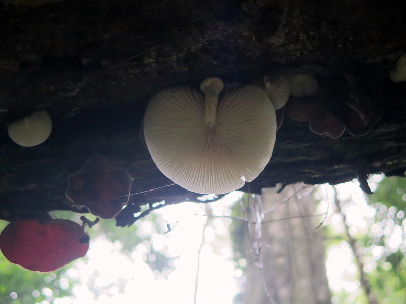
Peek: a tree that has fallen across the trail sports a family of fungi
This shy bug has pulled his eyestalks in and waits for me to leave.
A heavy vine winds around a tree and runs up into the canopy above
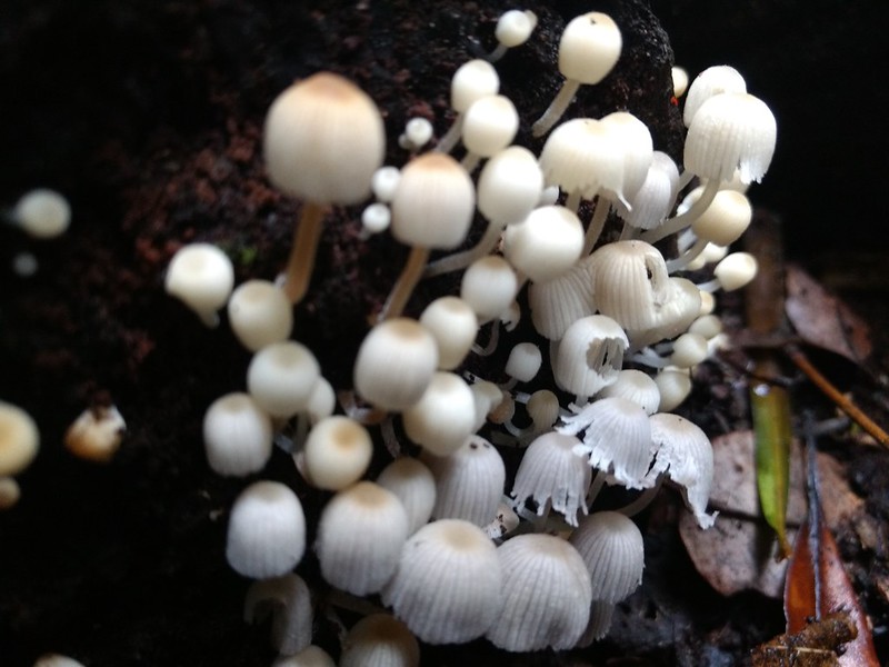
Little family: mushrooms of varying age and fray clustered together
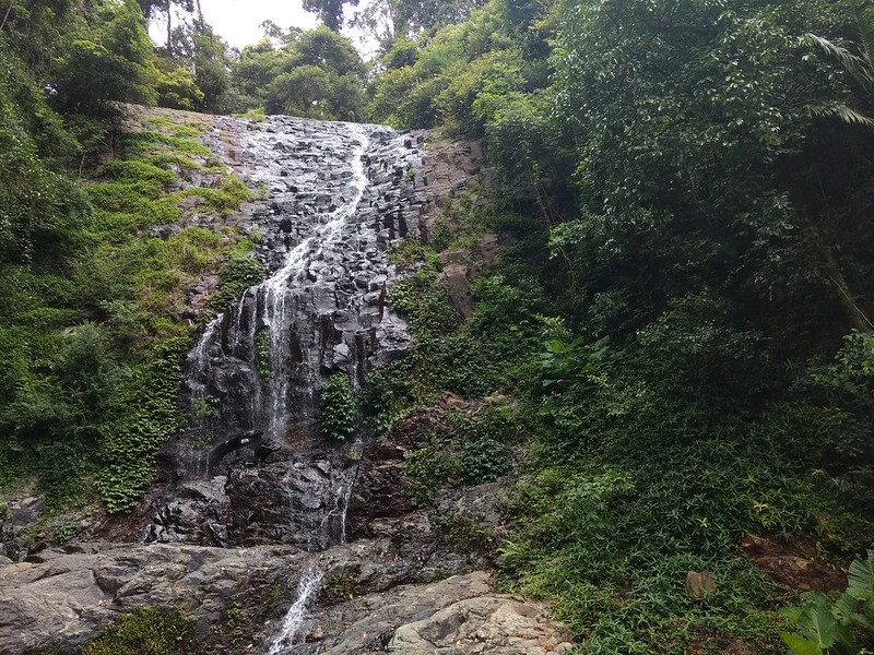
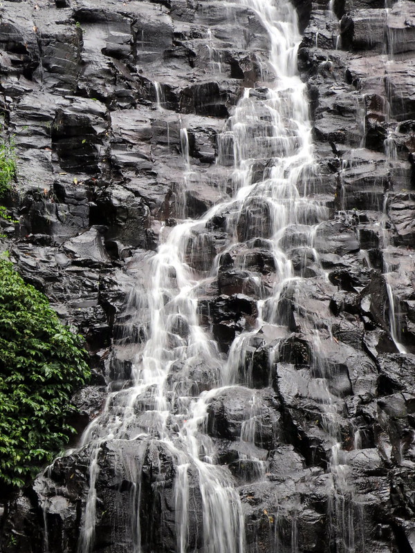
Crystal Shower Falls, at one end of the Wonga Walking Track
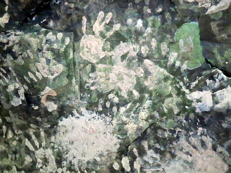
The view from the carved crevice behind the falls, where water collects and forms mud
Eco-friendly graffiti: Hikers put their hands in the mud pools behind the falls and leave their prints on the wall.
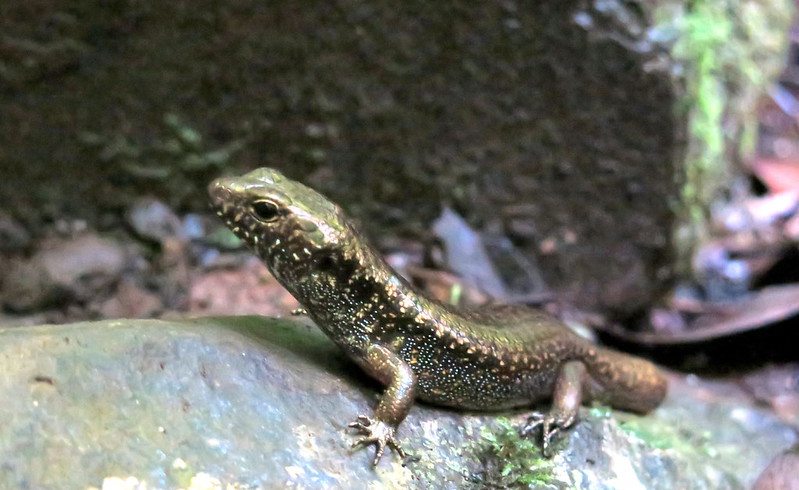
A skink rests on a rock near the falls. Possibly an orange-speckled forest skink (Eulamprus luteilateralis)
Hiding out: more tiny mushrooms huddle in a woody crevice.
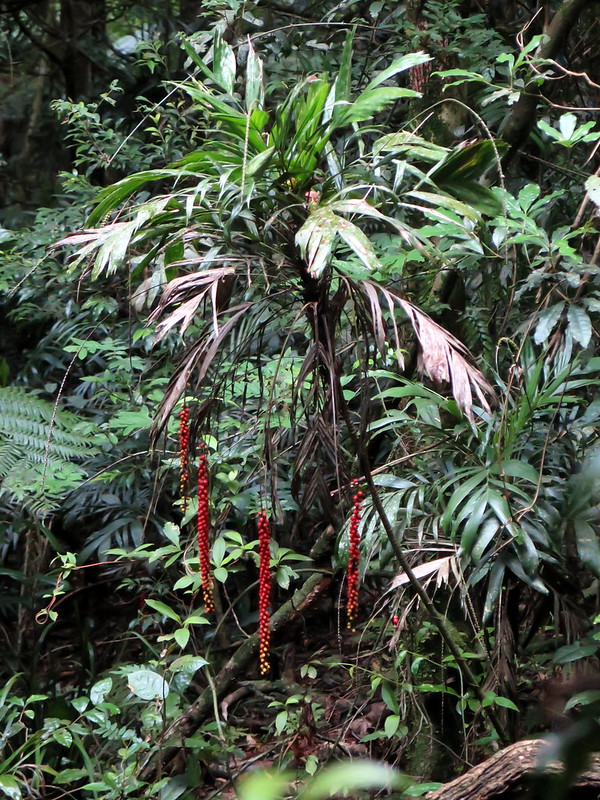
Red fruit hangs from a walking stick palm (Linospadix monostachyos)
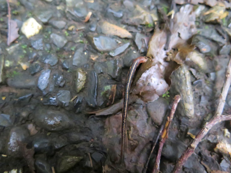
Spot the leech in this picture. Leeches were all over the forest, and we had a few get onto us and suck blood.
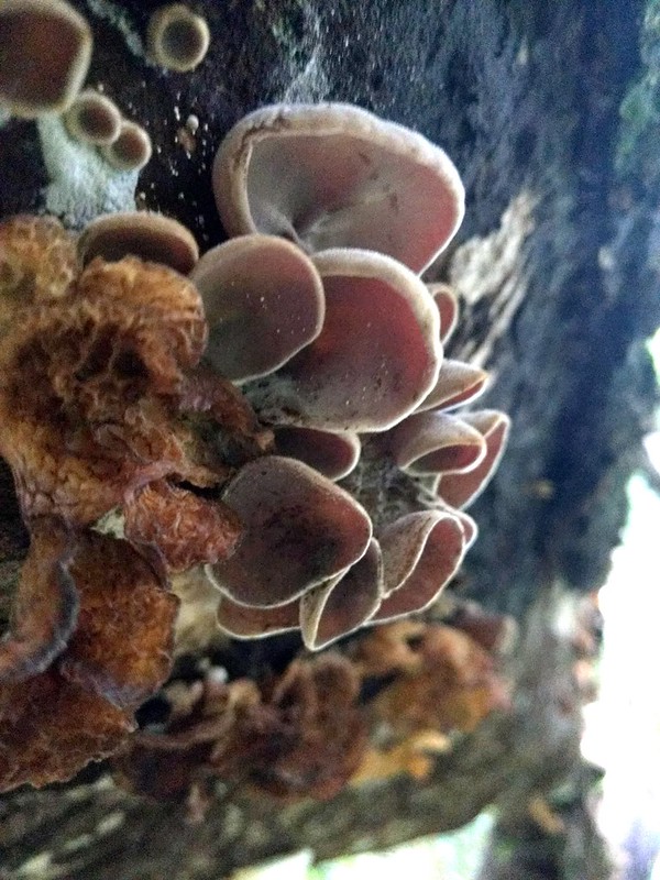
Ascomycete fungi grow from a tree trunk.
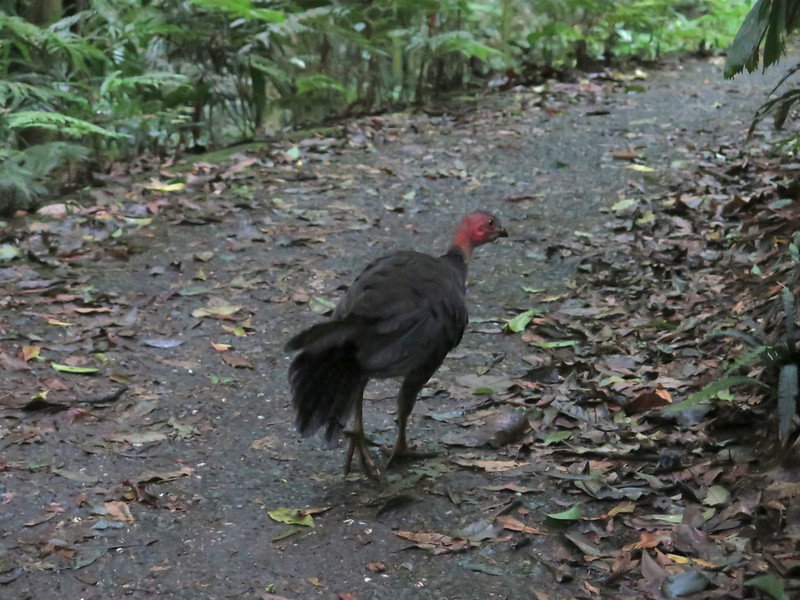
A large bird (Australian brush turkey?) dashes off into the forest.
Tristania Falls, the second waterfall on this hike.
The water of Tristania Falls flows over the contours of an unusual rock formation
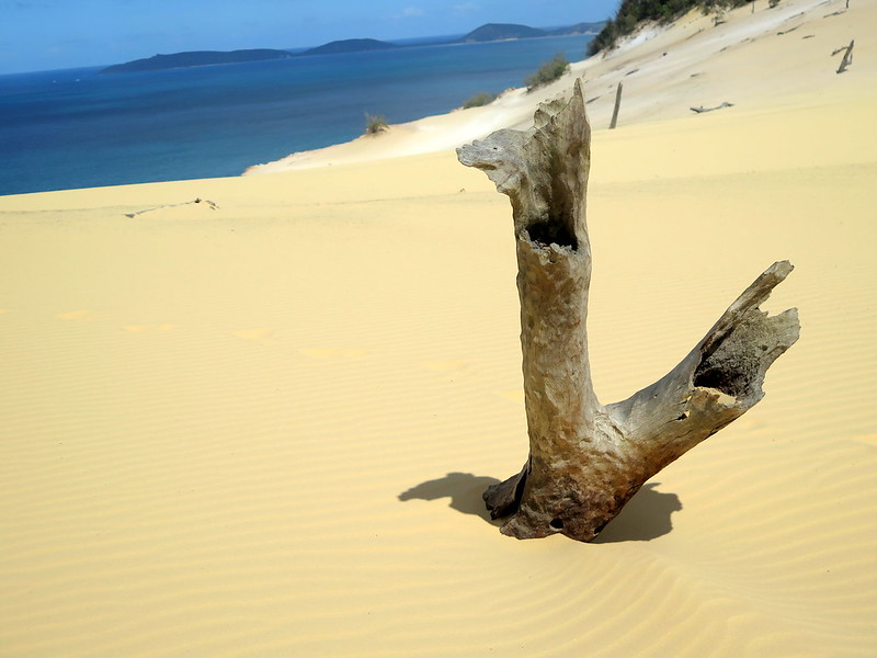
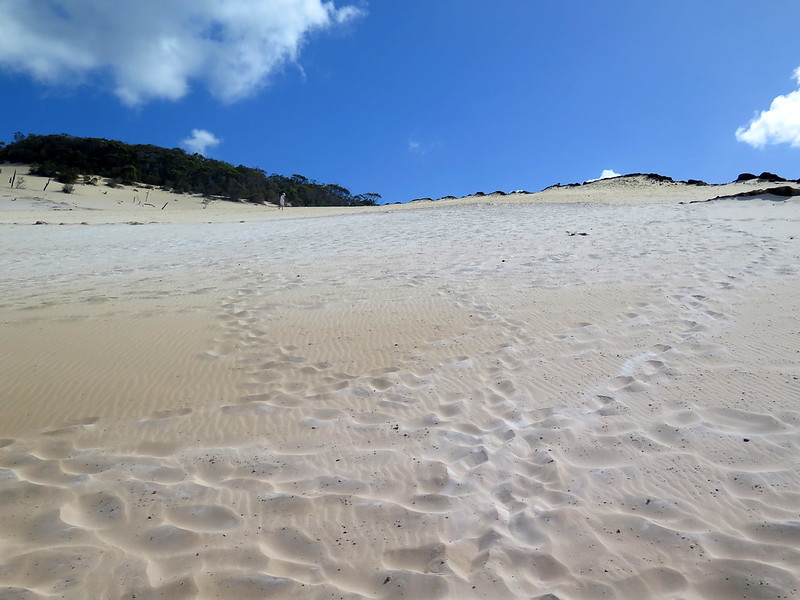
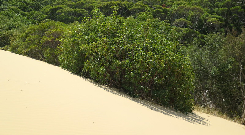
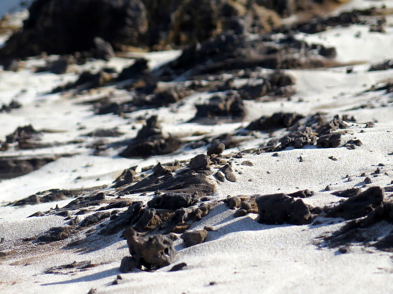
Somewhere along the vast Australian coastline, a giant is creeping. Grain by grain, the giant oozes further inland, engulfing trees and burying forests. Its particles whip free, tumbling through the air and over the precipice until they come to rest at the giant’s pseudopod. And we as we walk along the giant’s back, feet sinking into its visceral mass, we brace ourselves against the air that shapes this strange dreamscape with erosion. One day, the giant will engulf a city. But for now, it is content to nibble upon the land and the occasional contents of a human pocket, buried and preserved in the endless sand.
Human tracks across the surface of the sandblow
Not a bush: the sandblow slowly engulfs a tree as it moves inland each year
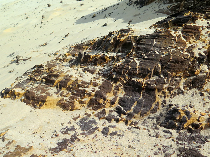
Patterns of erosion over sandstone embedded in the dune
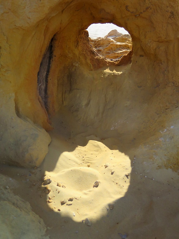
A view of a neighboring dune through a hole worn into the sandstone rock
Wind erodes the sandstone formation on the dune’s side, creating holes and tunnels
An exercise in irony: a silica packet recently devoured by the dune
Multicolored sandstone and limestone deposits jut from the giant’s backside
A line of black sandstone drawn in the dune sand, slowly weathering away
A close-up of weathering patterns in sandstone
Little spoils: manmade items (aka trash) collected from the dune
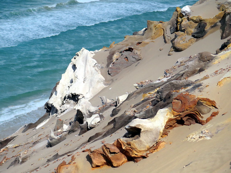
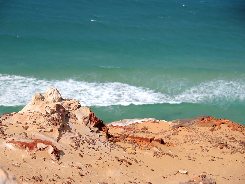
The rocky, steep back of the giant, with the Pacific Ocean in the background
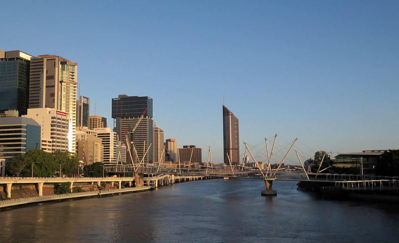
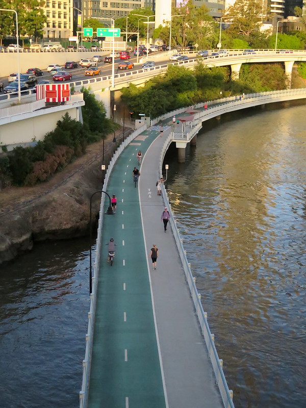
Brisbane is our first stop in Australia and little has changed in the years since I last visited. The city is still in eternal summer, just as I left it in August of 2010. It’s still a maze of suburbs, interspersed with parks and wide streets not built for pedestrian navigation. Cars speed through the metropolis while an underdeveloped bus network serves the rest of the population (and us). There are somethings I don’t remember from my last stay: new skyscrapers have appeared in the downtown area, and there’s a pedestrian/bike only path along the river. But if there were ever a sister city to my Los Angeles, it would be Brisbane.
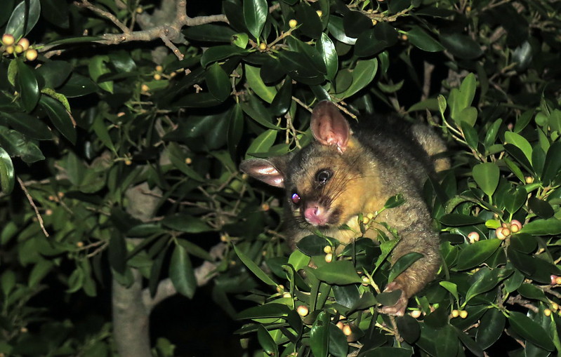
Then there are the things that are wildly different here in Brisbane: the flora and fauna. While there are plenty of European imports, like bobbling pigeons and frilly French marigolds, native Australian wildlife has taken to the city. Black-headed ibises strut through grassy parks where you’d normally see crows, and at night giant fruit bats and bush possums forage in park trees. It’s wild and jarring, a reminder that we’re on a continent on the other side of the world.
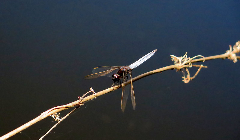
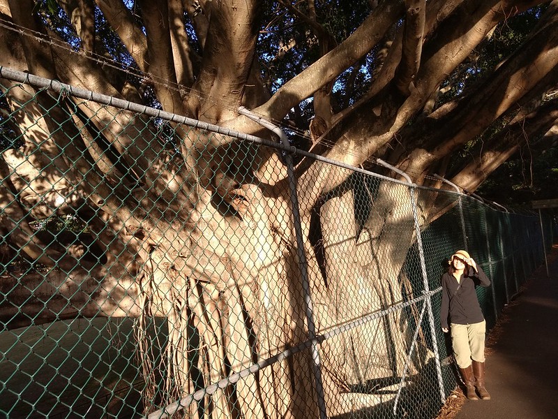
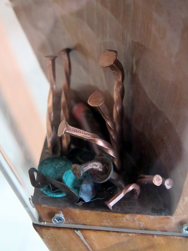
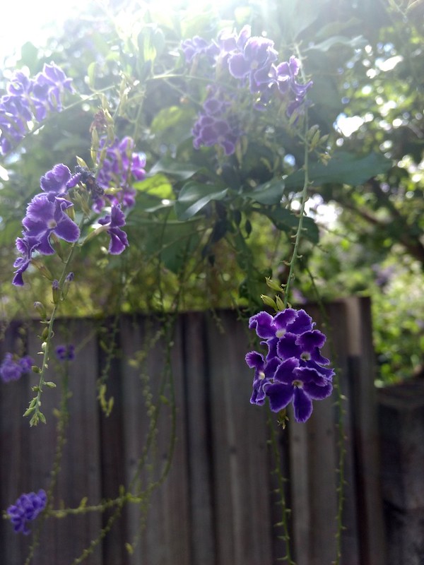
A car speeds down a four-lane road in a Bribane suburbA dragonfly perches on a twig in Mt. Coot-tha Botanical GardensA brushtail possum (Trichosurus vulpecula) eats flowers from a tree in a local park.I pose for scale with a Ficus tree growing in a local park.A tiled mural along Brisbane’s riverfrontBent copper nails sprout from a sculpture at the Brisbane Airport.Golden dewdrops (Duranta erecta), an invasive plant from the Americas, grows along a garden fence in suburban Brisbane.Pedestrians and cyclists traverse a car-free path on the north side of the Brisbane River.
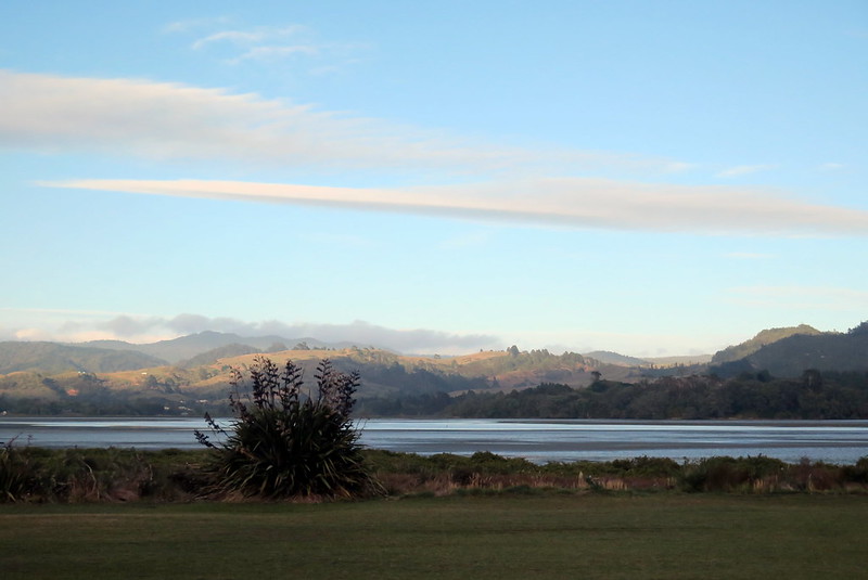
With its swooping green hills, sandy beaches, and snow-capped peaks, New Zealand is effortlessly beautiful. And while anyone with a camera or phone can capture the country’s wild perfection, though photos don’t do the land justice. For you, who hopes to visit, who has visited, or who lives there now, we present our fifteen most breathtaking landscape photos from our two weeks on the North Island. And it’s just a small slice of New Zealand’s beauty:
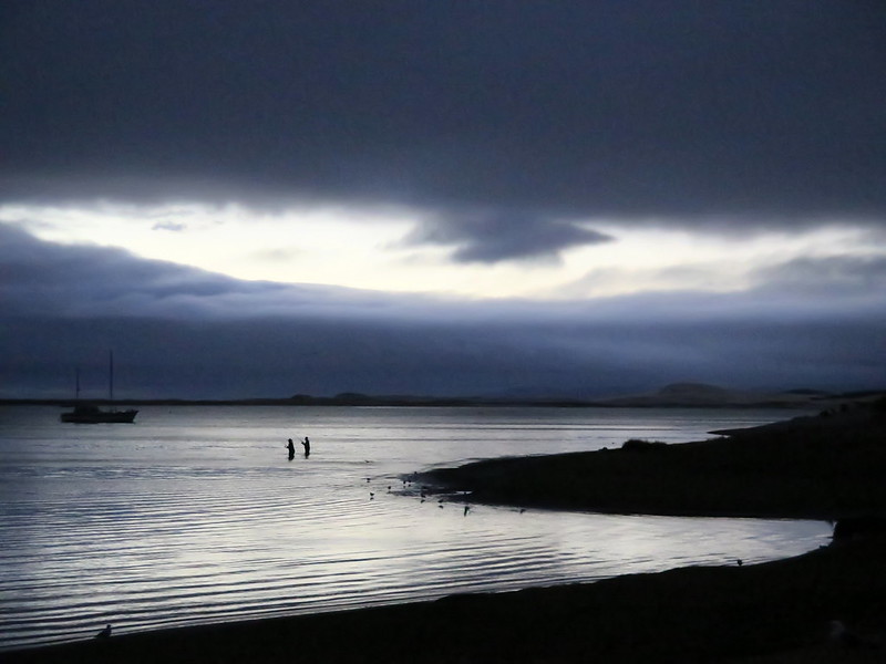
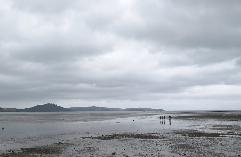
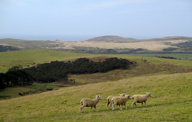
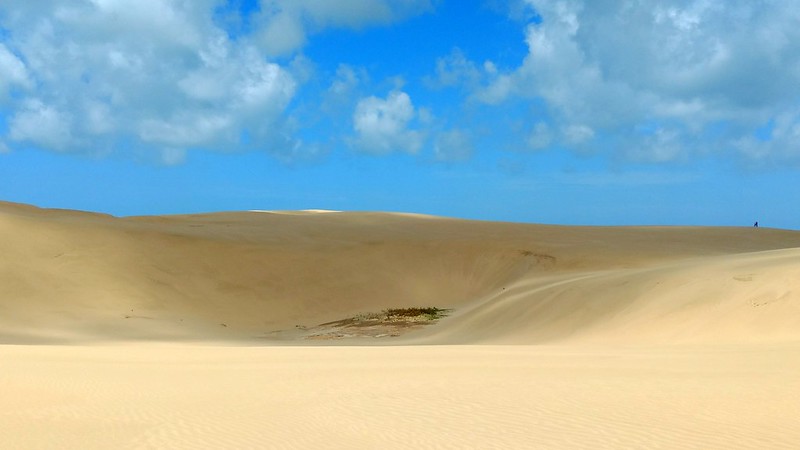
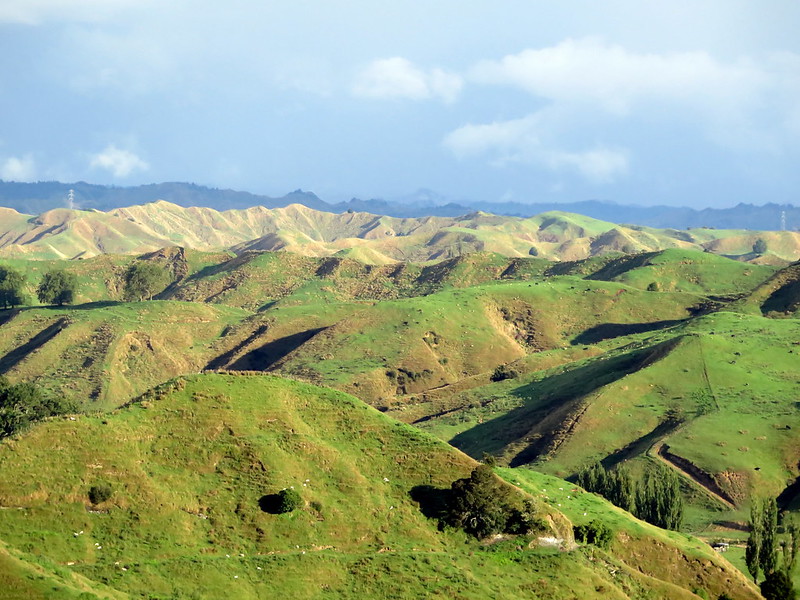
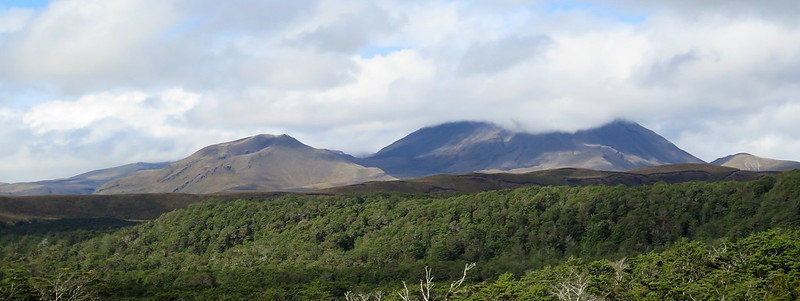
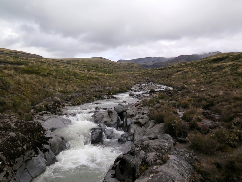
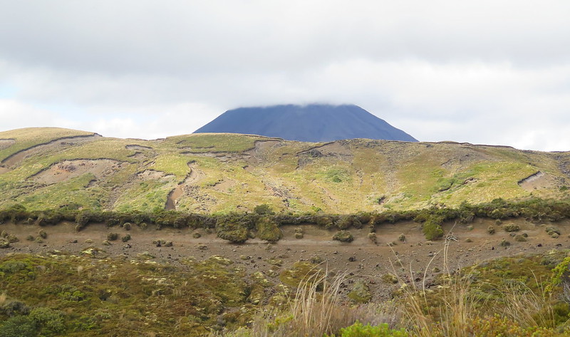
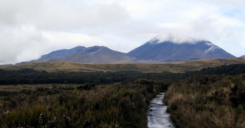
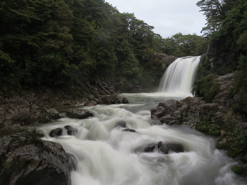
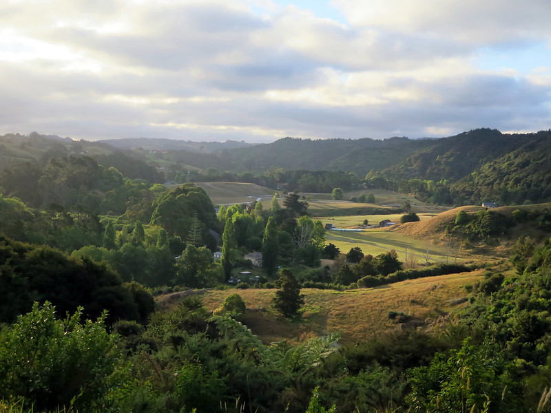
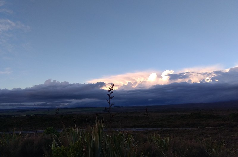
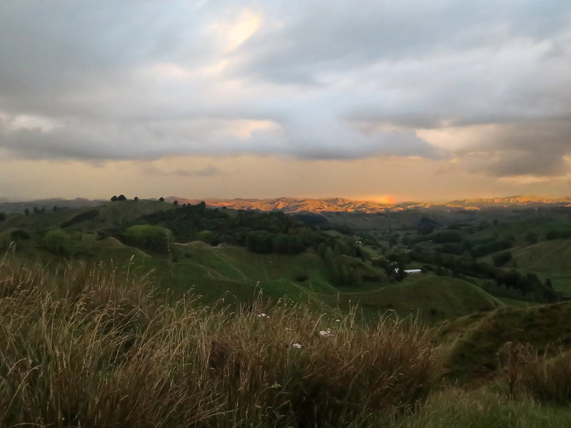
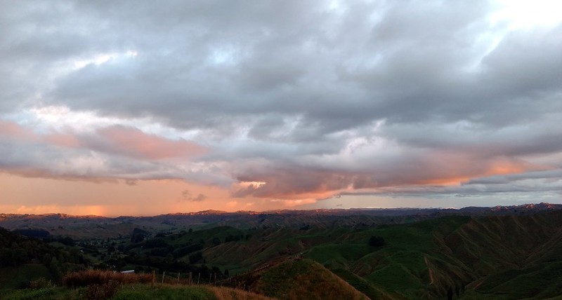
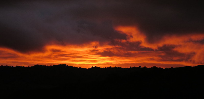
People fishing at sunrise near Mangawhai Heads, Northland PeninsulaForagers collect cockles on a beach, south of AucklandEarly morning at a campsite in the center of the North IslandSheep run across a grassy hill near Cape Reinga, Northland PeninsulaThe view from the lighthouse at Cape Reinga, Northland PeninsulaClouds (shadows) and people (black dots on right) pass over dunes at the Te Paki Sand Dunes, Northland PeninsulaThe endless hills of New Zealand as seen from the Forgotten World HighwayVolcanic cones rise from the landscape at Tongariro National ParkTaranaki Falls and Wairere Sream cut through the landscape of Tongariro National ParkWairere Sream just before plunging over Taranaki Falls, Tongariro National ParkPatchwork vegetation grows in the shadow of a volcanic cone, Tongariro National ParkThe Tongariro National Park landscape on a rainy dayTawhai Falls (Gollum’s Pool) on a rainy day, Tongariro National ParkThe cooling tower of Ohaaki Geothermal Station disappears into the clouds, central North IslandSteam rises from hot springs and rivers hidden in the forest, central North IslandLate afternoon on the tramping track in Puhoi, Northland PeninsulaSunset and cloud formations as seen from the Mounds Walk, Tongariro National ParkSunset on a rainy day, including a distant rainbow, at Nevin’s LookoutSunset and dusk in one photo as seen from Nevin’s LookoutThe last rays of sunset over New Zealand’s hills at Nevin’s Lookout
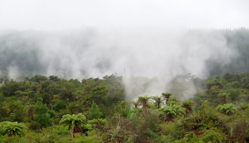
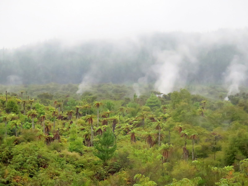
Steam from geothermal pools mingles with morning mist over the forest
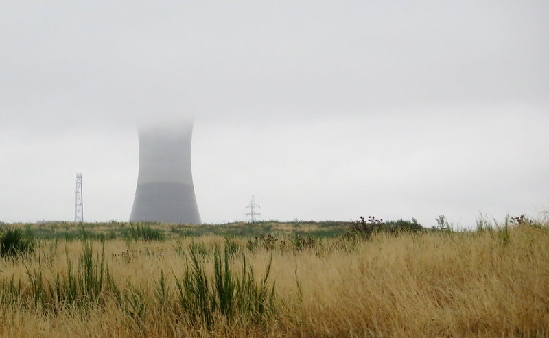
Though we’ve left Kerosene Creek, we’re still in the island’s hotspot as we drive south along the 5 Highway, and the peridot-green forests beside the road are thick with rising geothermal steam. Everything is damp this morning. We’re damp and smell like sulfur after taking a morning bath in Kerosene Creek. Our towels and clothes are damp from the steam of the creek and morning mist. The car is damp from morning mist and intermittent rain. It looks like it’s going to be gray all day.
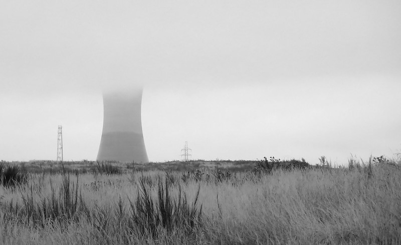
Stoytcho is driving, so I’m the first to notice the imposing shadow of the cooling tower along the horizon. My first thought is to associate the tower with nuclear power and ask myself “What’s a nuclear power station doing out here?” Stoytcho hands me the phone and through some Google work, we find out that it’s not a nuclear power station but a geothermal one, harnessing the boiling energy of the hotspot. It also appears to have a gift shop.
“Wait, what?” Stoytcho says.
“Yeah, it says it has a gift shop,” I repeat.
“So we can go visit it?”
“I have no idea. We can try.”
Ohaaki Geothermal Station up close
We turn off the highway into the road leading up to the station, a gravel stretch flanked by fields of swaying grass. At the entrance, we look for some kind of sign directing us to a gift shop, but only find visitor parking. We park and get out of the car to look around, but the entire area is fenced off with chain-link and barbed wire. It doesn’t look like there’s a gift shop anywhere, so we walk to the front gate to find an intercom and this sign:
“TOURS: PRESS BUTTON FOR ENTRY. TOURS FOR CLASSES OR GROUPS ONLY. NO PRIVATE TOURS.”
Well darn, it looks like we won’t be getting a tour or a chance to visit the station’s gift shop, so no geothermal-themed keychains for anyone back home. Then we notice an asphalt path off to the left titled “VISITOR WALK”. Hey, we’re visitors and we’re here. Might as well do that.
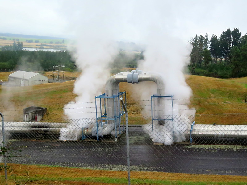
The asphalt path leads out to an observation area overlooking the station’s external pipes, where steam rises from everything. The pipes carry hot steam and boiling water from the hotspot below into the station, where (I would guess) the water/steam is used to heat a closed loop of pure water (so they don’t have to worry about impurities in the geothermal water), turning that into steam which is used to turn turbines and generate electricity. The cooling tower above is there to cool that water down again, condensing it for reuse in the system.
Pipes carrying geothermal fluids (steam and water) from underground into the stationArtificial natural patterns: something, whether moisture, light, or temperature, causes the lichen on the walkway to grow only outside the “shadows” of the walkway’s southern bars.
There’s not much else to explore beyond the visitor path, and in half an hour we’re back on the main highway. As we drive past the cooling tower, we stop for a photo of this giant, resting in the fields beneath a low sky. Its form dominates the landscape, a testament to our power in harnessing the energy of the Earth.
The giant cooling tower of the station dominates the horizon and disappears into the clouds.
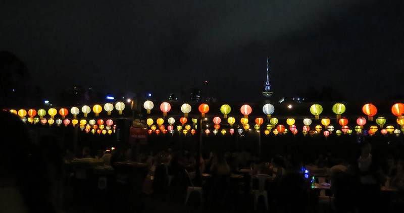
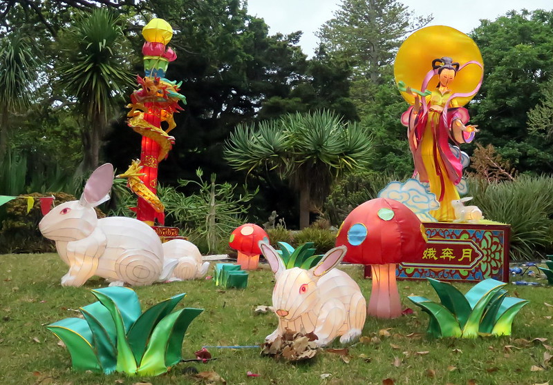
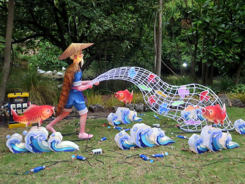
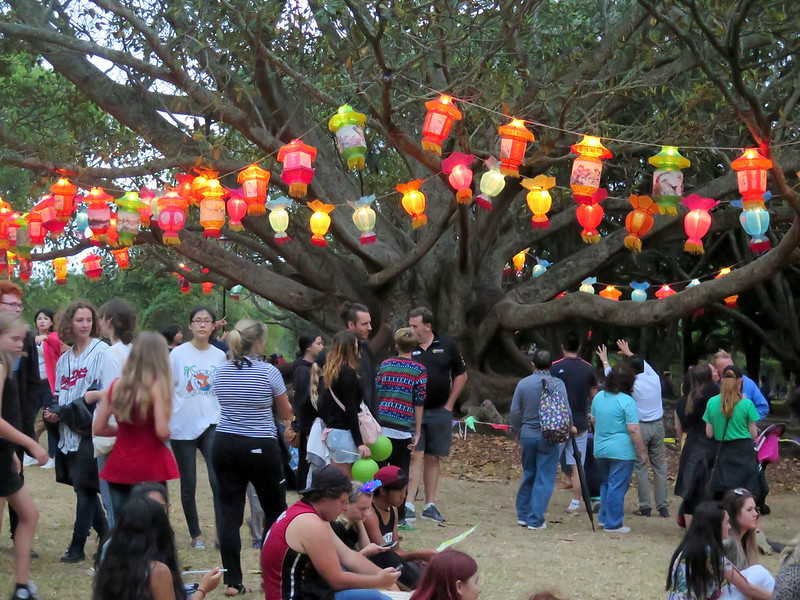
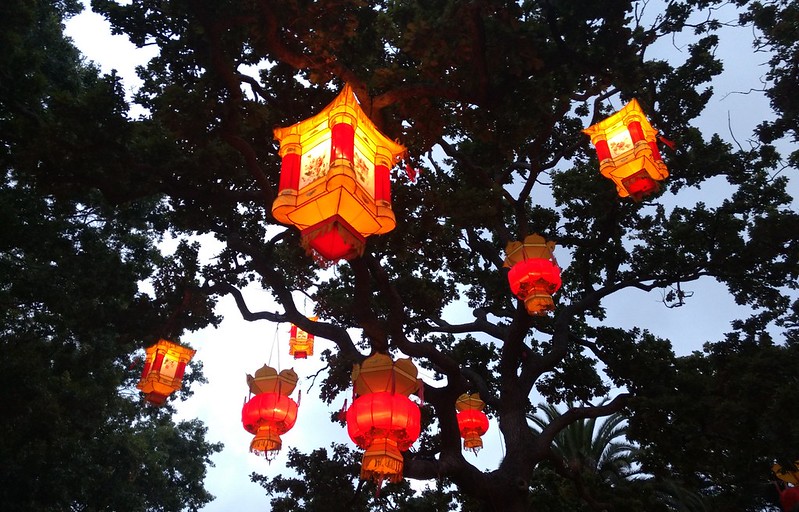
After our loop in the Northland Peninsula, we’re back in Auckland to see the city’s annual lantern festival. What began nearly twenty years ago as a small celebration with lanterns borrowed from cities in China is now a festival with hundreds of handmade lanterns and hundreds-of-thousands of attendees a year. And though the Lantern Festival is a celebration of Chinese cultural heritage (it’s part of our celebrations for the Lunar New Year), people of all races and ethnicities have turned out for the event. Here are our best shots from the festival:
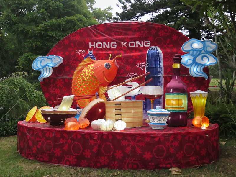
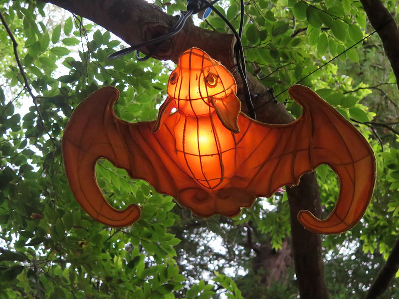
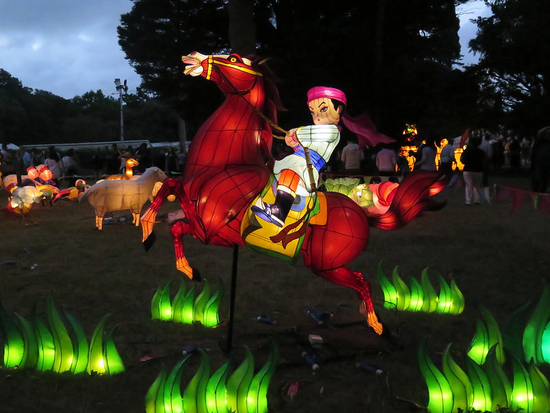
Lanterns depicting the moon goddess Chang’e and the white rabbits that live with her. It’s still daytime, so the full beauty of the lanterns remains hidden.Lanterns depicting an old fisherman with his net.A lantern dedicated to Hong Kong (and mostly focused on food). Having now been to Hong Kong, I can say this is 100% accurately delicious.A bat latnern in a tree. Bats are considered good fortune because the words for “bat” and “luck” are homophones in Chinese.A boy shakes hands with a rooster mascot. 2017 is the year of the rooster in the lunar zodiac.More people gather to admire the lanterns (and eat amazing street food). As the sun sets, the lanterns reveal their beauty.A latnern of a boy and horse against the darkening Auckland sky.Red lanterns hanging from the trees.Twin dragon lanterns hover over a fountain. After dark, the full beauty of the lanterns appears.
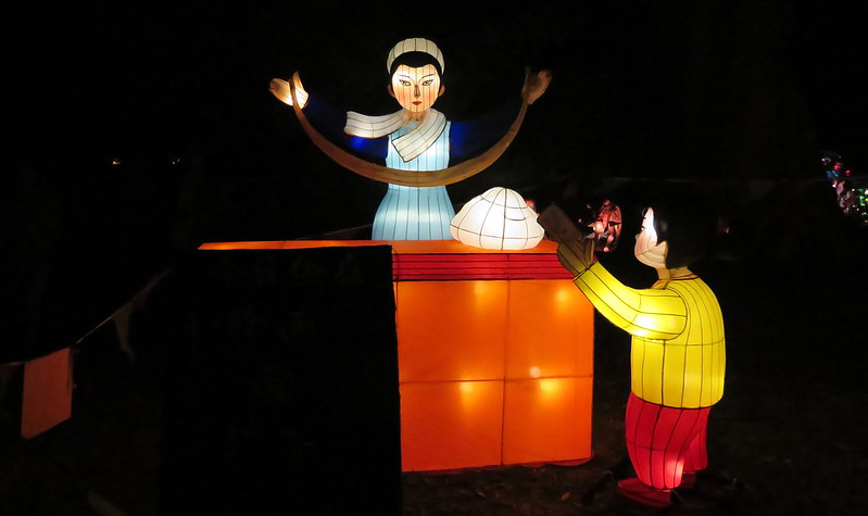
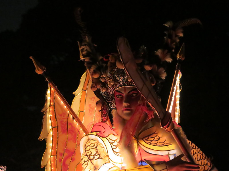
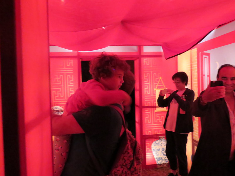
In this lantern, woman makes hand-pulled noodles from dough.A lantern version of a Chinese opera character.People take photos inside of a lantern shaped like a house. Though there were far more intricate lanterns at the festival, this lantern was one of the most popular.
That’s all from us for now, but tomorrow we head out from Auckland again, this time southward to see the rest of the North Island.